Three days to the end of the journey! I leave Amanda in Lambert’s Bay and continue onto the railway service road, that same nice gravel road cutting straight through the coastal landscape of the Western Cape.

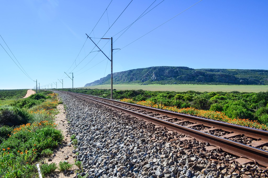
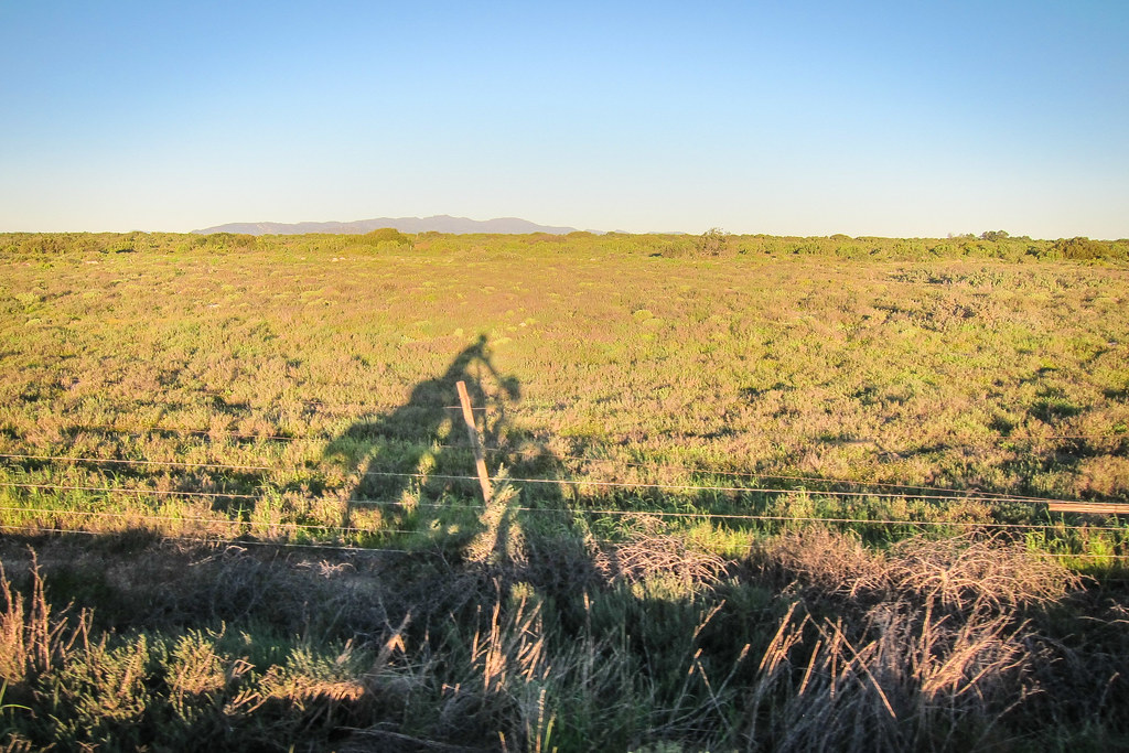
The 30 kilometers following the Sishen-Saldanha railway are quiet, but I notice the few cars overtaking me leave a reasonable distance. They’re not afraid to put their wheels on the other side of the road, unlike in the Northern Cape. That would give credit to a theory I heard earlier, claiming that the bad drivers of the Northern Cape are actually Namibians, while South Africans are used to be more considerate to cyclists.


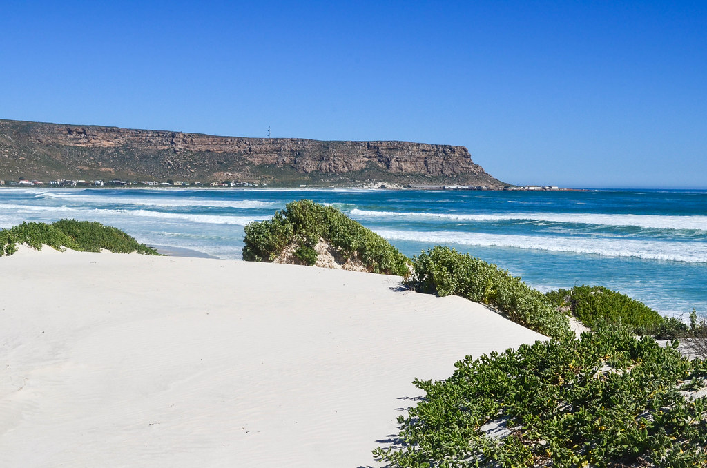
Elands Bay, or Elandsbaai, is a pretty coastal town surrounded with white sand dunes, and attracting kite surfers. I don’t have any kite-surf so I’ll take pictures, again, of the very long train, and treat myself with mussels and French fries.

Elands Bay houses look pretty by the sea, just below a mini Table mountain, but it doesn’t say clearly how I should proceed further. The railway passes in a tunnel, the only tunnel of the whole 861 km line, so I can’t continue alongside. The main tar road is going uphill, but the restaurant owner suggests I take the small road by the old crayfish factory.


It seems that every of these coastal villages has an old crayfish factory. The dirt road I am taking is actually the railway service road, going along the coast around the cliff, and meets the railway again a few hundred meters further.
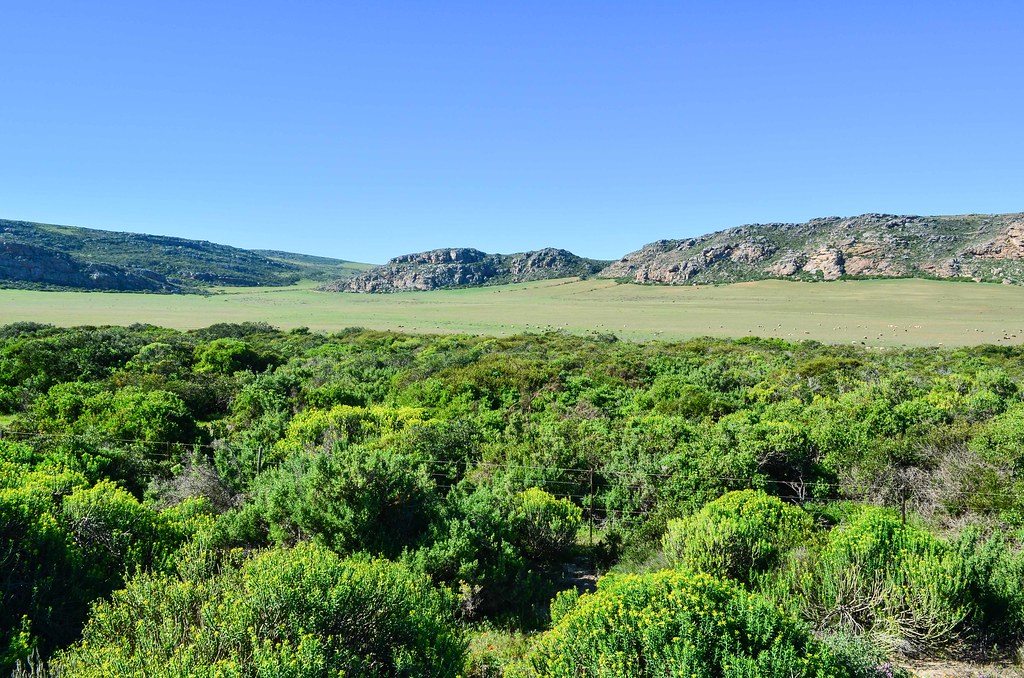
The landscape is very pleasant all along. I alternate between the Transnet private gravel road and a south-bound tar road. Amanda had drawn me a map of a farm, a contact of hers, but I’ve not seen anything looking like a farm in a long time. I’ve probably taken the wrong road and went too far. There are now farms and B&B, but I’m close to Dwarskersbos, another coastal village, that I reach just for sunset.

This place is very strange. It looks brand new but deserted. Similar to the new resorts on the Spanish coast between Barcelona and Valencia. I cycle a good 2-3 kilometers between nice houses, but only spot a few people and a few cars. Here, it’s not the result a speculative housing bubble, but just holiday homes for weekenders. It still doesn’t make sense to me: I’ve spent lots of time among people for whom a new tar road and a fancy house was a commodity reserved to the country’s elite, so whenever I am camping near a hundred empty houses, equipped with electricity and running water but no one living in them, it feels wrong.

Francois shows up on the beach while I am taking pictures. He is one of the few permanent residents of the town, and suggests that I camp at a specific spot and let the neighborhood watch know about it, so that I am not mistaken for one of the regular housebreakers in the area. Or, also, I can follow him and we can have a nice chat with wine.
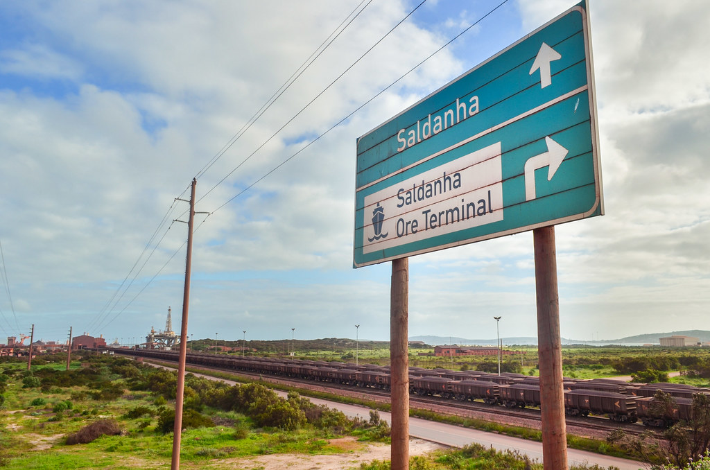
Thanks to Francois’s hospitality, I get to sleep in the fisherman’s hut and learn many things, among them about the presence of large ships off the coast in Dwarskersbos. They are “queuing” there for the permission to access the iron ore terminal in Saldanha. Apparently, overlanders are sometimes allowed to have a look inside the terminal, so I will try my luck tomorrow.
My dear N900 phone is agonizing, I have to take extra care of him to ensure my GPS trace is recorded. The batteries barely last half a day, and they charge only when removed from the phone. It did a good job by staying alive during my whole journey but it’s now a pain to deal with. I will need a new phone when I arrive. A new everything else too, since my clothes are torn, my hard drive is faulty, etc.
I was recommended the small town of Paternoster and its camping, at the Cape Columbine, between the St Helena Bay and the Saldanha Bay. But camping there is windy, and considering rain is on the menu for the next days, there is little chance I enjoy it. I head then straight south. Not that straight, since I’ll be making a small detour to see the Saldanha iron ore terminal.


The Berg river, originating from Franschhoek, where they make wine, pours into the Atlantic ocean here, by Velddrif and Laaiplek. I continue onto Vredenburg, the side wind is strong and I struggle a bit. Plus, trucks and some cars now drive entirely in the emergency lane, on the left side of the yellow line. That’s MY shoulder, it’s for cyclists! Apparently it’s common, for vehicles feeling slower than the average, to drive there.


サルダーニャの最終的なポイントはある、 Sishen サルダーニャ鉄道, it is where the iron ore, among other minerals, is loaded on boats and exported worldwide. The steel factory, and maybe the whole complex too, is owned today by ArcelorMittal ex-Iscor.


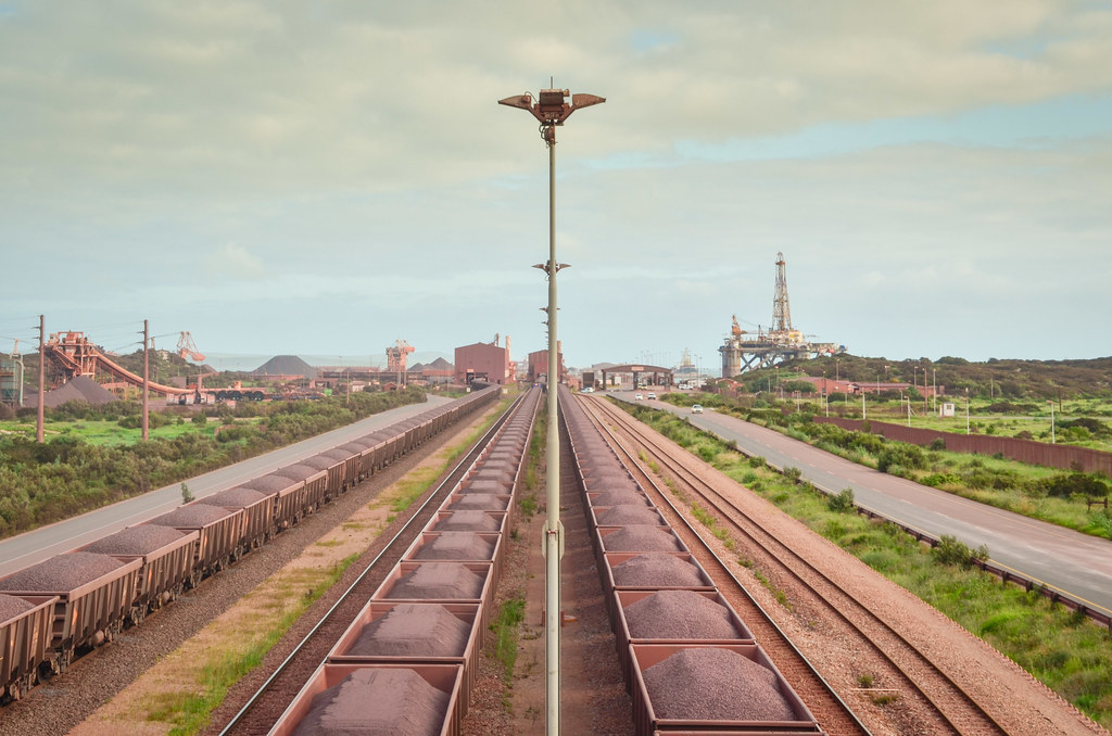
It’s hard to see it on the photo, and much easier on 衛星ビュー: the jetty is impressive, it can accommodate capesize ships, the largest cargo ships that can’t fit in Suez or Panama. And it’s red, like the iron ore. At the end of the 18th century, the British Royal Navy defeated ships of the Dutch East India Company in the Saldanha Bay, before they took over the Dutch settlement in Table Bay and called it the Cape Colony.
I reach the terminal entrance a bit further, but as expected, I am refused entry. I can only get an overview of the 3.7 km long trains from the bridge. I can also spot an offshore platform probably being serviced, and the steel plant.


Everything around the railway line is rusty red, contrasting with the spring green all around.

The next villages on the coast are Mykonos and Langebaan. I thought they would be fishing villages, but they look more like posh little towns for tourists and weekenders, with supermarkets and all. It’s quite big, with many tall, modern and fancy houses, and just like in Dwarskersbos, at least half of them are probably empty for most of the year.
I am now 100 km from Cape Town, so it will probably be my last night. At 5, I check CouchSurfing and WarmShowers, and several hosts show up, sign that I’m back to civilization for real, with real people using internet. But I don’t feel like emailing and waiting, relying on the response time of potential hosts, and I’d rather go and find a campsite or something else instead. I barely used CS on that trip.
I don’t see any campsite in Langebaan, and despite the small impression the town gave me on the map, it is quite populated. There are business streets with shops, supermarkets, plenty of tourism facilities and signs … Langebaan is a kite surfing hotspot, as it is situated in a 半島に面したラグーン. On the beach, two parents are pouring a bucket of ice cubes on the head of their daughter, while filming the scene. Strange practice, I thought …. (I will only learn later what it was actually about).

Langebaan spreads for quite a while along the lagoon. I’d say a good 3 km of holiday houses, and nowhere looking like a remote spot to camp. I end up climbing the final hill leading to the adjacent national park. I guess I won’t be allowed to camp inside the park, and I know the gate is closing for the night, so I’m really pushing my luck there. It’s cold and will probably rain during the night, so I’d welcome any sheltered solution.
And as usual, at the last moment comes the ideal solution. One of the last houses of that hill is covered with flags of the world, it’s a backpackers! Jackpot. Just when it starts to drizzle. But as I get in, the lady says the price is 300 rands. Because this luxury “backpackers” is only a backpackers in the name: it has individual rooms only. Since when a backpackers only has individual rooms? That’s the saddest thing to witness, coming from the freedom of sleeping anywhere and cheap hostels, to end up where even the symbols of “cool” stuff are targeting high-end customers. The starting price on their website is higher than the backpackers in Zürich, a price that must already be scary for anyone budget-traveling through Europe. Well, I think South Africa, and maybe Southern Africa as a whole, is not a cheap destination at all, it’s rather fancy and for people with lots of money. The others can go to India or SE Asia.
Sadly, I continue and Langebaan is over. After a 1 km downhill, I reach the closed gate of the West Coast National Park. I look around, … but everything is fenced. Hmmm, it doesn’t look good. And it’s getting night. I try to climb over fences to see if there are some houses hidden from the road, where I could ask to camp, or just hide. The first two are fails, and it would be a pain to lift by loaded bicycle above the 2-meter fence anyway.
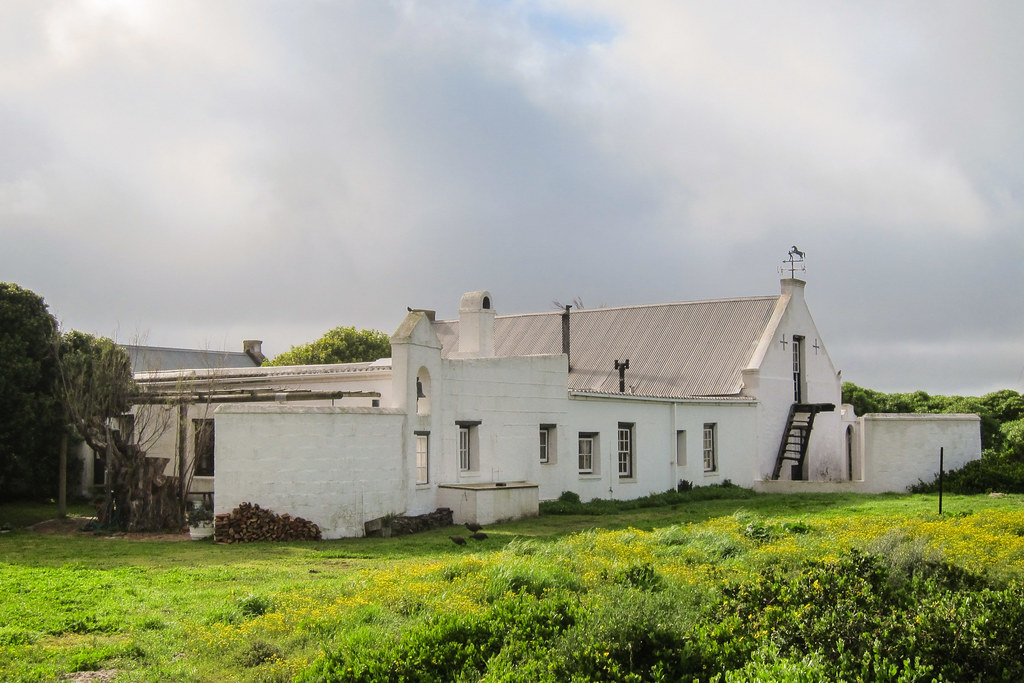
The third fence, however, is a win. Two hundred meters further on a sand road, I find three hidden old houses, with people in it. And I am welcomed with big smiles. I don’t even need to camp, as I am offered to take a bed in the vacant house. Once again, it’s the very last chance at the very last moment. This house is geographically the last house before the national park.
Diane and Graham have had this place for more than 50 years, and now live there permanently, without electricity, and just a windmill for water. They were here before Langebaan became a holiday resort, when it was still a Coloured community (which was kicked out), when there was no shop around, when there was no Saldanha iron ore terminal, when the island in the bay was still disconnected from Saldanha town …
After passing these fancy holiday houses and tourism facilities, it’s quite a shock to end up in a place where time stopped 50 years ago, and it’s in fact the best thing that could have happened to me. We have a drink, look at old maps of Africa and exchange travel stories. In the past, they couldn’t see any other construction from the house, but now some big new homes have started populating the southern side of the hill. New constructions there are forbidden, it’s an environmentally protected area, but apparently an Italian investor managed to buy his way through the negotiable South African law, and voilà.
During our chat, we are interrupted by another visitor. It’s actually the guard of the national park, from the security booth nearby, coming to warn my hosts that a suspicious person with a big bicycle has been roaming around fences, and may currently be threatening them! It’s me, thank you. South Africa has so much crime that it’s really not a good idea to look suspicious at night (well, in fact, it’s probably even worse to look wealthy at night). But I must admit, a touring cyclist looking for a place to sleep develops the same skills as a burglar, and behaves in the same way.
I have been very lucky with my accommodation in South Africa, and the people very hospitable. It’s like cycling in Europe, but with people who do open their doors. And for my last night, I am sleeping in house right in front of the lagoon!
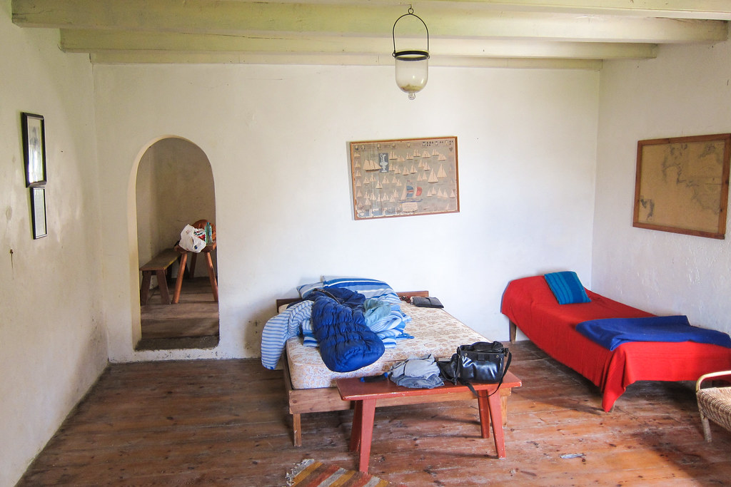

More accurately, I am sleeping in the room occupied between 1966 and 1970 by Frank Armstrong Wightman, a 船員および作家, living the life of a hermit.

My last day on the road will be grey again, but Diane and Graham motivate me with a brandy-shot’d coffee.

Immediately, I have to pay the entrance fee of the ウェスト コースト国立公園. I wouldn’t need to if I had stayed on the main R27, but because I took a smaller road, I am on the same path as tourists and it’s not free. The National Park surrounds the Langebaan lagoon, and half of the peninsula is closed to visitors most of the year, except now, during the flower season. But there are no flowers yet, and it’s drizzling anyway, so I cycle straight to the exit of the park.

I paid 56 rands, it’s a lot just to cycle 25 kilometers in the mist, but is still less than the foreigner’s fee. I was asked to pay the South African entrance fee: maybe the guard thought my South African flag flying behind my bicycle was a proof of identity. It’s there originally, hanging sideways, to make cars a bit more respectful when overtaking me, but if it can also give me discounted entrance fees, why not!

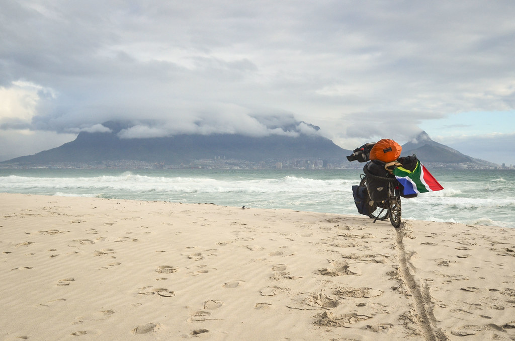
The sunshine appears while crossing the park, and the drizzle stops. A good tailwind pushes me and I speed on the R27 straight to Cape Town. I will make it today.


I took the road at 11 but I already completed 100 km by 4 pm. That’s one good average speed, I took no break but a short lunch at a station. As traffic increases close to Cape Town, I turn right at the Koeberg の原子力発電所 into Melkbosstrand, and continue cycling in upmarket neighborhoods. Koeberg (2 x 900 MW), built by Framatome-Areva, is the only nuclear plant of Africa, and funnily enough, it has been ANC による爆撃 during its construction.

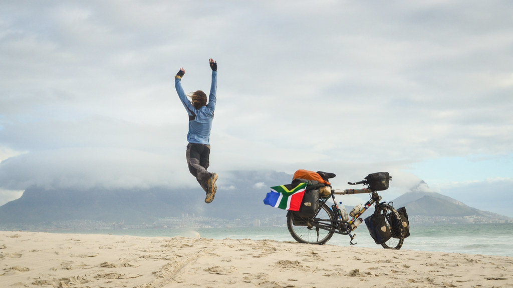
Table Mountain! When I was thinking about 最後です, while pedaling on the endless Namibian gravel roads, I was imagining Table Mountain appearing in front of me, and getting bigger and bigger as I cycle towards Cape Town. Today, it is covered by clouds and it kind of spoils my arrival. Plus, I won’t get a proper photo of it. Robben Island is cleared up, but it doesn’t work for a good “arrival photo”.


ケープタウン、私はそれを作ったよ !
Here I am, on August 26, 2014. I had announced it その場で, and I know I am very delayed by publishing this last post in April 2015.
The most intense emotion in that moment is simply the fullness of the achievement. It’s equally shared between the interesting, challenging, and memorable adventures and encounters that I have lived, and the absence of mishaps, health problems, bicycle damages, and safety accidents. It’s easy for me now to feel invincible and over-optimistic.
I started feeling successful when I crossed from Angola into Namibia. And I am now 100% successful, I have cycled the whole length of the continent by myself in one go! I was not so confident about it when I left. Mission accomplished!
Still, I want a proper “final picture” with blue sky, and at the Cape of Good Hope. I will cycle there in a few days and that will make a very last blog post. And I will also write some “synopsis posts” with statistics and with my return to Europe by cargo ship.


Jean, what more can I say than you are a MAN. As we say in Afrikaans; “Jy is ‘n yster.” You are an Iron. Few people will be able to do what you have accomplished. Hats off for that.
You are a nice person. And I am glad that by luck we have met at Springbok. And thank you for welcome me when I arrived at the Castle In Cape Town on Saturday 30th August. My schedile was planned that I must arrive in Cape Town on a Saturday other wise I would have ride with you all the way.
Are you going to write a book about your experience? You should.
Thank you for all the posts here on Facebook. I enjoyed every one of them and can relate with your experience. Best of luck.
ジャッキー