Quello che mi piace il deserto del Namib e il Sperrgebiet è che, dal momento che nessuno vorrebbe vivere lì per lo stile di vita, ogni struttura artificiale trasporta una parte della storia industriale locale.
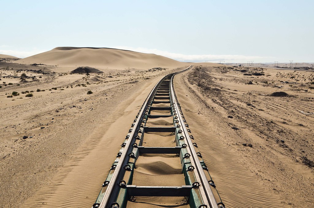
I miei quattro giorni a Lüderitz erano molto piacevole e io ora sto in bicicletta torna a Aus e quindi ottiene veramente vicino Sud Africa. Come lascio laCittà fantasma di Kolmanskop, la ferrovia in fase di ristrutturazione ancora corre parallela alla strada B4.

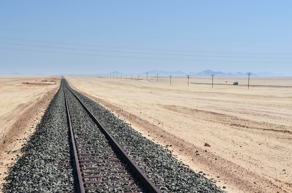
Tempeste di sabbia sono frequenti in questa regione, hoha vissutoQualche giorno fa, e ho incontrato a Lüderitz i ragazzi che spostano la sabbia dalla strada tutti i giorni. Hanno un "ufficio" e macchine di fronte all'aeroporto. Con forti venti, le dune di sabbia possono spostarsi fino a 15 metri al giorno. La ferrovia, non ancora riaperta ma il cui completamento è previsto entro la fine dell'anno (spoiler: un treno riapparso a Lüderitz nel novembre 2014), necessita anche di una manutenzione regolare in queste condizioni. Un treno che trasportava rifornimenti è deragliato di recente a causa della sabbia. Si parla di costruire un tunnel lungo 7 km per evitare l'onere di dissabbiare la ferrovia...
Subito dopo Kolmanskop, a venti chilometri dalla costa, mi fermo a cantone di Grasplatz.

Grasplatz si chiama così perché il luogo era utilizzato, prima della costruzione della ferrovia nel 1906, per immagazzinare l'erba per i buoi che trainavano i carri. Ho visto i piani al museo ferroviario di Windhoek.

La ferrovia Aus-Lüderitz fu orgogliosamente completata nel 1906 dai tedeschi, dopo soli 9 mesi di lavori. Citando un sito web molto ben documentato, “questa linea ferroviaria è costruita con il lavoro dei campi di concentramento di Shark Island vicino a Lüderitz, senza ricorrere a un'alimentazione adeguata e a strutture mediche. Le statistiche del progetto ferroviario sono spaventose. Secondo i dati dell'Amministrazione coloniale tedesca, tra il gennaio 1906 e il giugno 1907 furono utilizzati per la costruzione della ferrovia un totale di 2.014 prigionieri dei campi di concentramento. Di questi, 1.359 morirono mentre lavoravano sulla linea: un tasso di mortalità del 67%. Ciò significa che ogni cento metri della linea ferroviaria da Lüderitz ad Aus c'è un prigioniero morto dell'Isola degli Squali della Namibia“. Le immagini della ricostruzione nel 2002-2004 sono qui, e la maggior parte delle rotaie che vedo sono di questi anni.
Ian mi aveva anche detto che intorno alla strada ci sono vecchi forti costruiti dai tedeschi. Così, ho deciso di raggiungere a piedi qualsiasi struttura sospetta che avrei individuato dalla strada. Essendo nel deserto, è facile individuare i manufatti nel paesaggio, ma ci vuole tempo per raggiungerli.

Per quanto riguarda l'esercito tedesco in questa regione, non ricordo se fosse per combattere contro le tribù locali, o durante la prima guerra mondiale contro il Sud Africa. Ad ogni modo, da quella collina posso ancora godermi la vista sullo Sperrgebiet con più di un volo a volo d'uccello. Ed è davvero fantastico.


Non so se questa sia la candela del boscimane o no. Mi è stato detto che qui intorno cresce una pianta, chiamata Candela del Boscimano, e può essere bruciato come una candela (ma con un'avvertenza specifica, come il fumo è tossico o qualcos'altro). In effetti, il Sarcocaulon ha "rami carnosi, ricoperti di cera, sono infiammabili e possono essere usati anche quando sono bagnati come legna per accendere fuochi", ma sono abbastanza ben equipaggiato da non aver dovuto provarlo.

Un esempio divertente di come la Namibia sia così ampia e così piccola allo stesso tempo, è l'immagine qui sopra. Mentre "in posa" con l'autoscatto, un'auto è passata con un rimorchio vuoto; Si trova all'estrema sinistra della foto. È Steve, il meccanico/capostazione di Aus, che probabilmente vedrò domani, e che si è recato a Lüderitz per consegnare un'auto rotta.
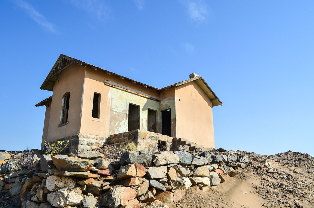
Finalmente raggiungo la mia destinazione prevista per la notte, le rovine della stazione di Haalenberg. Da Lüderitz, le stazioni di Kolmanskop, Grasplatz, Haalenberg e Garub sono le uniche della Linea Aus-Lüderitz dove rimane una struttura. Tschaukaip è solo un segno.

Non c'è vento, ma per ogni evenienza (c'è un "Attenzione: Iene" a un chilometro di distanza), ho montato la mia tenda all'interno delle rovine: ho 3,5 muri e un tetto, non è male.

Ho chiacchierare un po' con i ferrovieri di stanza qui e poi ammazzare il tempo di pulizia lato interno di tutti i miei link di catena. Durante la notte, io vengo visitato da qualcosa. Non posso dire cosa fosse, probabilmente un Orice gazzella.

Haalenberg è l'unico punto sopra i 120 km di quella strada vuota dove le colline sono così vicina dalla strada. Al mattino, salgo uno di loro, ancora in cerca di questi "forti tedeschi". E infatti, vedo strutture artificiali: non forti, ma trincee e cumuli di pietre. Lo fa apparire come un sistema di difesa. Trovare un proiettile in uno di loro, ma nessuno può dirmi se è una pallottola tedesca da WW1, prima, o un cacciatore dilettante del XXI secolo.

Più tardi oggi, darò a Ian, incontro per caso su quella strada.
Il vento è oggi nella mia schiena! Molto spesso in Namibia, la mattina porta una sorpresa: dopo mi sveglio e camminare la mia tenda, il vento costruisce lentamente mentre mangio e raccogliete la mia roba. Per il momento che io sono sulla sella, posso chiamarlo tailwind o vento contrario e immagino che se la mia giornata sarà una buona o una dura.
Così, a parte gli ultimi 40 km della tempesta di sabbia sul mio modo di Lüderitz, sto avendo un piuttosto fortunato 240 km giro in Sperrgebiet, con tailwind più della metà del tempo.


Un vento contrario in un posto così desolato sarebbe deprimente. Me lo ricordo troppo bene nei dintorni di Tarfaya in Sahara occidentale e la Skeleton Coast.

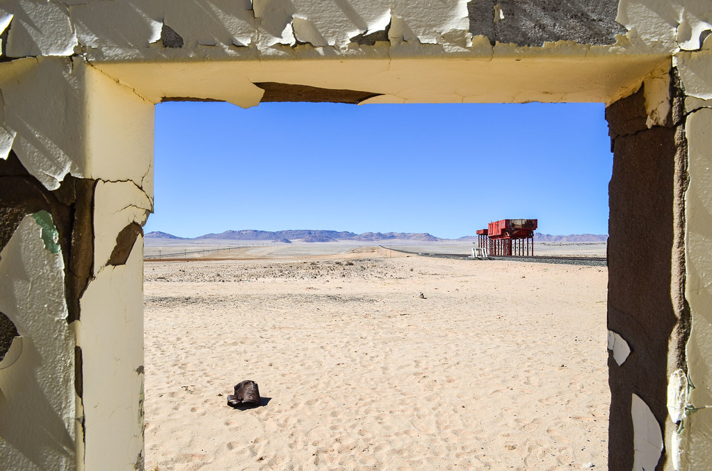
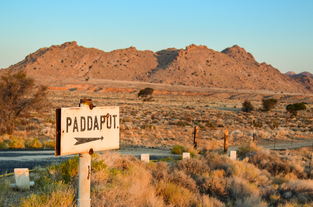
La mia prossima fermata ferroviaria è la stazione di suggerimento. Ha un edificio fatiscente, due alberi morti e serbatoi di acqua elevato arrugginito. C'è una macchina parcheggiata lì, e questa è la coppia francese che ho incontrato quando lasciando i backpackers a Lüderitz.

Allo stesso tempo arriva un tour in bus. Ho a malapena visto nessuno in un tempo così lungo! Che mi offre l'opportunità di scattare la foto più sorprendente della giornata:

Essi stanno per rovinare mio photoshoot della stazione fatiscente? Non credo. Persone che viaggiano in autobus solitamente abbiano nessuno spazio di tempo e non personale. Lo trovo un peccato, soprattutto in Namibia, dove la maggior parte del paese è a godersi lo spazio infinito. È un po' atmosfera stessa come gli annunci di turismo d'oro-settimana giapponese per "visita Europa in 5 giorni". D'altra parte, per godere veramente che time + spazio meraviglioso della Namibia, un turista ha bisogno di un sacco di tempo e un veicolo (spesso quello che costa un sacco in affitto), allora esso non è una destinazione economica. (E ancora una volta, bicicletta vittorie).
Quando avremo finito di chiacchierare con i due altri francesi, il tour bus è già andato e io sono rimasto solo con il sole e le rovine.

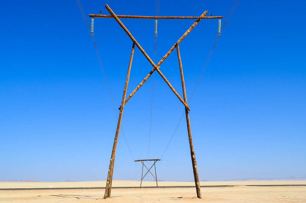
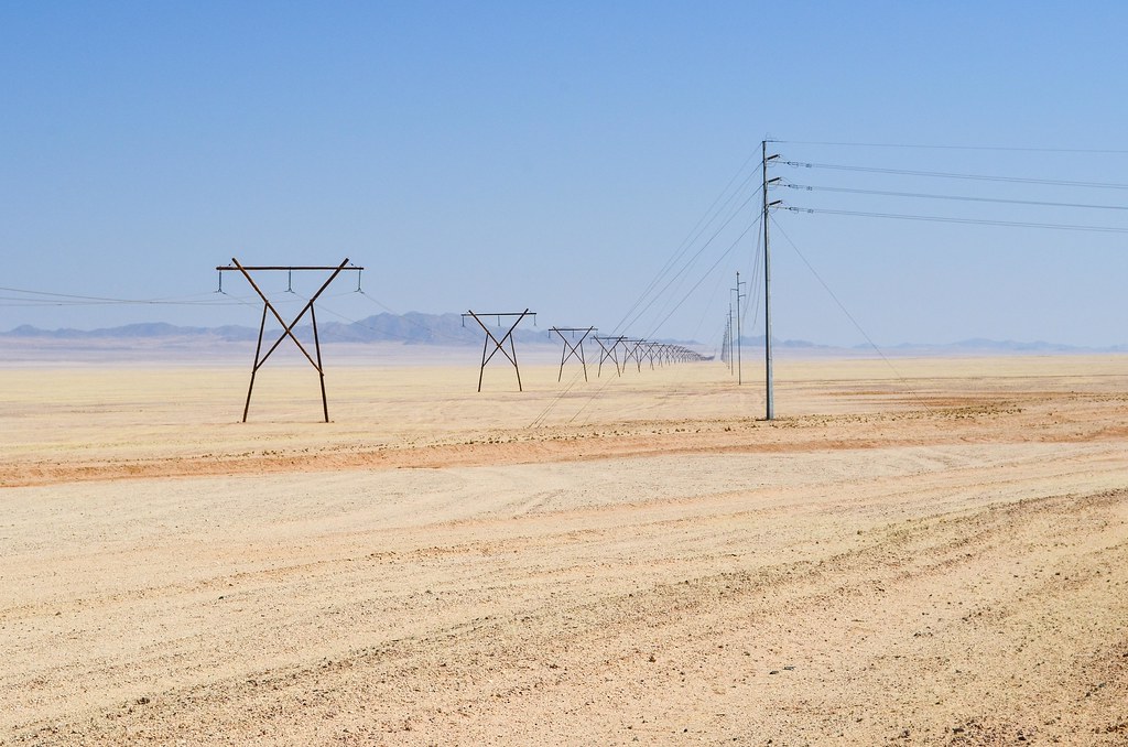
Nulla è realmente cambiato in 100 anni. I pali elettrici e le linee telefoniche sono state sostituite e aggiornate, alcuni alberi sono morti e sono apparsi fotografie a colori. E naturalmente, le nuove guide.

È il momento per me di controllare ciò che è in quelle vasche di rossi. La ruggine ha parzialmente masticato i lati e il Fondoschiena di loro, ma non la scala.

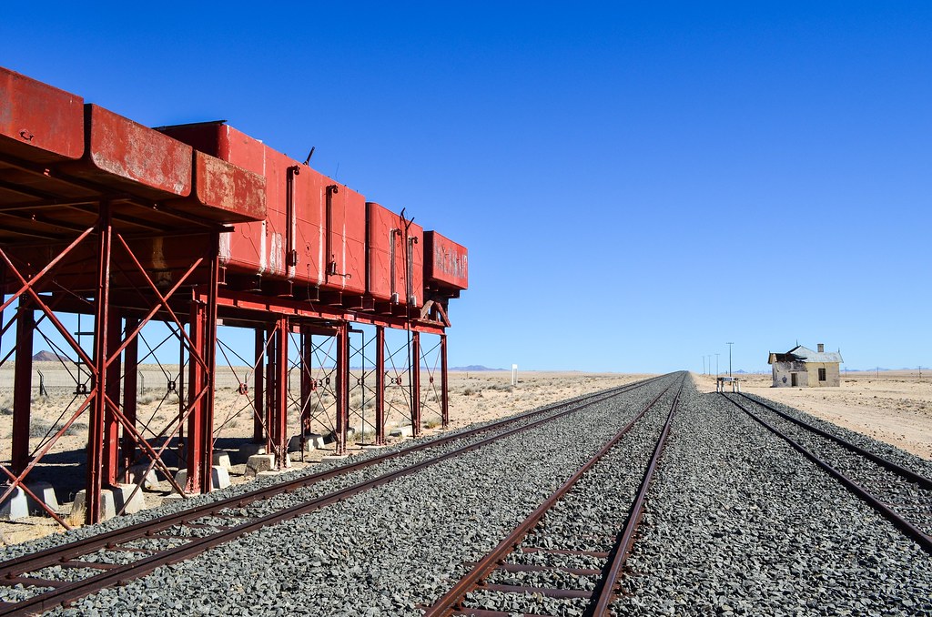
Questi serbatoi sono in realtà più di serbatoi arrugginiti. Erano l'allattamento Lüderitz con acqua, e hanno reso possibile la costruzione della ferrovia nel 1906. A quel tempo, l'unica acqua potabile era una fonte 2 km dalla stazione ferroviaria di suggerimento. Per trasportare l'acqua dalla sorgente fino a questi serbatoi rossi, da cui e quindi ha distribuito fino a Lüderitz, 100 km di distanza, a quanto pare fino al 1990, fu costruita una ferrovia di 2,4 km. Nei suoi primi giorni, Lüderitz ricevuto acqua in nave da città del capo. Non so se questi serbatoi rossi furono attivi fino al 1990, ma ho visto una stazione di pompaggio abbastanza recente 40km da Lüderitz. Le Sito Web Namwaterdice che la pipeline di 120km dalla depressione Koichab fu commissionata nel 2002.
Non ho trovato le rotaie di questa linea di 2,4 km, che Klaus Dierks girato nel 2002qui e ci, ma forse li possiamo indovinare guardando le linee rette sul foto satellitare. Un buon punto su deserti sopra foreste di pioggia, per scopi storici, è che le cose non cambiano e tracce possono durare per anni. Che comprende anche 4 × 4 di guida fuori strada e distruggendo il paesaggio per un secolo.
C'è qualcosa di veramente bello che ho trovato presso il Museo ferroviario di Windhoek: l'orario dei treni nel 1914. Poiché il tedesco sud ovest Namibia non fu sconfitto ancora da Sud Africa, è scritto in tedesco. Vale la pena di nulla che, in primo luogo, i treni avevano un regolare servizio di 100 anni fa, più frequentemente e in luoghi molto remoti rispetto ad oggi. E inoltre, la maggior parte delle stazioni sono oggi abbandonate.


La mia mappa preferita del Museo ferroviario di Windhoek è la ferrovia di concetto tra Namibia e le cascate Victoria. A quel tempo, Namibia era SWA, Botswana era Bechuanaland e Zambia era nord-Rhodesia. Era troppo costoso costruire una ferrovia attraverso il deserto, e comunque i tedeschi furono sconfitti rapidamente in Africa. È, in una scala più piccola, simile agli altri progetti troppo ambiziosi ferroviario degli imperi coloniali: Francia volendo collegare Dakar-Gibutie gli inglesi quasi riuscire nell'edificio i Il Cairo a città del capo ferroviaria.

Era un centinaio di anni fa. Ma, c'è maggior bisogno di questi progetti allo stato attuale che mai. Botswana senza sbocco sul mare è cercando di costruire una ferrovia attraverso la Namibia per esportare i suoi prodotti di data mining, liberandoli dalla dipendenza il Sud Africa. Su scala continentale,Corridoi trans-africana Infine si connettono posti carente cooperazione internazionale. A proposito, il Mappa di nove autostrade dimostra ancora una volta come la giungla del DRC non è compatibile con viaggiare.

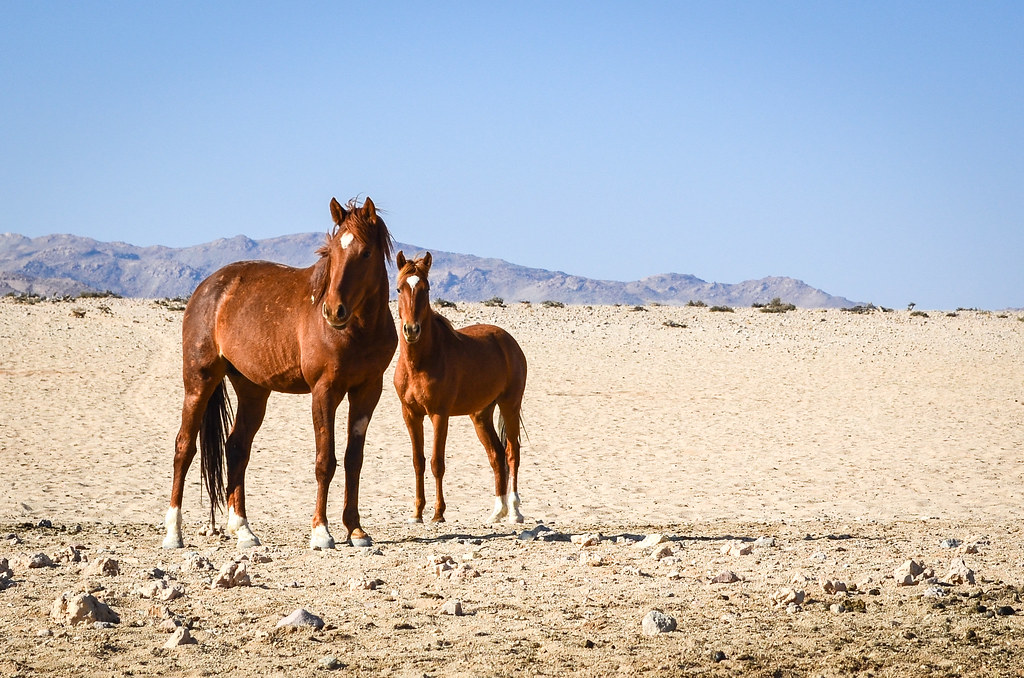
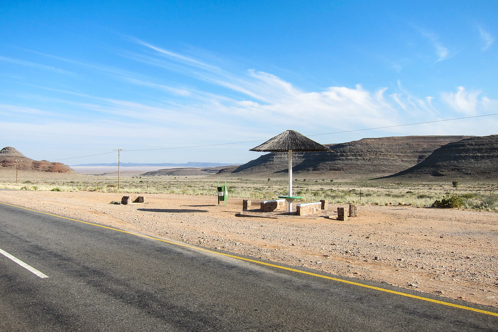
C'è una pozza d'acqua e un punto di vista di fronte alla stazione ferroviaria di suggerimento. Sembra fuori luogo... un punto di vista nel Sperrgebiet? Era passato il mio modo di Lüderitz e ora lo pagherà una visita. La pozza d'acqua dovrebbe per ottenere i cavalli selvaggi di suggerimento.
Questa parte del Namib ospita circa 150 cavalli selvatici (276 al conteggio del 2001 prima di una grave siccità). Nessuno può dire con precisione perché ci sono qui.

Ci sono Varie teorie.
Una teoria plausibile si riferisce all'occupazione tedesca dell'Africa sud-occidentale: un gran numero di cavalli era necessario per la cavalleria e un eccentrico nobile tedesco, il barone Hans-Heinrich von Wolf, istituì una stazione di allevamento di cavalli nel suo stravagante castello, Duwisib, ai margini del deserto. Una volta che il barone partì per la prima guerra mondiale in Europa, nessuno si occupò della scuderia di oltre 300 cavalli e dopo la sua morte le mandrie di cavalli si scatenarono, vagando per il veld intorno a Duwisib fino al 1950. È possibile che alcuni di loro abbiano vagato per i 150 chilometri a sud-ovest fino all'acqua di Garub.
È probabile, inoltre, che alcuni dei cavalli selvatici provengano dalle cavalcature Schutztruppe, così come da quelli appartenenti a un corpo di spedizione sudafricano che prese il controllo della linea Lüderitz-Keetmanshoop durante la prima guerra mondiale. Un'altra teoria è che una nave che trasportava purosangue dall'Europa all'Australia si sia arenata vicino alla foce del fiume Orange. I cavalli più forti avrebbero potuto raggiungere la riva e trovare la strada per le pianure di Garub.
Non riesco a immaginare che l'ultima teoria sia vera, dal momento che la foce del fiume Orange ha acqua dolce perenne e molta più erba dello Sperrgebiet. Ed è meglio per i miei occhi da viaggiatore incontrare cavalli tedeschi abbandonati. Qualunque sia la loro origine, è comunque incredibile che i cavalli addomesticati abbandonati nell'ostile Namib siano riusciti a sopravvivere.
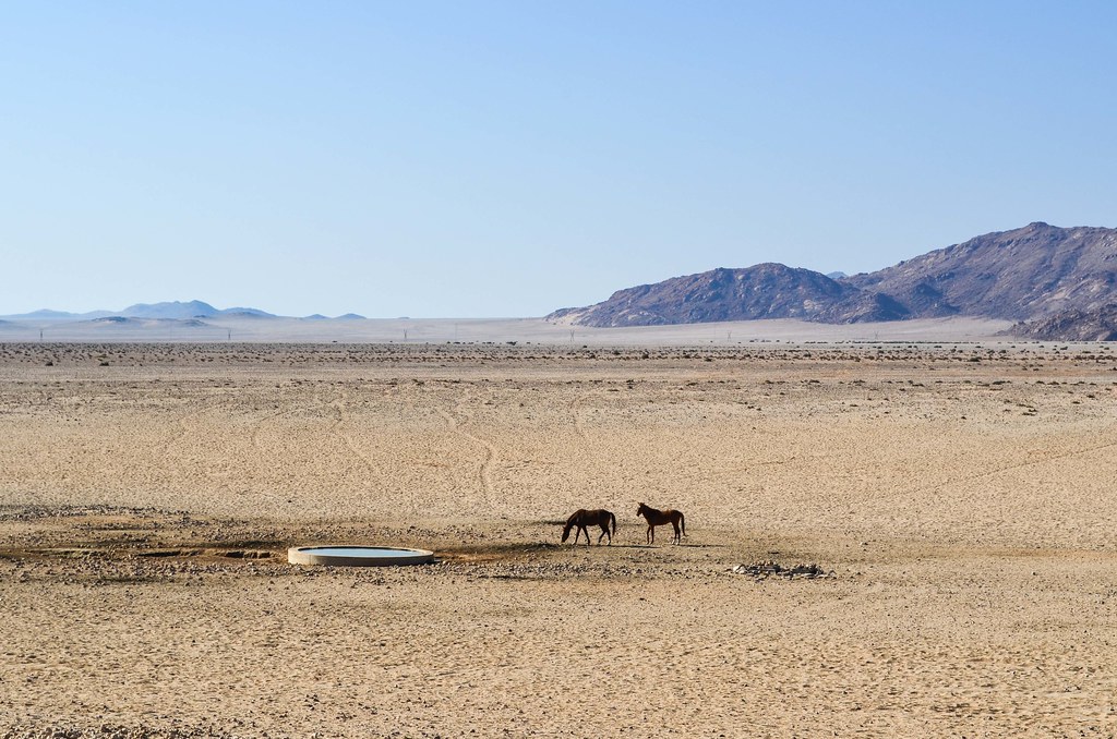
Pochi minuti dopo essermi presentato al punto panoramico, mangiando qualcosa all'ombra (sì, all'ombra!), ho la fortuna di vedere due di questi cavalli selvaggi che si avvicinano. I loro percorsi regolari sono chiaramente visibili nella sabbia. La mancanza di un teleobiettivo mi spinge a camminare fino alla pozza d'acqua, dove non sembrano spaventati dalla mia presenza come lo sarebbero i gemsbok o gli struzzi.
La pendenza fino ad Aus è dura e sento il notevole cambiamento di temperatura quando mi avvicino ai 1400. Per fortuna ho ancora un po' di vento in poppa e sono fiducioso di raggiungere Aus prima di notte.


E dopo aver incontrato Ian sulla pista, raggiungo la mia destinazione per la giornata appena in tempo. È abbastanza raro che io faccia un piano per finire la giornata da qualche parte, e che riesca a realizzare il piano anche se mi fermo spesso.
Come in ogni città pianificata dai sudafricani dell'apartheid, c'è una township chiaramente separata dalla città. Anche per quel minuscolo posto di Aus ...


Steve, della stazione di servizio Aus, è ancora gentile come la mia prima visita. Mi fa uno sconto per il campeggio e mi permette di comprare una birra. L'acquisto di alcolici in Namibia è vietato dalle 13:00 di sabato fino a lunedì.
Mentre cenavo con i turisti israeliani, incerti se presentarsi come italiani a causa del conflitto mediatizzato in corso a Gaza, metto a punto un'altra modifica del piano di rotta dell'ultimo minuto. Non prenderò la strada per Keetmanshoop, e poi visiterò il Fish River Canyon, ma andrò invece a sud da qui a Rosh Pinah, visiterò una miniera dove Ian mi ha messo in contatto e pedalerò lungo il fiume Orange, apparentemente una grande strada panoramica. Così, se voglio vedere il Fish River Canyon, il canyon più grande dell'Africa, dovrò aggiungere un anello di 4 giorni poco prima di attraversare il Sudafrica. Vedrò come mi sentirò allora.
Il miglior vantaggio di Aus, dal mio punto di vista, è che tutte e quattro le strade che lasciano Aus sono in discesa. Infatti, il piccolo paese si trova ad un'altitudine di 1500 m, ai margini del Grande scarpata.
Seguo la C13, una strada asfaltata che si dirige a sud verso il confine con il Sudafrica. I 3 km che escono dal paese in salita sono poi seguiti da un tratto di 50 km, durante il quale pedalo a malapena!

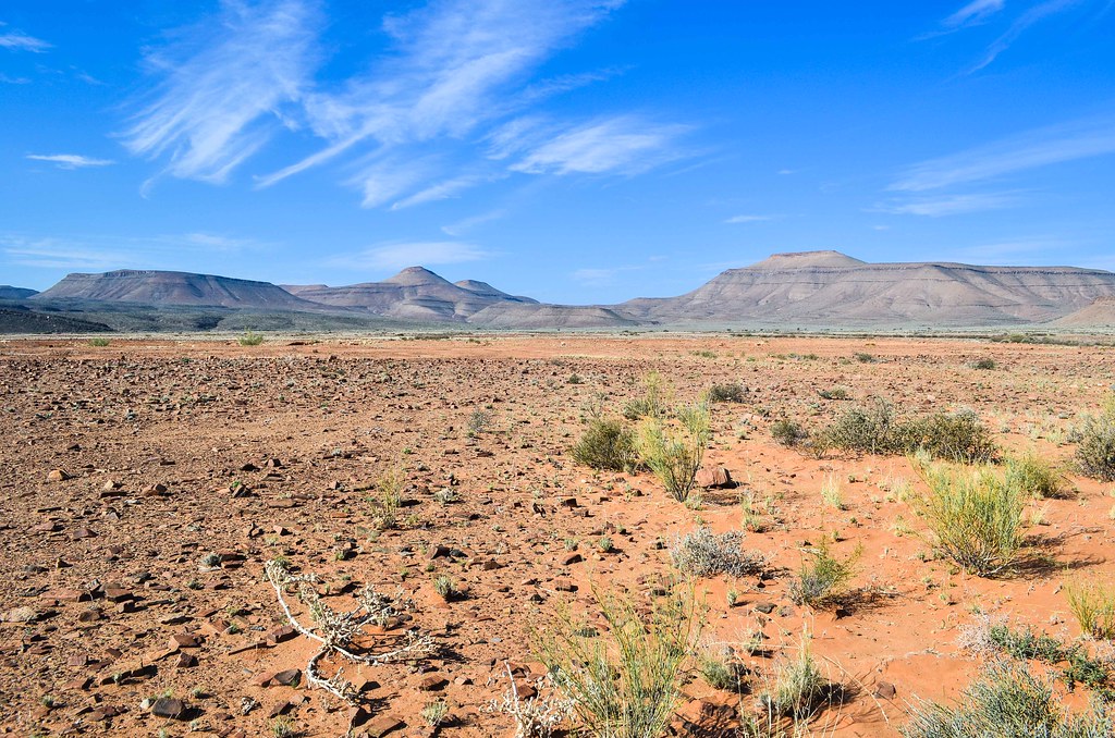
Guardando il mio GPS, sembra che la pendenza sia in media dell'1% in discesa. La buona superficie catramosa e il forte vento in poppa lo rendono molto piacevole, in quanto mi viene lasciato a godermi il paesaggio spoglio e gli struzzi senza fare molta fatica. Come al solito, non c'è quasi traffico, e le montagne e gli altopiani che mi circondano sembrano modellati dall'acqua e dall'erosione.


Il bel cielo azzurro fa passare il tempo velocemente. Avrei potuto percorrere i 170 km fino a Rosh Pinah nello stesso giorno se fossi partito presto. Ma me la sto prendendo comoda e due giorni andranno bene, se il vento non cambia lato.


Nota per i futuri ciclisti: Al "Rosh Pinah: 90" cartello stradale, c'è un rudere lungo la strada. Tre muri che basterebbero per piantare la mia tenda e rimanere al riparo dal vento. Ma è ancora presto per me, quindi vado avanti.

Alla fine della giornata, sono andato a 100 km da Aus. È una buona distanza, ma sono ancora circondato da un paesaggio spoglio. Decido di spingere fino al km 120, ricordandomi che Steve ha detto che c'è un mulino a vento al km 120. Se c'è un mulino a vento, probabilmente c'è anche una vasca di cemento nelle vicinanze, o anche una fattoria, dove potrei dormire. Inoltre, una delle mie mappe indica "Witputz cattle post" lì, all'incrocio tra la C13 e la D463, quindi spero di trovare delle rovine, e di piantare la mia tenda al riparo dal vento.
20 km in più da percorrere in bicicletta significano che ci arriverò dopo il tramonto, con pochissima luce, e non potrò cercare nella boscaglia un buon posto per campeggiare. Quindi è meglio che ci sia qualcosa lì.


Raggiungo Witputz (scritto anche Witputs), e scorgo due mulini a vento, ma nient'altro. È buio e non mi stupisco troppo che anche un incrocio spoglio abbia un nome. A causa dei mulini a vento, ci devono essere animali e una fattoria qui intorno, ma potrebbe essere in qualsiasi direzione, e forse a 5 km, 10 km o 15 km di distanza. Troppo rischioso da cercare, su sentieri sterrati non segnalati, di notte.
La ghiaia D463 si sta dirigendo verso est, proprio nel canyon del Fish River, e sembra un'altra strada panoramica senza nulla su di essa per 100 km. Mi avventuro su di essa per accamparmi lontano dalla C13, asfaltata e trafficata come, forse, 50 auto al giorno? E poi, c'è il jackpot! A solo un chilometro di distanza, scorgo edifici bianchi nel buio. Si presenta come un complesso agricolo abbandonato, con molti edifici. Ancora una volta, questo è il miol'ultima possibilità all'ultimo momento!

Tutti gli edifici sembrano belli e puliti, e sono tutti vuoti. Non sembra proprio una fattoria, ma più un ufficio di polizia o un'officina, con una fossa per la revisione delle auto. Ho una scelta di 10 camere, e scelgo quella con una porta e il miglior punto di vista contro i visitatori. Non credo che ci sia molta fauna selvatica in giro, ma non si sa mai. È una tappa perfetta per i ciclisti! (La catena del cancello principale è così arrugginita che può essere aperta e chiusa con poca pressione).
Quando lo lascio al mattino, vedo un cartello che mi era sfuggito la sera: Namibia Diamond Mining Company Ltd. Non sapevo che ci fosse l'estrazione di diamanti nella zona. E non riesco a trovare nulla online che mi dica un po' di più su dove ho dormito.

E ora, a soli 50 km da Rosh Pinah, arriverò presto e spero di visitare la miniera di zinco sotterranea.


Fotografie fantastiche! Viaggiavo non con l'orologio, ma con il proprio tempo, il che significa che si passa molto tempo libero a vedere luoghi interessanti anche da lontano. Ben fatto! Ho visitato Lüderitz a giugno 2022 e posso segnalare che la linea ferroviaria è ora in uso, un treno è passato a Kolmanskop davanti a me!
Grazie!
È possibile utilizzare alcune delle tue foto per un video informativo su YouTube? Posso darti credito, ovviamente, per favore fammelo sapere! 🙂
Cordiali saluti, sono stato a Luderitz poche settimane fa, e la ferrovia non è ancora operativa. Tutti quelli con cui ho parlato hanno riso all'idea che sarebbe stato disponibile presto, nonostante le numerose promesse che sarebbe stato pubblicato entro la fine del 2016.
Oh vergogna. Tempistiche elastiche ...
Ho visto le tue foto, almeno hai avuto la fortuna di andare fino a Pomona!
Ciao JB, grazie per questa serie molto interessante di blog, sono stati un'ottima lettura ... e ho ancora molti paesi da visitare.
Questo blog in particolare riunisce due cose che mi interessano molto, l'esplorazione e le ferrovie!
Una cosa da notare è che questa particolare ferrovia (Aus – Luderitz) è stata completamente ricostruita con un sistema ferroviario prefabbricato senza massicciata chiamato Tubular Track, come si è visto in costruzione all'estremità di Luderitz. Quindi il lavoro fatto in precedenza per riparare la linea utilizzando l'approccio tradizionale della zavorra, come si vede nelle tue foto intorno a Haalenberg e Garub, alla fine sarà sostituito dal tipo di rotaia vista nelle tue foto all'inizio di questo blog. Questo tipo di rotaia è più adatto alle condizioni desertiche poiché la sabbia del deserto si mescola alla massicciata nel tempo e altera la sua reazione al passaggio dei carichi che porta a deragliamenti. Maggiori informazioni sul sito web dell'appaltatore http://www.tubulartrack.co.za (disclaimer: non ho alcuna associazione con quella società).
Ho iniziato a leggere i vostri blog dalla sezione dell'Angola meridionale fino al vostro ritorno in Europa, e ora tornerò al vostro ingresso in Africa – non vedo l'ora di leggere le vostre esperienze al nord.
Grazie per le informazioni!
A quanto pare ci sono voluti già secoli per ripristinare questa ferrovia, quindi spero che saranno in grado di utilizzarla prima di sostituire ogni trave ...