El tiempo estaba nublado cuando llegué a ciudad del cabo la semana pasada, pero hoy en día, el último día de agosto, será perfecto para mi última etapa de ciclismo de África. Quiero terminar en el cabo de buena esperanza, e involuntariamente, esto cae en día 666 y KM 26500.

El Cabo de buena esperanza es de aproximadamente 50 km al sur de ciudad del cabo. A partir de los suburbios del norte, tener que pasar por toda la ciudad y tomando la carretera occidental, más, más me tarda en 100 km. buena esperanza no es el punto más meridional de África, y es no donde el océano Atlántico con el Océano Índico. Ese punto es realmente Cape Agulhas, 150 km al sudeste de buena esperanza, en 34 ° 50′0. 35″S en vez de 34 ° 21′29″S y se encuentra 50 km sur.
Pero no empiezo desde el punto más septentrional de África, para no tener que terminar en el extremo sur. Y bueno la esperanza es mucho más guapa que las agujas. También es históricamente más significativa: alcanzado por los primeros navegantes en 1488 (todavía los portugueses), albergó la primera emigración a gran escala de hugonotes franceses en 1687.
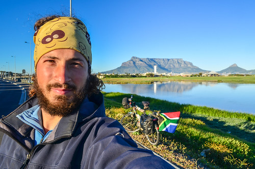
No sé si la llaman ciudad del cabo una ciudad africana, ya que no se ve nada como otras grandes ciudades del continente. Se ve bastante parecida a una ciudad costera de Europa, como uno no se pierda en Cape Flats. Una gran diferencia para mí es la presencia de carriles bicicleta, que son unos como raros en África como un Peugeot 504 en Suiza. Con los carriles para ciclos en un domingo por la mañana, ciudad del cabo, una ciudad de casi 4 millones de personas, se siente como un pueblo.
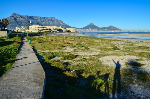
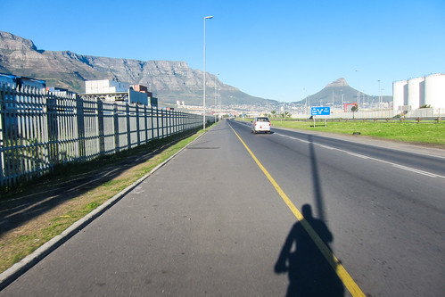
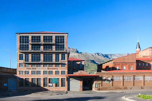
Sin embargo, en Woodstock, empiezo a tener problemas. Los carriles de bicicleta han desaparecido así que salí a la carretera donde la diferencia de velocidad con los coches es demasiado, y ahora estoy atrapado entre dos ferrocarriles, entre el norte y la línea sur, entre la estación de Esplanade y Woodstock. Es inmediatamente menos amistoso, y el único hombre de las calles desiertas a quien pido mi manera sugiere que seguir las pistas ferroviarias: me llevan al centro de la ciudad.
Seguro que lo hará, pero después de unos metros, parece obvio que no voy a poder hacer mi bici en uno o dos kilómetros de la pista de lastre. Tal vez es el camino más corto para los peatones, pero demasiado para mí. Giro de 180 grados entonces.

Mi otra opción es la pasarela sobre el ferrocarril, que incluye llevar mi bicicleta subir y bajar escaleras, un ejercicio de destrucción de hombro, incluso con la mitad de las maletas en. Pero en el otro extremo de la pasarela, en la parte inferior, dos metros de la carretera, un torniquete bloquea mi camino. ¡Más mala suerte! Hay una puerta abierta, donde fácilmente podía dejar pasar, pero un guardia de seguridad antipático que se niega a dejarme ir. No sé por qué, puesto que sería capaz de pasar a través sin la bicicleta, y empiezo a odiar a ciudad del cabo.
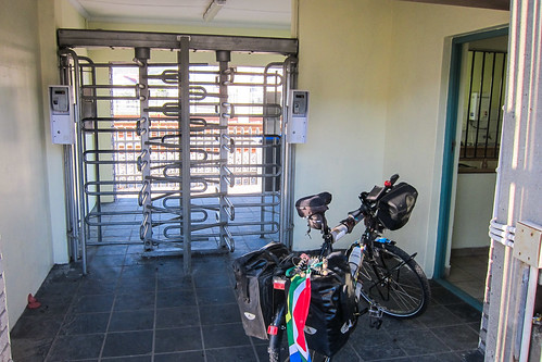
Otro giro de 180 grados y otra bicicleta levantamiento de entonces... y ahora, desde la pasarela, veo el carril bicicleta otra vez: ahora funciona a lo largo del carril MyCiti, un nuevo sistema de tránsito rápido del autobús.
Deseo que yo había planeado esta travesía de ciudad del cabo en internet, porque no es obvio que donde los carriles bicicleta iniciaron y detener. Unos cientos de metros más lejos, el carril de la bicicleta se detiene otra vez, a la derecha en el CDB. Hay una gran rotonda con semáforos en el centro. Como si construyó una rotonda primero y se dio cuenta más tarde que no funcionará sin la colocación de semáforos para entrar y dejar. Semáforos y rotondas no tienen sentido juntos, pero para decir la verdad, es más limpio que el otras rotondas He visto en África, que trabajar con las siguientes reglas: 1-los coches pueden entrar en la rotonda en cualquier momento, y 2 - bocina de un coche para romper el flujo y la salida. Resulta en un círculo de cero velocidad ruidoso que debe parecerse a un agujero negro artificial para tragar el tráfico desde todas las direcciones.
Por cierto, la mitad de las rotondas del mundo están en Francia y para la diversión más hechos acerca de rotondas en el acento frenchest, hay Esta presentación de diapositivas de la Conferencia Nacional de la rotonda.

Aiming at crossing the CBD with the fastest and easiest way possible, I catch the first cyclist I see and follow him for a while, before continuing on my own with his instructions. I cross Buitengracht street, a major intersection of the CBD, but also a site for a special sight adding to Cape Town’s traffic nonsense: a highway bridge to nowhere.

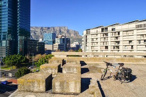
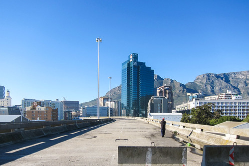
El Autopistas Foreshore are well known to the Capetownians since they have been hanging there since 1977. There are muchas historias around it.
One school of thought blames it all on an engineering error, convinced that the project was abandoned when it became apparent that the two spans of the highway bridge were not going to come together at an expected point. Others say it’s all because a shop owner whose establishment stands (or used to stand) in the way of the bridge refused to budge. According to a slightly different story, it was because the city authorities would not pay him pay him what he asked for. There are even some people who, tongue-in-cheek, maintain it was a plain and simple Hollywood conspiracy. According to them, the construction was never even intended to be sculpted into a bridge. Instead, it was meant to become the world’s top scenic spot for driving a car off a bridge in a movie. The official explanation is that the city had run out of the money and decided to stop the work on the projected highway. The traffic volumes at the time did not justify the cost anyway, and there were other priorities.
Since I am passing so close, I pay them a visit. There’s a nice view and it would make an excellent party spot. Two homeless men have built a shelter on one of the lanes.
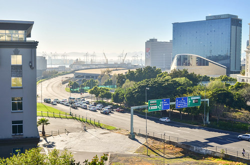
I finally meet the cycling lane again in Green Point, and from now on it’s easy to exit the city. I cycle past the Cape Town Stadium, built for the 2010 football world cup, and which is today jointly serviced by the same French company looking after the Stade de France.
Then it’s Sea Point, where many Europeans have bought houses, and where it doesn’t look at all like the Africa I know.
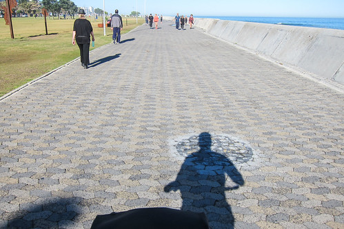


So many people are jogging, walking, cycling, roller-skating, etc. It feels like a great city, maybe like Nice, with young people in it. It’s a nice way to finish the Trans-African journey, starting in Europe and finishing in a Europe-like environment.
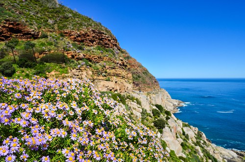
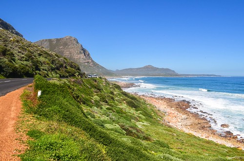
After passing the very posh suburbs of Clifton and Camps Bay, the ideal place for a wealthy businessman’s holiday home, I am finally out of the people and the traffic. My road takes me along the scenic Twelve Apostles, the steep Atlantic side of Table Mountain.

I meet a lot runners and cyclists on this road. One of them stops and tells me that September 1st, tomorrow, is Spring Day, meaning that all outdoors activities can resume after a cold and rainy winter. There are many cyclists preparing for the Cape Argus, the world’s largest timed cycle race with over 35’000 contestants, on these very same roads, in March.
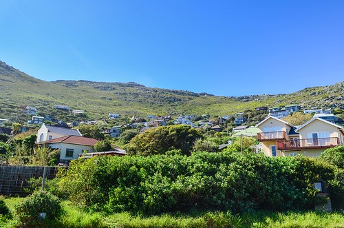
El próximo pueblo en mi camino Llandudno, a surfing spot and expensive suburb, where a Zimbabwean minister built a gran mansiónwhen he was supposed to have only Zim dollars.

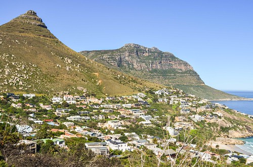
I am not yet halfway to the Cape of Good Hope, but the landscape gets prettier and prettier.

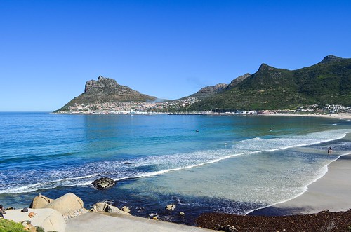
There is that sign just after Hout Bay: “Cyclist stay alive at 1.5 m". Parece que está diciendo ciclistas para respetar una distancia al ser superado por un coche... es raro. La ley en Francia establece que un conductor adelantar a un ciclista debe dejar una distancia de 1 metro en los centros urbanos y 1,5 m en los demás casos. Por lo que es bueno ver que lo mismo se aplica en ciudad del cabo. Después de todo, África sigue siendo un continente donde un hombre en una bicicleta es un hombre pobre que no puede permitirse un vehículo más rápido; ciclismo no es visto como un modo de transporte saludable y conveniente o una actividad de ocio. Esa es la razón por la cual tengo una bandera colgando de mis alforjas traseras del lado del tráfico aumentar la distancia dejada por automovilistas de 10 cm a 30 cm.

There, the sign is placed in a way it can only address cyclists, when obviously, motorists are the ones to be taught how to respect slower vehicles, not the other way around. I’ve also seen a journalist on South African TV saying that “not all cyclists respect the 1.5 m rule” … How can a driver expect a cyclist, already riding as close to the gutter as he can, to distance himself from cars overtaking him? This whole mentality sounds very messed up.
Por otro lado, ese hombre en Hout Bay, dándome indicaciones, que además hacía mucho senderismo y ciclismo, me dio otro punto de vista. Dijo que la península del Cabo es un lugar maravilloso para correr por senderos, pero que los corredores siempre deberían ir en grupo para evitar a los delincuentes oportunistas del campo. También dijo que los ciclistas de Ciudad del Cabo están más o menos en guerra con los conductores: no van en fila india, sino que uno al lado del otro, no respetan las normas de tráfico y se hacen responsables de la carretera. Tampoco es inteligente.
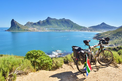
After Hout Bay, until Noordhoek, the road is called Chapman’s Peak Drive, and it’s a stunning one. There is a toll gate for vehicles, but cyclists get through for free. It’s a Mediterranean version of the James-Bond-driving-in-the-Alps kind of road. It’s often too narrow to stop, even for a bicycle, but it certainly makes me happy not to have picked the east side of the peninsula, via Muizenberg.

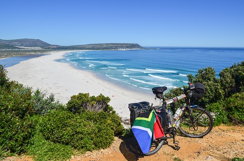
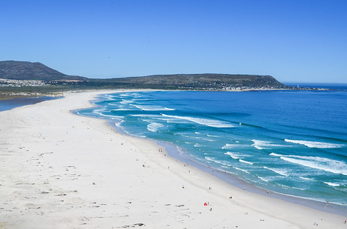
Paso entonces Kommetjie, another surfing spot, and its Faro centenario. The road is gently leading me to the national park of the Cape of Good Hope.
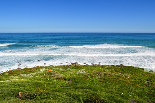
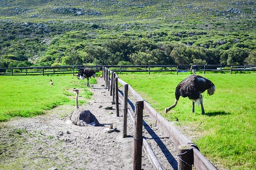

I must pay the R105 entrance fee for the last 10 kilometers, as they are part of Table Mountain National Park. For a short while, I cycle on the same road with an ostrich.

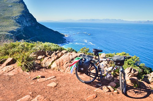
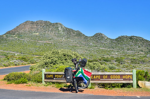
Cape Point is another cape, very close to Good Hope. It is the location of the most powerful lighthouse of South Africa. I turn right, and … it’s the end!
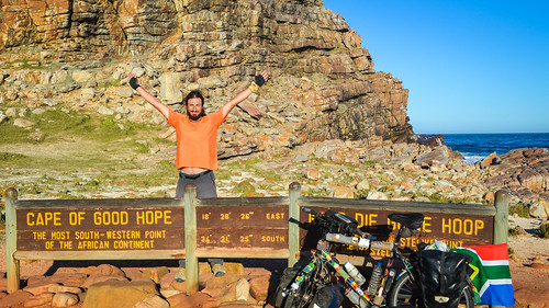
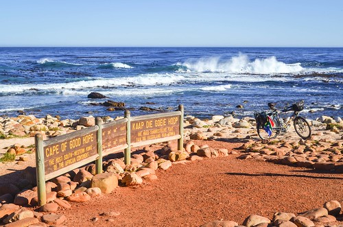
It’s actually not that easy to get a picture. The national park attracts tourists and one must queue.

That’s it for my 666 days and 26609 kilometers on the road. Now, I am on holidays!
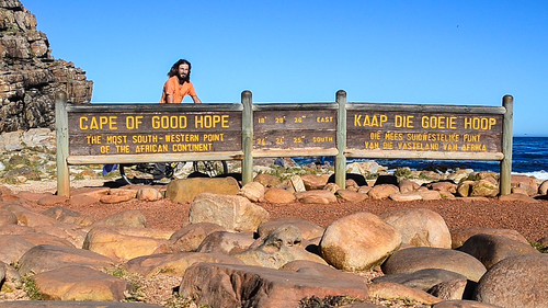


I was lucky to have cycled in this area a couple of times, what a great ending to such a tremendous jouney!
Wow! Fantastic story and photo! Thanks so much for sharing. Quite a feat!!
i have it on good authority that there isn’t much “coming next” for quite some time… 🙂 besides, this is an achievement of a lifetime and will only grow in value. congratulations, jb! very, very proud
JB,
I stumbled across your Blog when you where reporting about Oranges in Spain. At first reading I did not get what it means to cycle through Africa to Cap Town.
Now that i followed your Blog, regulary checking for updates of your Trip, I have some more of an idea what it might be. But still i think it is kind of hard to believe.
Felicidades a usted para su viaje valiente! Estoy mirando adelante cuál es próximo.
todo lo mejor
Martin
¡Sí, cambió mucho desde España!
Gracias por tus palabras