It is 4°C in my tent when I wake up. I’m in Africa, but I’m sleeping at 1740 m high (the highest night of the trip so far) in winter. It has been a long time since I woke up in the cold with frozen fingers to fold my tent. I leave on the bike with jacket, hat and gloves, as in the good cold times.
I quickly join a junction to the main road, direction the source of Oum Errabia, south. That makes 30 km, seemingly without anything along the road, and I’m glad I had a bread left for breakfast this morning.

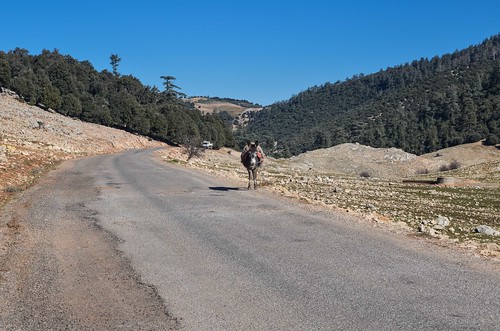
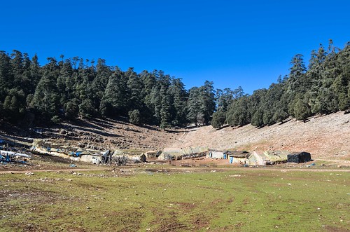
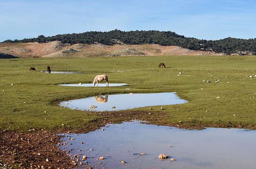
So I am cycling the Middle Atlas now. It looks more like a high plateau than a snowy mountain range. My elevation is between 1600 and 1800 m, and the weather is just right to be warm without sweating. It is quite green, and farms, shacks and donkeys populate the area.
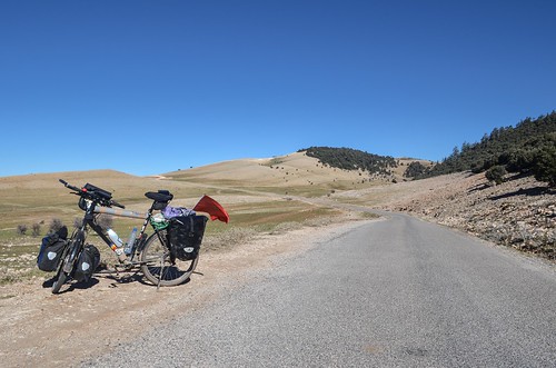
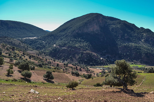
I make it for lunchtime to the source of Oum Errabia, the second longest Moroccan river. The source springs by a small village where kids beg for money to anyone moving on wheels, prices are much higher than the average, and where I see my first pay toilets of Morocco.

It is a touristy place, but again locally touristy. It is my 4th “local tourist spot” after Moulay Yacoub, Ifrane, and Mischliffen, where all the tourists were Moroccan townsmen. I have not seen a foreign tourist there. On the other hand, at the gates of the desert, or in the medina of cities like Marrakech, Fès, Chefchaouen, the foreign tourist is the center of business. Tourism is much better developed where foreigners go, with more shops, more food, more police, more traps, more “exotism”. On the other hand, the striking feeling when arriving in a foreigner-less tourist area, is that I can just watch people and things on my own: I am not instantly surrounded by fake guides offering anything and I can walk 5 meters without hearing “Hola amigo”. And I must admit, this relative loneliness in a pool of visitors sometimes feels strange.
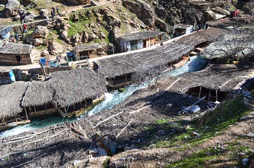
The source is in a nice location. The fresh water is good to drink, and the stream of a beautiful color is bordered by small huts offering tea or tagines. Most of them are empty though. I meet 2 young road cyclists (and it’s very rare to see cyclists) and we visit the waterfall together.

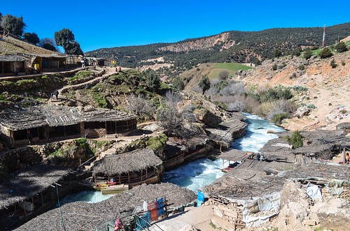
They invite me to stay at their place in Mrirt, but it’s unfortunately in the opposite direction. The day is hot now and I remove my jacket to go uphill on an empty narrow road, often destroyed but suitable for a small car and careful driving skills.
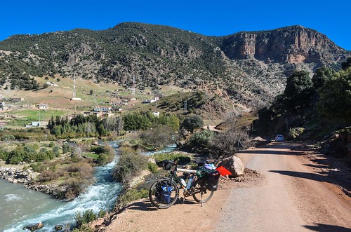

The small road leads me to Khenifra, the big city of the region. But 20 km beforehand, I have to make a decision: to head west to Khenifra-Marrakech and pass the High Atlas at Tizi n’Tichka, or to head east to Midelt-Errachidia and pass the High Atlas in the Ziz gorge. By lack of reliable information, I exclude the idea of going straight and pass it on dirt roads through Imilchil, probably the highest and most beautiful, but also the riskiest in this winter time.
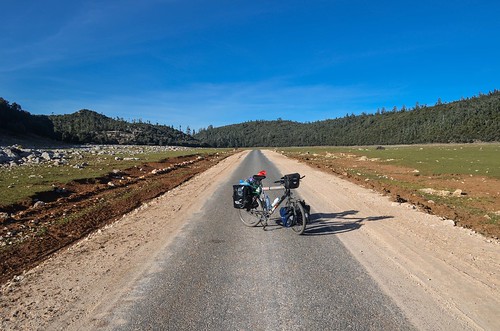
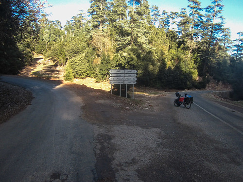
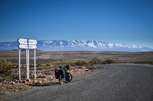
I revert east towards the N13 and as a consequence will cross the High Atlas at the east end of it, between Midelt and Errachidia. Yet, I have to finish my hilly roads of the Middle Atlas first. At least, road signs, paper map and OpenStreetMap now agree together and all show Itzer in the same direction, at 74 km of asphalted road.
I was doubting of this road but it seems well paved. The paper map indicates it as surfaced, and a local told me it was indeed asphalted, but with a lot of potholes, which on a bike don’t mind much. I just want to avoid wet mud tracks, as when I get stuck into it, the mud quickly clogs the wheels and solidifies inside my fenders and around the brakes.
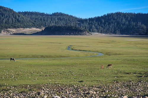
On the quiet roads, I see a monkey. With the dogs, that makes a new threat in camping in the forest. With the night coming within the hour, I ask to camp within the fence of the only brick house of the plain, but get refused.
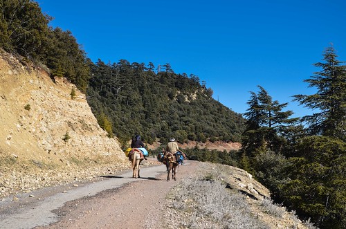
So I continue into the forest uphill until the night. The pavement has now disappeared. It keeps reappearing for one meter or two from time to time. The patches of snow reappear from time to time too. It is getting darker and lonelier, just when 2 men on donkeys appear out of nowhere. I continue climbing until what looks like a last turn and suddenly … the High Atlas!
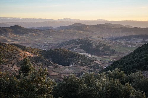
I am above 1800 m and the road on the edge of the mountain now shows an opening in the forest. I have a wonderful view with sunset tones, of a plateau in the foreground, and high white peaks in the background, far away. I also hear and see many animals. In a place that felt so quiet during the ascent, donkeys and cows are everywhere. The families living in rustic houses are leading them home. People really use all of the territory workable. I thought Morocco would have more wild and empty areas than Europe, but it is not the case at all. It makes the task of finding a good campspot harder.
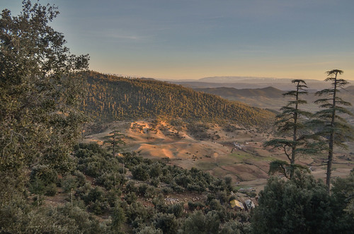
Now with beautiful views, but still without a suitable campspot, I continue riding the poorly asphalted road. That’s when Mehdi passes by in his pickup and offers his place to sleep. He says it’s only 6 km away, so I accept to cheat and to tie my bike in the Toyota. We have a conversation in a limited French, but with a lot of football. One cannot simply travel Morocco without knowing the news about Real Madrid and Barcelona, or without knowing who Messi and Ronaldo are.
The road feels much longer than 6 km and the little pavement left is now replaced by big potholes. I am a little annoyed that we are now doing the scenic part of the road, downhill, with spectacular views on a canyon and the snowy peaks in the background, in a car and not on my bike. I don’t know when we will reach his home and hope I’ll have some of the scenic road left for tomorrow. The road is wide enough for one car only and is the kind of road that should have a protective barrier along its whole length.
Finally my cheating has lasted 15 km. We reach his house on the steep slopes of the valley, just below the road, steep enough so that the three-storied building has its roof at the level of the road. It felt much longer than 15 km, probably because the road is destroyed and we must drive slowly. A last scary U-turn at the edge of the road, without seeing how deep the drop into the valley is, and we’re home.
I am welcomed by the family with thick milk, delicious sweet tea, butter, olive oil and bread. The kitchen is a room weakly lit with a lamp bulb mounted on a gas cartridge. We are all sitting around the wood stove. Eight persons in a not-so-big room and a fire, it is super hot. I learn a few words of Tamazight, the Berber language. There is no electricity, no tap water, the worse road to reach the house, but the 3G network and Facebook have penetrated the area successfully. Maroc Telecom brings the 3G here but with my Meditel SIM card, I don’t even have network.
After the snack, we go and watch the CAN game Burkina Faso – Togo. I was surprised at the idea, having no electricity in the house. Actually the brother has a TV in his room, a satellite dish and a solar panel on the rooftop, so there is football and movies after a sunny day. The game on Eurosport Germany is of a poor quality, especially when I have seen many Real – Barcelona and other “big” European league games. Burkina Faso qualifies, Adebayor is out, and we head back to the kitchen to eat lentils in the most dishwashing-efficient configuration ever (2 plates and 3 glasses for 8 people).
The cellphone syndrome of we-are-all-around-the-dinner-table-typing-on-our-phones happens here too, with the 3 men silently on their phones. I am excluded as I don’t have network, but go quickly fall asleep, under 3 berber blankets, which keep me as warm as if I were sitting right by the fire. I am missing the perfect clear sky night, but will catch up with it in the desert.
In the morning, I leave Mehdi’s family after a good breakfast, again made of oil and butter with homemade bread.
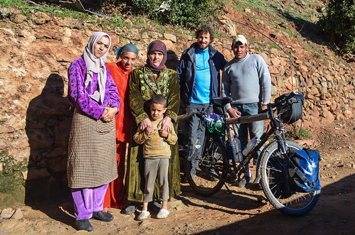
It is now my turn to move on those bad roads. My destination, Itzer, is at the exit of the Middle Atlas. So I should be done today with the first wave of hills and snow.
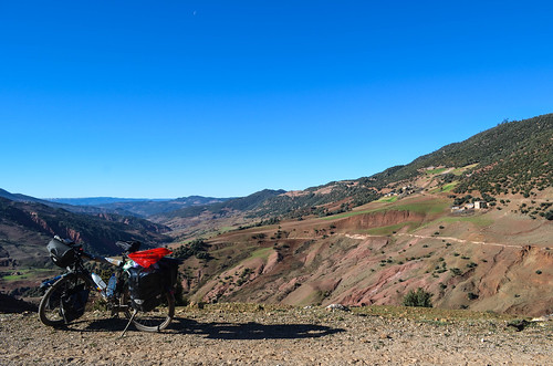
For the first kilometers, I see no one on the road. No cars, no pedestrians. Few shapes are moving by houses down the valley. With the only noise of the wind, it feels like a hostile and lonely landscape.
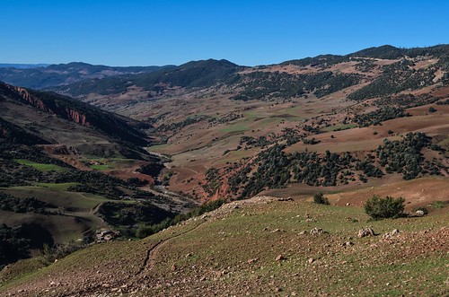
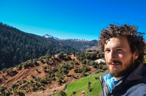
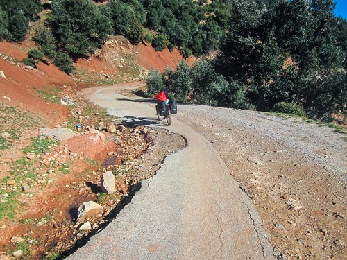
The road goes worse and worse. It seems to have been washed my mud slides and melting snow. Sometimes the pavement reappears from under the mud.
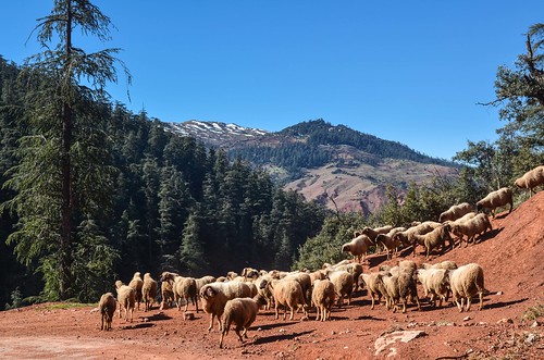
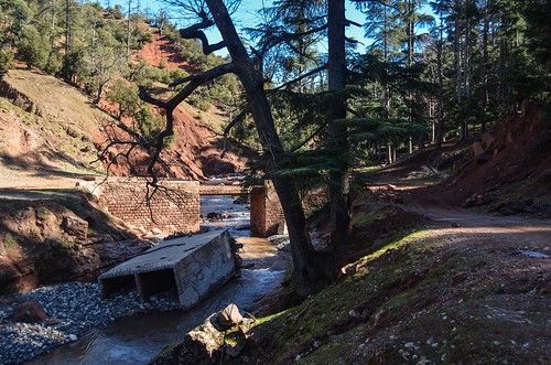
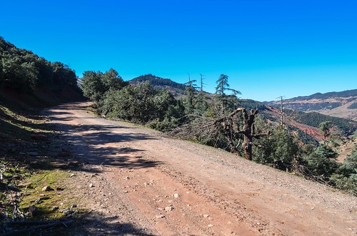
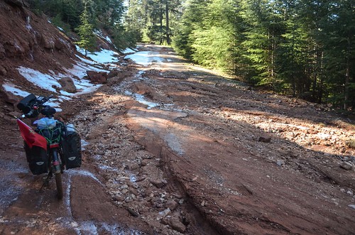
I am still going up, actually from 1500 to 2000 m. It’s a very beautiful landscape. I am a little worried about the road, as I have seen only one pickup on it during the whole morning, and hope it will reasonably take me to the other side.
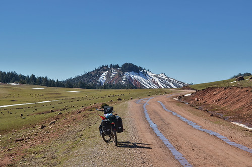
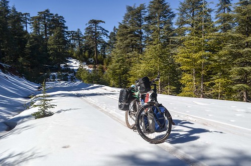
I reach above 2000 m what seems to be the top for the day. It doesn’t look like a pass at all, with winding mountain roads, but like a huge flat and fertile area. There is no electricity, no cars, but there are sheep walking in the grass and 2 herdsmen. The grass feels more like moss, like a carpet. It reminds me of the green Gobi in Mongolia, chill, wild and hostile, yet wet and tamed. I am now cycling on gravel and waiting for the time when I will reach the southern edge of this mountain road, where I should have a view over the next mountain range, the High Atlas, as I’ve seen for 5 minutes yesterday evening.
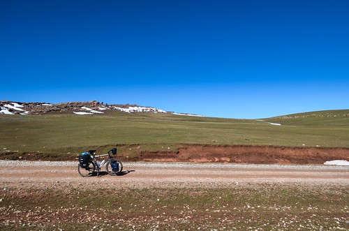
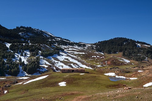
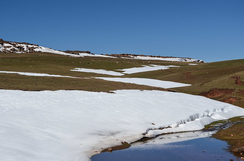
The first people I get to talk to today, in the afternoon, are two men on horses. Well, I can only show off my three words in Tamazight, “hello”, “thank you” and “milk”, so we’re quickly done with the conversation.
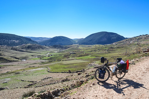
And as I expected, the deserved viewpoint arrived after a turn of the road. It’s grandiose.
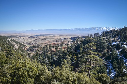
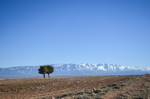
From now on, the road can only go downhill. I have done not even 30 km during more than half of the day and it’s a relief to see this vast plain in front of me. The snow caps behind belong to Jbel Ayashi of the Eastern High Atlas, rising to 3747 m. It looks like a snow barrier between the north and the desert, like a fence.

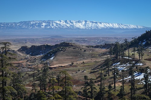
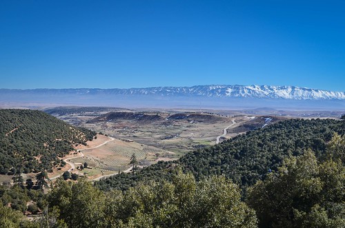
The downhill ride is fun, and features 100 m of cycling into the river that took over the road. I try to see on my map which mountain is which, as I see now many more snow peaks. I am still around 1800 / 1600 m high, watching the snow under the 4000’s, but it is quite flat and I feel like being at sea level, watching at 2000 m high mountains. It’s rather warm, but with a cold wind.

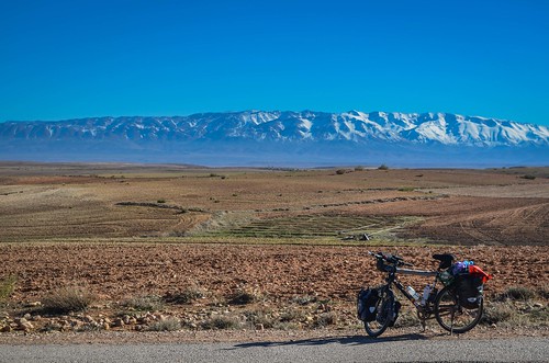
I didn’t encounter a shop since I left. The half-bread I was carrying with me is eaten since a long time and I am looking forward for food. So I cycle down not to Itzer, but to Boumia. And I realize something strange … it looks desertic … right, there are no more greens! Is it the desert yet?
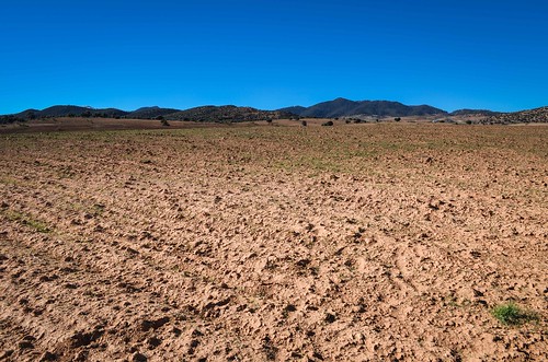
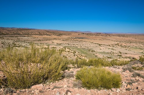
Boumia is a bigger town than expected. With 10’000 inhabitants, it has many shops along one long street. As usual, the shops are full of stuff, but it is the always the same stuff, and not what I need. The same shop can be selling healthcare, dry food, diary products, plastic toys, SIM cards, car parts, house tools … but no battery CR1225. It’s not bad, it’s just needed for the futile purpose of having the retrolighting on the screen of my Swiss army knife to read how cold it is at night in the tent. On the other hand, I am offered tea here at shops, a genuine offering, and not to tell me for hours about carpets and other handicraft I could pay by VISA and have it shipped home.
There is a hotel in town at 50 dh so it quickly overrides my idea of going camping. When the sun sets, the cold takes over the town and the shop keepers stick to their heater. I grab food here and there, and head to a café with a slow wifi. I have noticed the mint tea is often replaced with chiba, the absinthe leaf.


AlinC
Images sublimes, heureusement que l’on sait que tu es au Maroc car cela ressemble a certains paysages du haut Jura.Pour éviter la fringale tu n’as pas qqs centaines de grammes de sucre en réserve .
A+
En effet, c’est tout vert et boisé avec un peu de neige. Par contre le haut atlas juste en dessous n’a rien a voir.
J’ai bien des trucs sucrés en reserve, mais a la fin de la journée, il me faut quand meme 1 kg de trucs solides a manger 🙂