The weather was cloudy when I reached Cape Town last week, but today, the last day of August, will be perfect for my last stage of cycling Africa. I want to end at the Cape of Good Hope, and involuntarily, this falls on DAY 666 and KM 26500.

The Cape of Good Hope is roughly 50 km south of Cape Town. Starting from the northern suburbs, having to go through the whole city, and taking the western road, longer, it will take me closer to 100 km. Good Hope is not the southernmost point of Africa, and it’s not where the Atlantic Ocean meets the Indian Ocean. That point is actually Cape Agulhas, 150 km south east of Good Hope, at 34°50′0.35″S instead of 34°21′29″S, and lies 50 km further south.
But I didn’t start from the northernmost point of Africa, so I don’t have to end at the southernmost one. And Good Hope is much prettier than Agulhas. It’s also historically more significant: reached by the first sailors in 1488 (still the Portuguese), it hosted the first large scale emigration of French Huguenots in 1687.

I don’t know if people call Cape Town an African city, since it doesn’t look at all like other large cities of the continent. It looks pretty much like a coastal European city, as long as one doesn’t get lost in the Cape Flats. One major difference to me is the presence of cycling lanes, which are about as rare in Africa as a Peugeot 504 in Switzerland. With the cycling lanes on a Sunday morning, Cape Town, a city of nearly 4 million people, feels like a village.

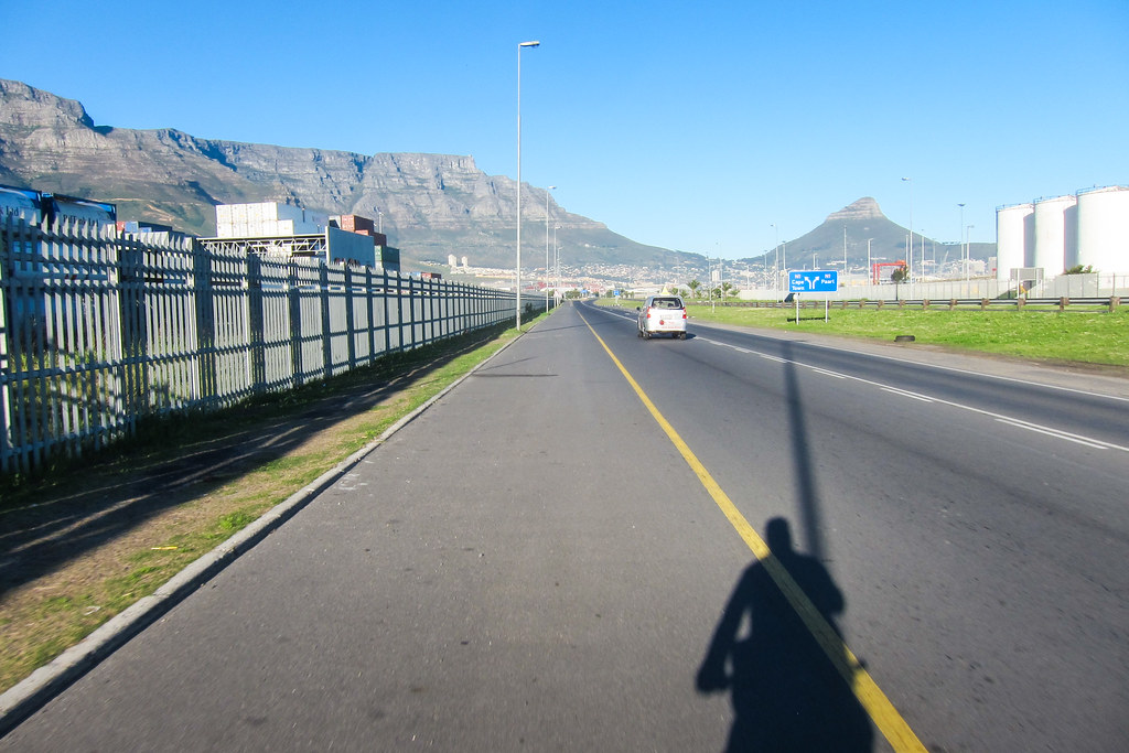

However, in Woodstock, I start to have problems. The cycling lanes have disappeared so I left the highway where the difference of speed with cars is too much, and I am now stuck between two railways, between the Northern line and the Southern line, between Esplanade station and Woodstock station. It’s immediately less friendly, and the only man of the deserted streets to whom I ask my way suggests that I follow the railway tracks: it will lead me to the city center.
Sure it will, but after a few meters, it appears obvious that I won’t be able to push my bike on one or two kilometers of track ballast. It’s maybe the shortest way for pedestrians, but too long for me. U-turn then.

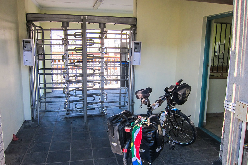
My other option is then the footbridge over the railway, which includes carrying my bicycle up and down staircases, a shoulder-destroying exercise, even with half the panniers on. But at the other end of the footbridge, at the bottom, two meters from the road, a turnstile blocks my way. More bad luck! There is an open door, where I could easily pass, but an unfriendly security guard refuses to let me go. I don’t know why, since I would be able to pass through without the bicycle, and I start to hate Cape Town.
Another U-turn and another bike-lifting then … and now, from the footbridge, I spot the cycling lane again: it now runs along the MyCiti lane, a brand new bus rapid transit system.
I wish I had planned this Cape Town crossing on the internet, because it’s not obvious at all to know where the cycling lanes start and stop. A few hundred meters further, the cycling lane stops again, right in the CBD. There is a huge roundabout with traffic lights in the middle of it. Like if they built a roundabout first, and realized later that it won’t work without placing traffic lights to enter and to leave it. Traffic lights and roundabouts make no sense together, but to say the truth, it’s cleaner than the other roundabouts I’ve seen in Africa, which work with the following rules: 1- cars can enter the roundabout anytime, and 2- a car honks to break the flow and exit. It results in a noisy zero-speed circle that must look like a man-made black hole swallowing traffic from all the directions.
By the way, half of the world’s roundabouts are in France, and for more fun facts about roundabouts in the frenchest accent ever, there is this slideshow from the National Roundabout Conference.

Aiming at crossing the CBD with the fastest and easiest way possible, I catch the first cyclist I see and follow him for a while, before continuing on my own with his instructions. I cross Buitengracht street, a major intersection of the CBD, but also a site for a special sight adding to Cape Town’s traffic nonsense: a highway bridge to nowhere.

The Foreshore Freeways are well known to the Capetownians since they have been hanging there since 1977. There are many stories around it.
One school of thought blames it all on an engineering error, convinced that the project was abandoned when it became apparent that the two spans of the highway bridge were not going to come together at an expected point. Others say it’s all because a shop owner whose establishment stands (or used to stand) in the way of the bridge refused to budge. According to a slightly different story, it was because the city authorities would not pay him pay him what he asked for. There are even some people who, tongue-in-cheek, maintain it was a plain and simple Hollywood conspiracy. According to them, the construction was never even intended to be sculpted into a bridge. Instead, it was meant to become the world’s top scenic spot for driving a car off a bridge in a movie. The official explanation is that the city had run out of the money and decided to stop the work on the projected highway. The traffic volumes at the time did not justify the cost anyway, and there were other priorities.
Since I am passing so close, I pay them a visit. There’s a nice view and it would make an excellent party spot. Two homeless men have built a shelter on one of the lanes.


I finally meet the cycling lane again in Green Point, and from now on it’s easy to exit the city. I cycle past the Cape Town Stadium, built for the 2010 football world cup, and which is today jointly serviced by the same French company looking after the Stade de France.
Then it’s Sea Point, where many Europeans have bought houses, and where it doesn’t look at all like the Africa I know.

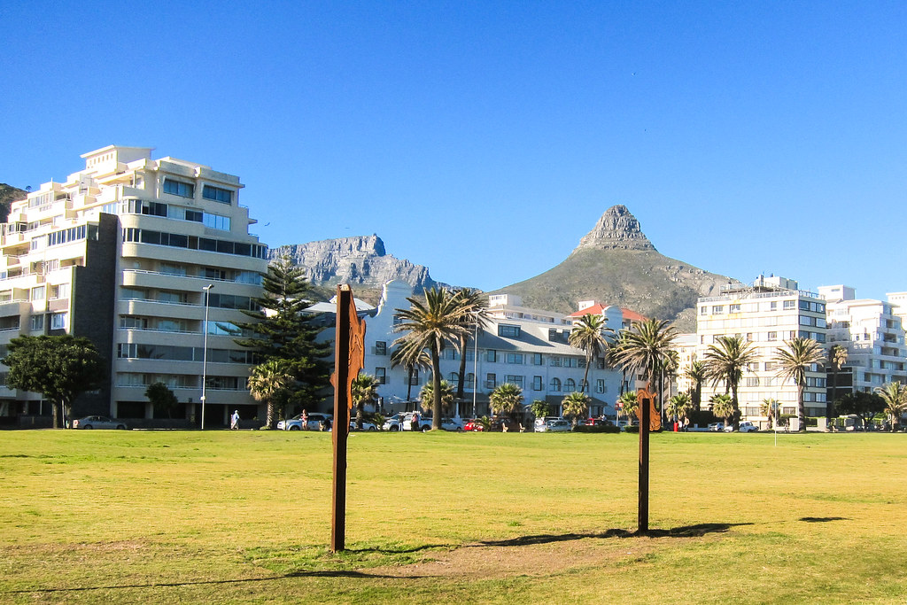
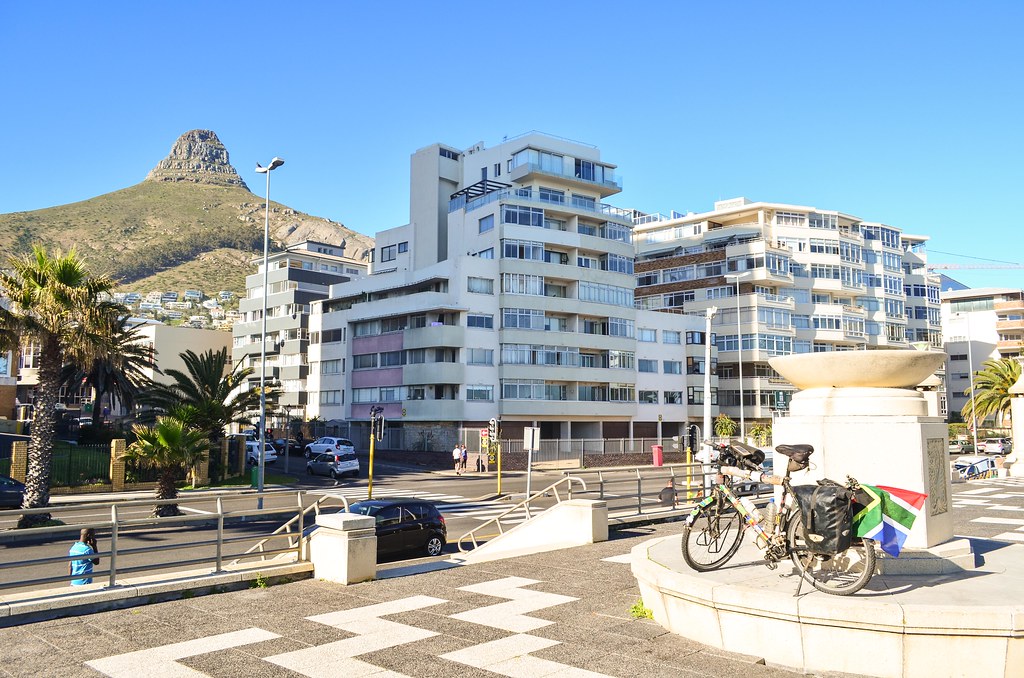
So many people are jogging, walking, cycling, roller-skating, etc. It feels like a great city, maybe like Nice, with young people in it. It’s a nice way to finish the Trans-African journey, starting in Europe and finishing in a Europe-like environment.
After passing the very posh suburbs of Clifton and Camps Bay, the ideal place for a wealthy businessman’s holiday home, I am finally out of the people and the traffic. My road takes me along the scenic Twelve Apostles, the steep Atlantic side of Table Mountain.

I meet a lot runners and cyclists on this road. One of them stops and tells me that September 1st, tomorrow, is Spring Day, meaning that all outdoors activities can resume after a cold and rainy winter. There are many cyclists preparing for the Cape Argus, the world’s largest timed cycle race with over 35’000 contestants, on these very same roads, in March.
The next town on my way is Llandudno, a surfing spot and expensive suburb, where a Zimbabwean minister built a large mansion when he was supposed to have only Zim dollars.


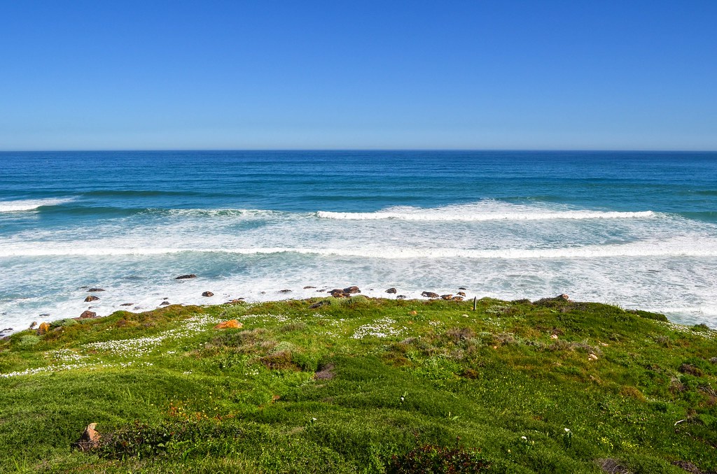
I am not yet halfway to the Cape of Good Hope, but the landscape gets prettier and prettier.


There is that sign just after Hout Bay: “Cyclist stay alive at 1.5 m“. It sounds like it’s telling cyclists to respect a distance when being overtaken by a car … it’s weird. The law in France states that a motorist overtaking a cyclist must leave a distance of 1 meter in urban centers, and 1.5 m in all other cases. So it’s great to see that the same applies in Cape Town. After all, Africa is still a continent where a man on a bicycle is a poor man who can’t afford a faster vehicle; cycling is not seen as a healthy and convenient transportation mode or a leisure activity. That’s why I have a flag hanging from my rear panniers on the traffic side, to increase the distance left by motorists from 10 cm to 30 cm.

There, the sign is placed in a way it can only address cyclists, when obviously, motorists are the ones to be taught how to respect slower vehicles, not the other way around. I’ve also seen a journalist on South African TV saying that “not all cyclists respect the 1.5 m rule” … How can a driver expect a cyclist, already riding as close to the gutter as he can, to distance himself from cars overtaking him? This whole mentality sounds very messed up.
On the other hand, that man in Hout Bay, giving me directions, who was also doing a lot of hiking and cycling, gave me another point of view. He said the Cape peninsula is a wonderful place for trail running, but runners should always go in a group to avoid opportunist bush criminals. He also said that cyclists around Cape Town are more or less at war with motorists: they don’t ride in a single file, but side-by-side, they don’t obey traffic rules, and they take ownership of the road. It’s not smart either.

After Hout Bay, until Noordhoek, the road is called Chapman’s Peak Drive, and it’s a stunning one. There is a toll gate for vehicles, but cyclists get through for free. It’s a Mediterranean version of the James-Bond-driving-in-the-Alps kind of road. It’s often too narrow to stop, even for a bicycle, but it certainly makes me happy not to have picked the east side of the peninsula, via Muizenberg.


I pass then Kommetjie, another surfing spot, and its hundred-year old lighthouse. The road is gently leading me to the national park of the Cape of Good Hope.


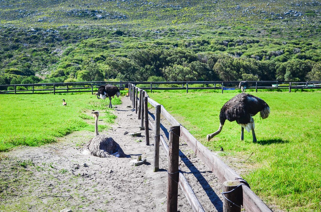

I must pay the R105 entrance fee for the last 10 kilometers, as they are part of Table Mountain National Park. For a short while, I cycle on the same road with an ostrich.
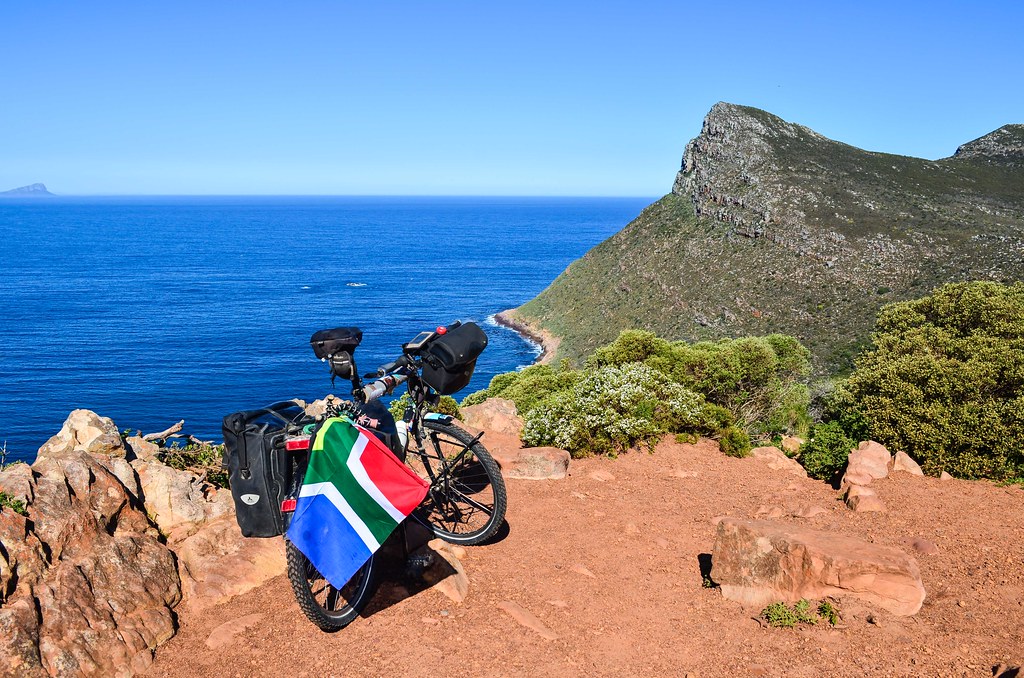


Cape Point is another cape, very close to Good Hope. It is the location of the most powerful lighthouse of South Africa. I turn right, and … it’s the end!


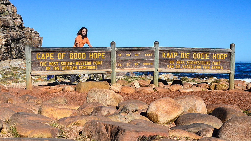
It’s actually not that easy to get a picture. The national park attracts tourists and one must queue.

That’s it for my 666 days and 26609 kilometers on the road. Now, I am on holidays!


I was lucky to have cycled in this area a couple of times, what a great ending to such a tremendous jouney!
Wow! Fantastic story and photo! Thanks so much for sharing. Quite a feat!!
i have it on good authority that there isn’t much “coming next” for quite some time… 🙂 besides, this is an achievement of a lifetime and will only grow in value. congratulations, jb! very, very proud
JB,
I stumbled across your Blog when you where reporting about Oranges in Spain. At first reading I did not get what it means to cycle through Africa to Cap Town.
Now that i followed your Blog, regulary checking for updates of your Trip, I have some more of an idea what it might be. But still i think it is kind of hard to believe.
Congrats to you for your brave Journey! I am looking forward whats coming next.
all the best
martin
Yep, it changed a lot since Spain!
Thanks for your words