A mob of youngsters arresting me? That’s what’s happening for the same usual silly reason: the obsession with the control of papers of anyone in Angola.

My shortcut Humpata -> Chibia won’t be as straightforward as I thought. I took it to avoid passing through Lubango again and discover a nice waterfall (quedas da Hungueria). The dirt road was bad in the beginning and it’s getting worse.

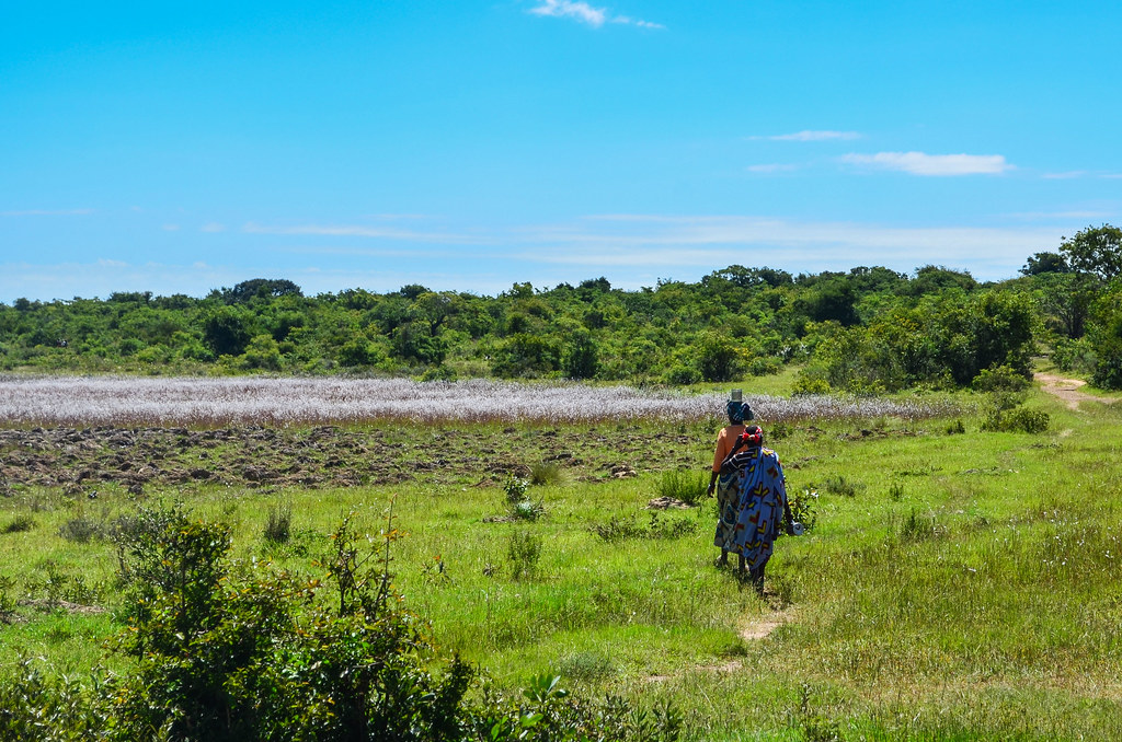
My road looks more like a cow path now. I would be lost if I didn’t have it on the GPS. I take a few pictures of a run-down school on the way and continue, passing a group of men, until a young man stops me. “You must stop and tell us what you are doing here“. I’m just passing through, going to Chibia.
“You must talk to the chief“. As I disagree and want to go, the young man doesn’t let me go, he holds on my rear luggage. By this time, more young men are surrounding me. “Bilhete, bilhete!“, they ask me, showing their own IDs and wanting me to show theirs.

I don’t want to show my passport to a mob of youngsters who have no authority on me. But they surround me on the narrow path and and I can’t continue. The whole situation lasts for about 20 minutes, during which I refuse to show my passport, and during which the whole village comes to me. I am already a few hundred meters past it, but the chief has come, the older men too, as well as a dozen of curious women. “You can’t pass here without telling us what you’re doing and showing us your ID. Who authorized you to be here?” I’m sick of this maniac ID control, but this is an extreme case, as this time random villagers perform it. Why do they have to spoil the visitor’s experience?
I keep refusing to show my passport, first because they most likely have no clue what a passport is, and second because I don’t want it to run between all the hands of the people there. Angola is not my country and I shall abide by the law, but I being stopped by villagers in the bush is too much. The situation unlocks when I convince them that everywhere in Angola the police know about me (which is not that untrue) and I will only deal with them. They call a policeman they know and receive the instruction to let me go.
The civil war has been over since 2002, but it seems many Angolans are still on this “we need to control” fear. These people here were saying that they can’t let an unknown man go through their village freely. They must check his papers. I have been invited into police stations at least 20 times so far for filing a report … Angola has a long way to go to change mentalities if they decide to open to tourism.
Well, I am now free to go, and this is when the road disappears from my GPS. There are tens of paths like this. The road on the GPS continues after 10 km as the crow flies. Until then, I am lost in the fields, and I just hope there are no rivers in between.


I zigzag on these small tracks. Some lead to isolated houses, some look wider than others but don’t go in the right direction … the map above shows, between KM 8 and KM 20, that I don’t know what I’m doing.
Luckily, I manage to meet the correct track again, but it’s full of sand and stones. Undoubtedly, I am masochistic. I could have stayed on the main highway.
But getting lost always brings good surprises. I “discover” an unmapped village, Jau. There is music this afternoon and some people are well dressed and well groomed. A wedding? No, it’s Saturday, so it’s the day of the Adventists, because the Seventh-day Adventist Church doesn’t celebrate the mass on Sundays.
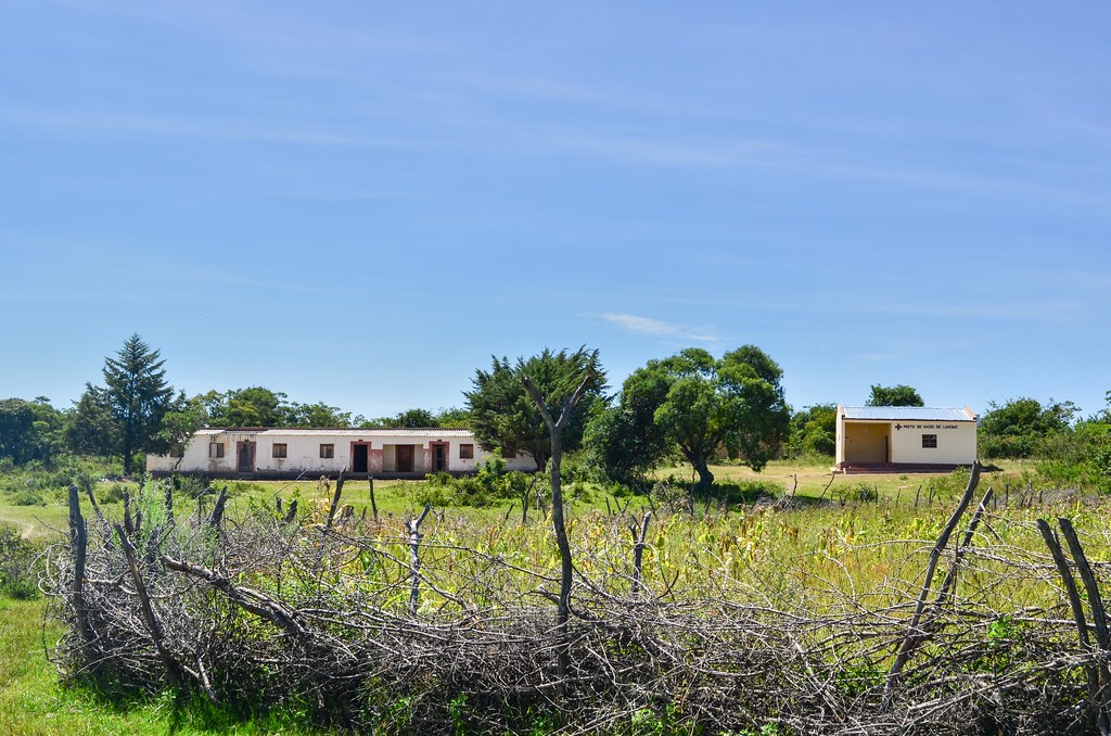
And what do I see further down in the village? A very nice catholic church and splendid old buildings. There is even a short aqueduct made of stones. What are all of these beautiful but seemingly abandoned buildings doing in the middle of nowhere?

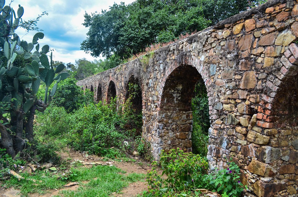
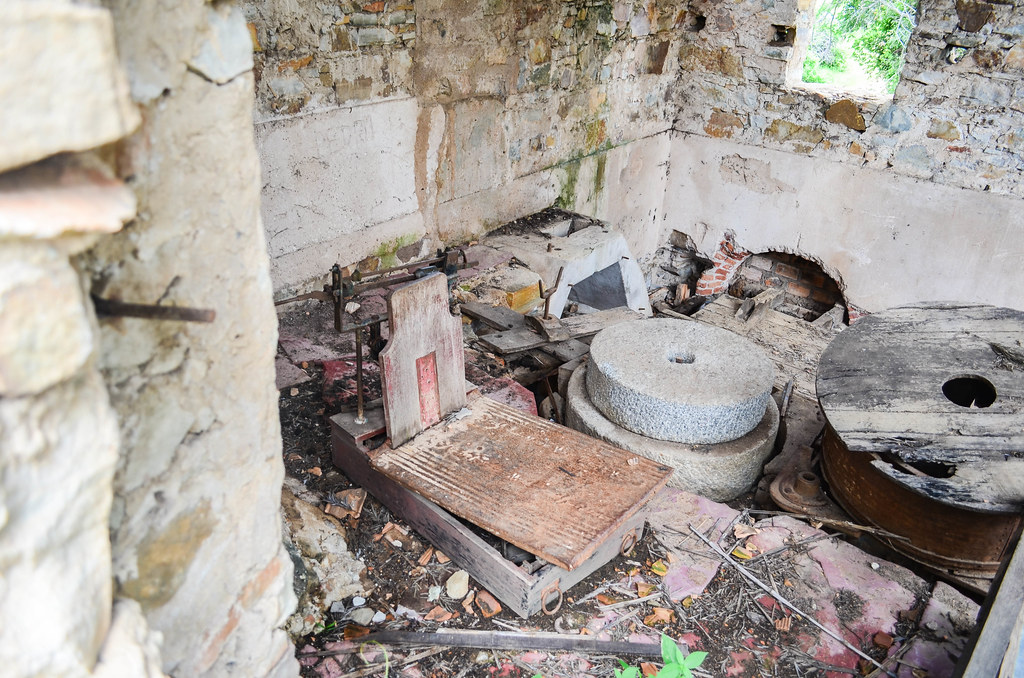

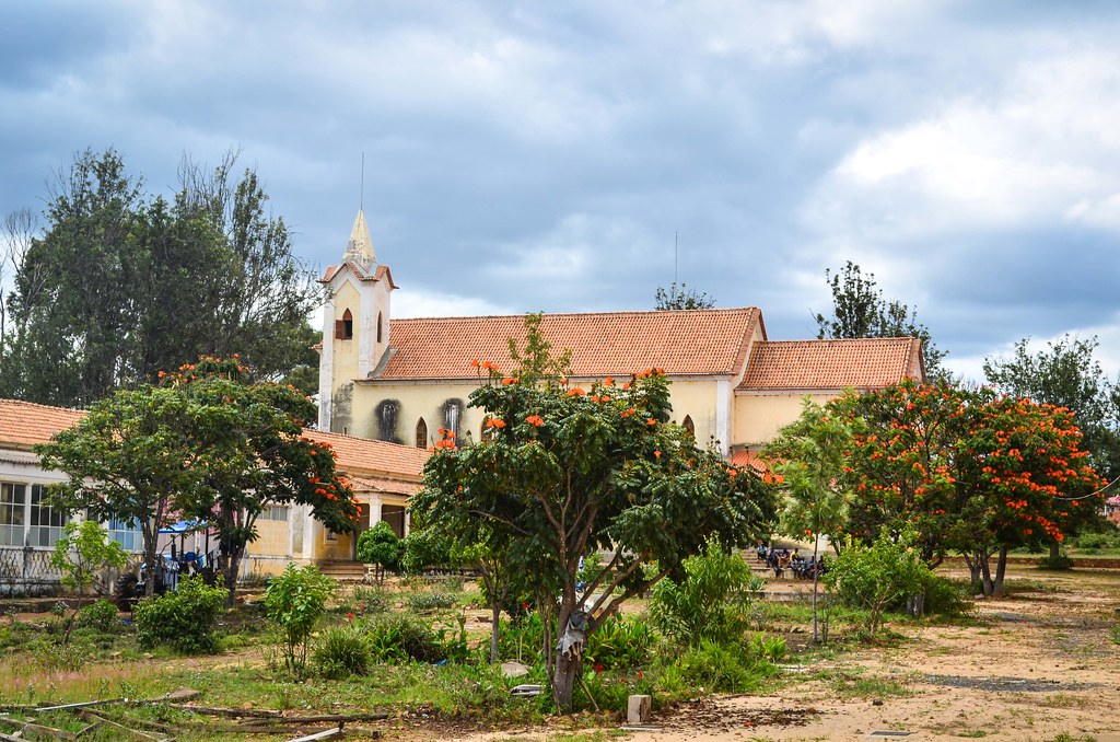
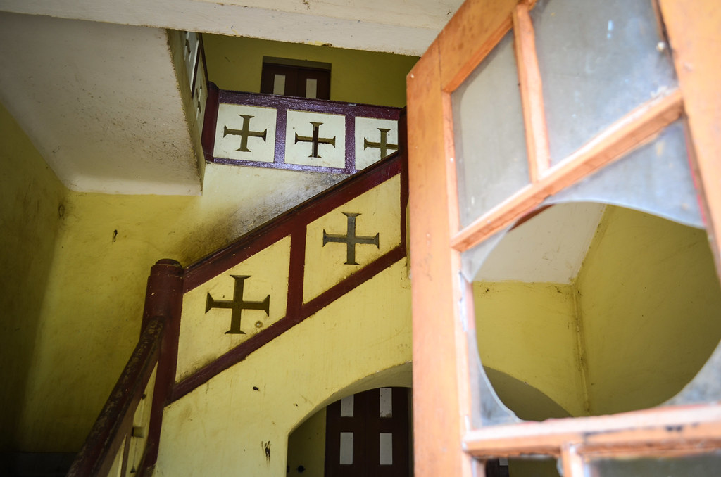
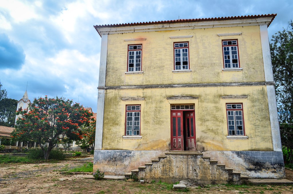
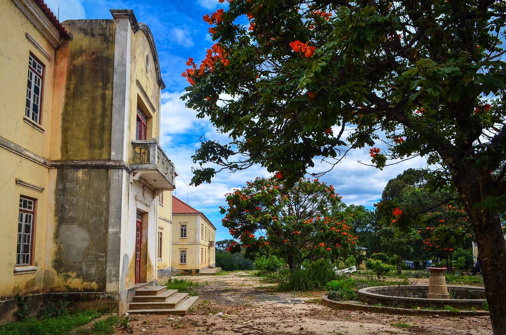
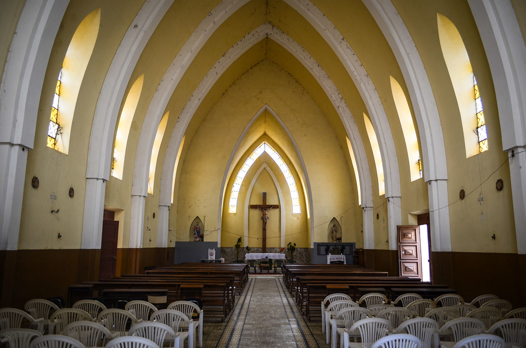
You surely need a 4×4 to reach this place. The reason why there are so nice buildings here is because it is the location for a seminar, the Missão de Jau. The main building reads MCMXL, 1940. I meet a student of Padre Texeira, who has been my host in Lubango. He says the mission is being renovated, I can the roofing is new already. It must have been deserted during the civil war. The seminarians are today in the missions of Lubango and Huilá instead.
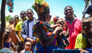
There is a hundred of children near the church repeating chants for tomorrow, Sunday, when the first mass of the new appointed priest takes place. The location is a little paradise, surrounded by fertile lands where anything grows. Definitely a good pick. Zoom out here to see where it is hidden.
I am glad to have bumped into this place as it makes it up for the bad experience in the morning and the lack of food. About ten kilometers after Jau, on a slightly better road, lies the junction to the waterfall, my planned highlight of the day, the quedas da Hungueria.
As usual, there are no sign. I have it roughly positioned on my Michelin map, but don’t have the GPS coordinates. I must rely on finding locals to guide me. Some boys are washing their bikes in the river near the junction. They say it’s just 5 minutes away, but they warn me: “the road is bad, there’s plenty of stones“.

It won’t be my first bad stony road, so off the waterfall I am. After one or two kilometers, I spend most of it pushing. The stones are too big and I can’t even cycle. At that moment, a Toyota Hilux passes me. As slow as a pedestrian. “How far is the waterfall?“, I ask.”Hmmm … some 25 kilometers away. Ah no, wait, maybe it’s 7 kilometers. You won’t reach before night anyway“. Even if it is 7 km, it will take me 2 hours of pushing and carrying my bike over these stones. I watch the pickup going away, climbing on the rocks very slowly. I don’t want to do that today, and tomorrow again on the way back. I ate my backup chouriço already. Plus, Dave, another cyclist with whom I planned to meet, is arriving in Chibia today. I’d rather drink beers for the evening rather than struggle on a terrible road and fear I break something.

My track gets better and I reach Chibia at 5 pm. There are many colored people there, not black, not white, but in between. It takes half an hour to realize that Dave and I are looking for each other in different towns … a loser’s evening. Thus, I just buy bread and go on.
A few kilometers further, now on the fast tar road that goes straight to Xangongo, Ondjiva, and Namibia, I stop at a compound along the road. Joan Luis lets me stay in a 20-foot container in his garden and we chat over a tea. As it happens too rarely, on the top of being a kind host, he is interested and surprised by my trip, and even tries to give me cash.
He is very light skinned for an Angolan. Angolans of Portuguese descent look Mexican to me. His grandfather was Portuguese and settled in Angola. Joan Luis was born here and stayed during the civil war. How was life during the war? “There was no bread, no work, it was survival, always looking for food. We had to hide in the bush. Children couldn’t go to school if it was too dangerous out there. South Africans operated bombing raids just here, and it went quiter only from Namibia’s independence (in 1990). Then, living conditions improved little by little, and it’s booming now.” Today there is bread, his business is running well, and the family owns better cars than the average European.

After only three kilometers of cycling for the day, I find a fried chicken stand by the road. This is one of the advantages of staying on the main roads! With all the small tracks I take, often struggling to find water and food, I forget how easier would be my trip if I was sticking to the tar between the main cities.
I venture ten meters only from the road to eat my chicken, and bim, puncture. During my whole trip, in 22000 kilometers, I had punctures only in Senegal (with the Chinese spare tire) and in Cameroon (first ones with the Schwalbe tires). And it’s not by lack of adventuring out of the beaten track! The Schwalbe Marathon Mondial have been excellent, my first set lasted 10000 km, and this one is at 12000 km.

Angola, in some parts of the country, looks similar to Senegal: hot and dry, with baobabs and many thorns. It’s actually logical, due to the equatorial symmetry: Dakar is 14°N, I am now 16°S. Next is Namibia, where I expect lots of sand and nothing much, like in Mauritania.
After patching, the road, smooth and slightly downhill, goes very fast until Quihita where I meet Dave.

I had contacted him via his site www.tiredofit.ca before I left Switzerland. He was developing an alternative to the crazyguyonabike website, which is the unique easy and free place on the internet for bicycle tourists to log their journals. It gathers a wealth of information, but the very ugly design and very limited functionality put me off. I wanted some freedom in the design, fancy stuff like stats and route maps, and control over my content and photos. Dave’s solution wasn’t ready yet (hopefully it will when he feels less tired-of-IT) so I decided to do it myself. Building up the FreeWheely website took me a lot of time in the last week before departure, precious time that I’d have rather spent on being more prepared about my route and gear, but today I’m happy it is running (almost) exactly like I want.

He started his African journey from Cape Town and was in Zambia when I left Switzerland. We kept in touch, thinking that we’d meet somewhere in West Africa. Instead, he went up the east side, until Kenya, couldn’t get a visa for DRC everywhere he tried, and had to return south to Zambia and Namibia. DRC is really a dilemma for trans-African travelers, the country is too difficult to enter (let alone to cycle through), and it occupies a large part of the continent. As a result, we only meet in Southern Angola.
Well, we are now in the same place, and obviously have tons of stories to share. The people of the small village of Quihita must have been wondering why are these two strange men stopping here for so long. I’m just going south and he’s going north.
We camp in the bush near the village, just when the rain decides to join the party. It rains during almost the whole morning, something that I don’t remember to have happened to me while camping. The field we are in transformed itself into a mud pool. Not mud like in soft mud, but mud like in sticky clay mud. Try to push a heavy bicycle into this: one wheel revolution only is needed to lock it. Try to push a heavy bicycle whose wheels don’t turn anymore: it’s not fun.

So we have now bicycles so dirty they won’t be rideable until they are clean and wet tents. We’re good to spend another lazy day in Quihita, taking care of our gear and our bellies.


I get Dave’s cycling gloves and his P&S camera, to replace mine which died a long time ago. This second night, we spend it more comfortably at the school. At the time of writing, Dave just entered DRC successfully and will reach soon 50’000 kilometers (only for two half-continents …).

The road is now easy for me: smooth and straight to Namibia. I make 127 km this day. I hadn’t logged a 100-km day in ages due to my expertise in selecting the worst roads.


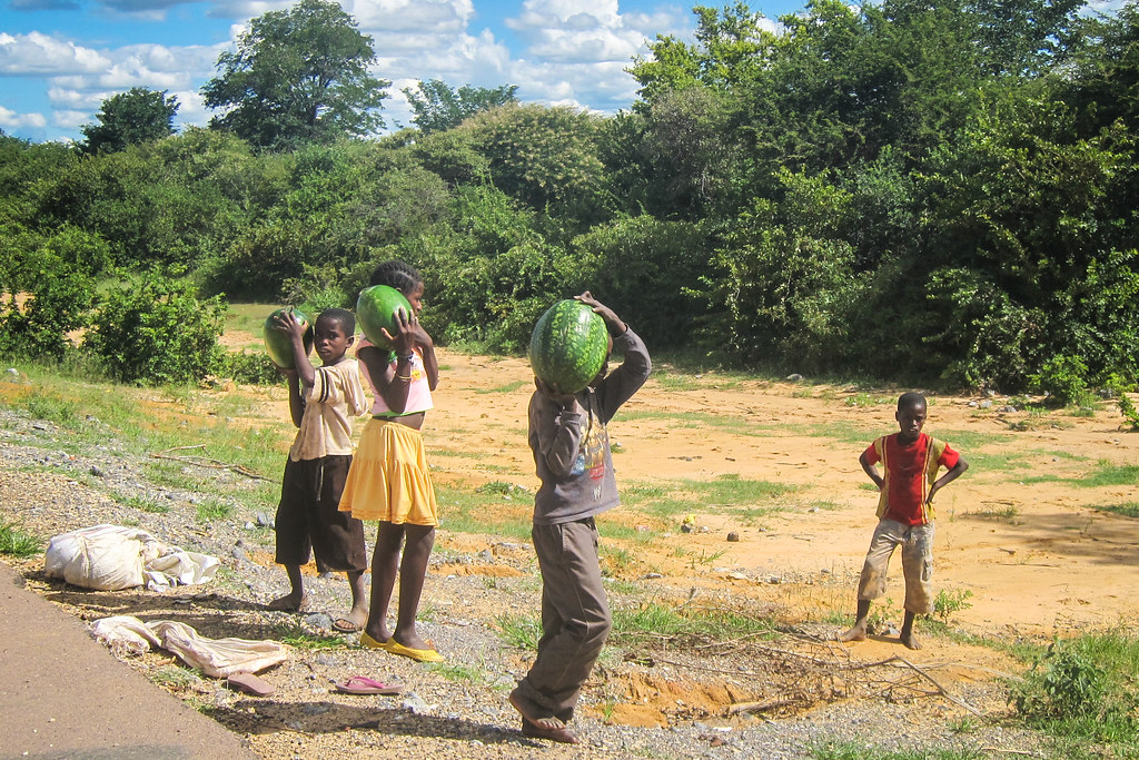
On the road, I experiment my new camera. The road is flat and straightforward, I can say boring, after what I experienced lately, so I can keep my eyes on the settings while cycling. There are topless ladies walking on the side, some quasi-naked ones bathing in a river (no photos), and kids selling watermelons. I reach Tchibemba for a Coca-cola break, at the main shop of the town, held by a Vietnamese speaking almost no Portuguese. He has been here for a year only but is already the main point of sale. A White Angolan, still looking Mexican to me, warns me against bathing in the rivers around here because of the crocodiles.

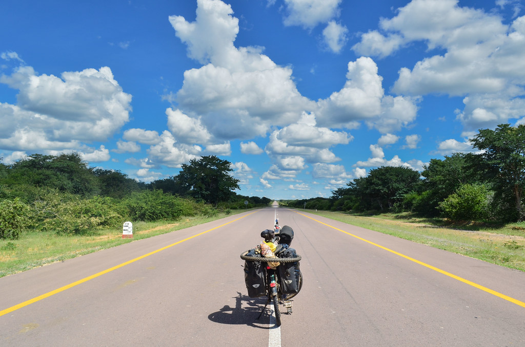
It has been a long time I didn’t go this fast. I would have stopped for a watermelon if I was not so happy to ride easily again. I see overland 4×4 travelers, a rare sighting, but this road is quasi-compulsory for people going from Namibia to Angola. Dave told me the adventure is almost finished for me: Namibia and South Africa are not “real Africa”, there are good roads, electricity and supermarkets. It feels indeed close to the end.

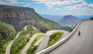
Past Cahama, I quit this nice road for another dirt one. Why doing things easily when I can take up more shit? The main road to Namibia is via Ondjiva and Oshikango, but there is also a small dirt road via Otchinjau and Ruacana. It crosses to Namibia at the Ruacana falls that I want to see. And I dislike the adventure-less feeling of the main roads. I have been told ten times that this way is too difficult and too stony, and only once, that it is fine as long as it doesn’t rain. Well, it doesn’t rain right now, so let’s go.

The sky has been blue with regularly spaced bubble clouds all day long. But now, flat dark ones are invading the airspace. I usually cycle until the last minute of daylight, but this time, I have a feeling of foreboding. There is a school in Ediva. It is already the middle-of-nowhere, and maybe I should sleep there.
There is thunder on the horizon. As soon as the sun sets, a heavy rain pours down and I hide in the school. Schools are really a blessing, often the only public and concrete buildings in the bush. The lightnings are violent and all around me. It’s a small apocalypse! I am watching it from the veranda, even showering from the roof water. During one of the many lightnings bolts, which turn the night into a B&W picture, I see a man standing next to me! I thought I was alone, and seeing the silhouette of a man during the split-second flash of a lightning bolt does scare me. It’s okay, it’s just the man I had met earlier by the road, sheltering like me. He is scared as well when I call him out.
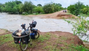
But the scariest thing remains, what will the road look like tomorrow?

Looking forward to pt.2 of this episode. 🙂
keep on rolling! all the best.
m.