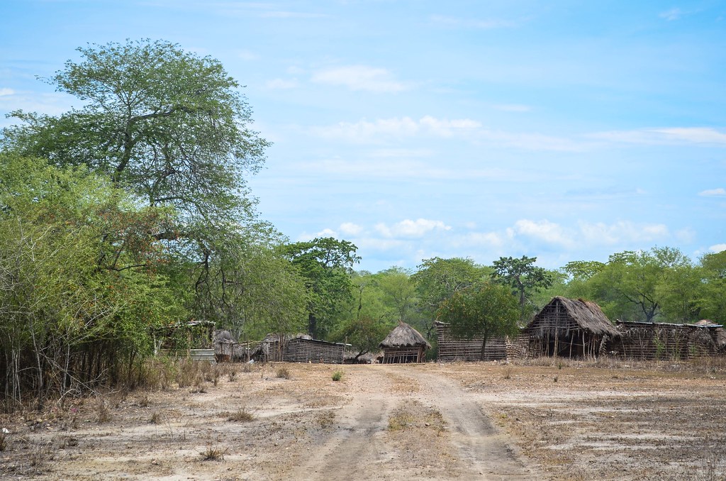
Despite Angola having many very good and brand new roads, I think I am destined to cycle only the worst of them. When they still exist.

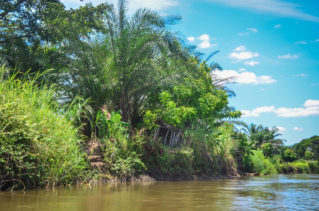
I wake up in a magical scenery by the powerful Kwanza river. Luckily, the villagers don’t come to observe or disturb me, they bath and do laundry at their habitual spot.
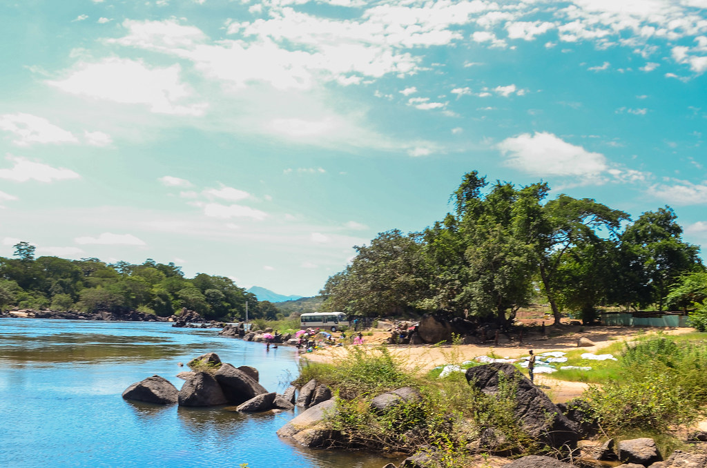
I decide to cycle back to the Cambambe dam. It is 5 km away. Yesterday, Isaac from the military said it is possible to visit it, to enter the turbine hall, and to take photos à vontade. The military is in charge of the dam security. It is quite surprising, as such power installations are usually seen as “strategic for the country” and it’s quasi impossible to approach a dam, even less plausible to pull out a camera near it. Plus, for a paranoid country like Angola, I highly doubt it. Isaac was quite drunk too. But for 2 x 5 km, it is worth giving it a try.
Obviously, when I reach the gate of the Cambambe dam/town, the guards refuse to let me enter. I need, as usual, an authorization from the operator, more precisely a letter from Luanda. I expected this, but I still manage to enter the worker’s town to buy a gazosa by leaving my passport at the gate.
I can’t get close to the dam nor can I take pictures, but I am allowed to roam in the town. A tourist on a bicycle is suspicious so I won’t risk taking photos. But at the end of the town, there is a very quiet site with an old monument. A sign reads Fortaleza de Kambambe, XVIIth century. It is not the popular Fort of Massangano, not too far from here, east of Dondo, but it may have a similar history.

The first Portuguese settlers founded Luanda, but also went inland, as Cambambe had the rumor of having large silver deposits. The prosperity of the Angolan colony attracted other countries and Luanda ended up being invaded by the Dutch in 1641. The Portuguese had to retreat to Massangano. Seven years later, the Portuguese reconquered Luanda, annoyed that the slave supply to Brazil had been cut.
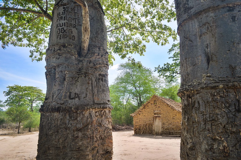
The fortaleza in Cambambe is quite small but very beautiful. Plants are growing into the walls of the ruins. It is a shame that such history is left abandoned and hidden to visitors, but it leaves me the opportunity to shoot many pictures. Still, I don’t see the dam.


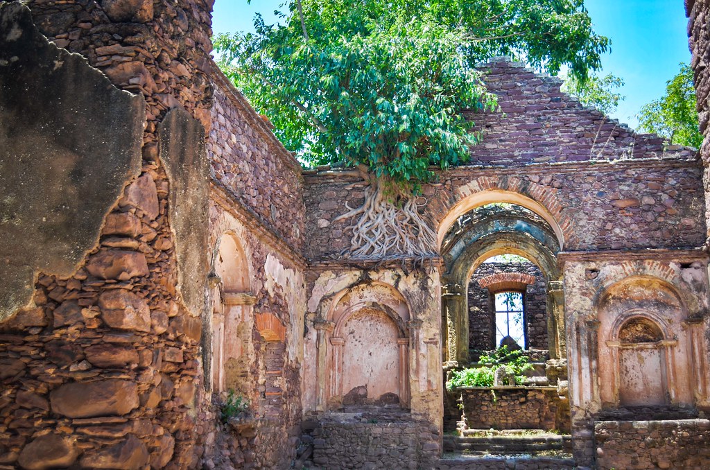
Just adjacent to it, history makes a jump 300 years into the future with a tank cemetery from the civil war.

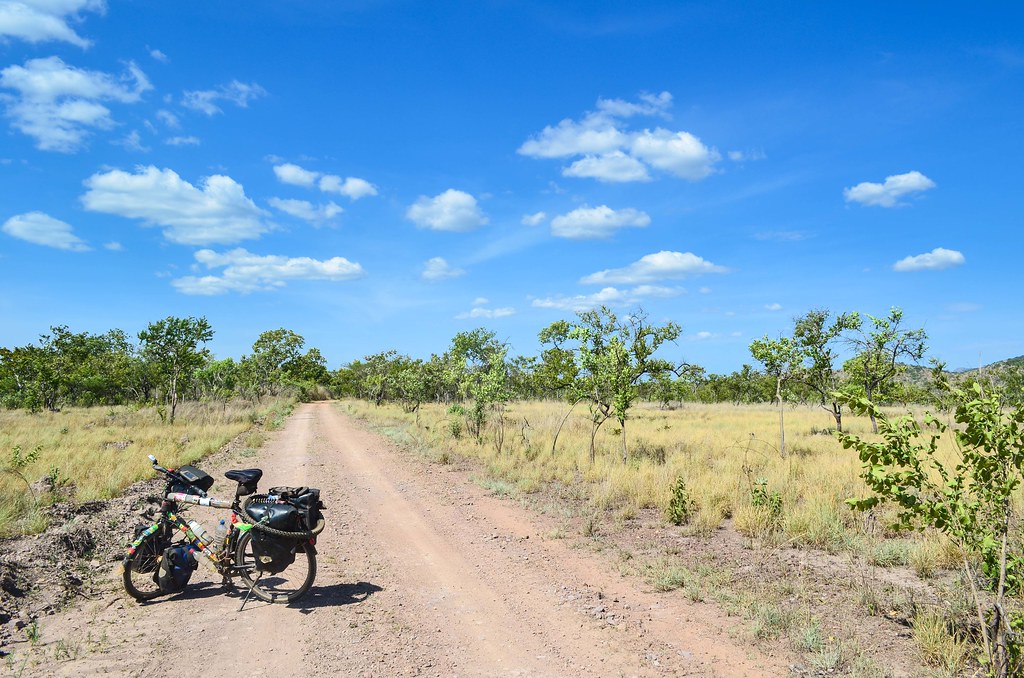
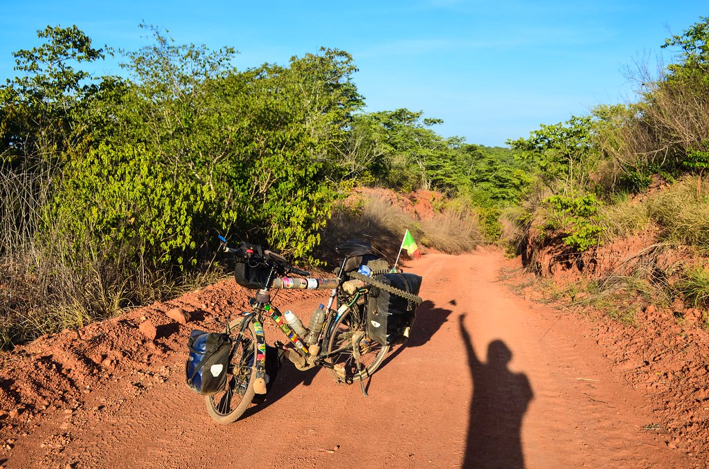
I quickly escape the restricted “no photo” town, recovering my passport without showing my cameras, and cycle further onto the main road to Huambo. It has not been raining for four days in a row and the sky is perfectly blue.
The trucks and buses are driving dangerously. This is the main interior highway, parallel to the coast, between the large cities of Ndalatando, Dondo, Huambo, Lubango. I have to jump on the side of the road when I see a car overtaking in front of me. No way to stick to the asphalt when two trucks are coming. That feeling that I am invisible and that any vehicle can drive over me makes me sick already, and as soon as I see a dirt road on the right, I want to take it and recover the freedom to cycle head up, in the middle of the road.
There is a sign reading “Kixinge 24 km”. I don’t have this road on my maps, but a few people idling near the junction confirm me that this road goes on further to Mumbondo. On my Michelin map, I have then a road from Mumbondo further south. Good then … it will add one or two more days to the 400 km journey to Huambo, but at least I will be in peace.

The atmosphere is very hot and dry. The scenery reminds me of Madgaliesberg in South Africa. Except it’s so empty with a real feeling of being lost. Well, as long as the road remains obvious, it should be no problem. I only meet two vehicles: one water truck delivery, that kind of saved me, but also means that water is scarce in the region if it need to be trucked from 50 km away, and a motorbiker.
Once in Kixinge village, I can hope to refill water and food. Unfortunately there are no shops. Just a policeman sitting in the shade of a tree and a few animals running around. It looks deserted, making me wonder if it’s still inhabited.


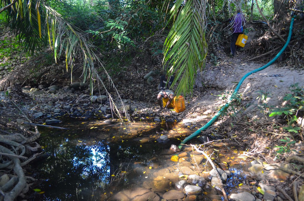
The motorbiker is here: Denis Mauricio is a priest. Where do I find water here? There are no other options than going to the “river”, four kilometers away, where he takes me on a wild ride with his bike. There was no way I could find it by myself. The hundred of deserted tracks makes a maze in the dry bush.
The river is almost dry. It didn’t rain for the past two years here. Where people used to bath, there are only stones. The river disappears underground except for a small pond, the only source of life for the area. It is like a desert. Denis gives me a much appreciated extra 1.5 L bottle as my three liters won’t be enough here.
I am saddened at learning that Mumbondo is still 70 km away. I hope they get the distances wrong, as it is too often the case. Boumba is halfway and has a cantina, these tiny shops with shelves almost empty, selling whatever is still available, like tins and gazosas. I still have no roads on my maps and hope their advice of “just stick to the biggest track and don’t make any turn” will work.

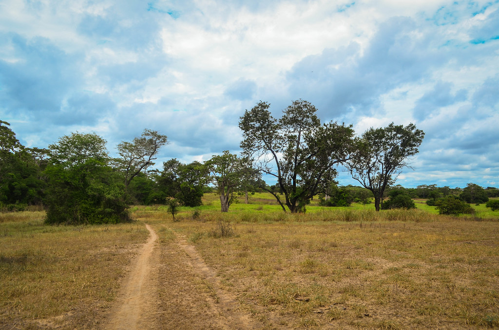
The ambience is absolutely quiet. It’s quite bushy but the heat and the distance makes me feel like in a desert. I completely underestimated the distance, and the track winding in the middle of nowhere seems to never progress on my GPS.
Not seeing anyone increases the feeling of loneliness. The only life I see are animals: small antelopes, small running animals like squirrels, and large antelopes with horns, making strange sounds when I disturb them.
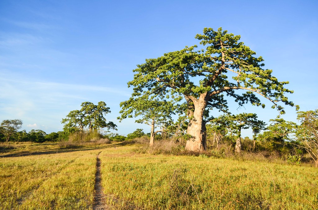
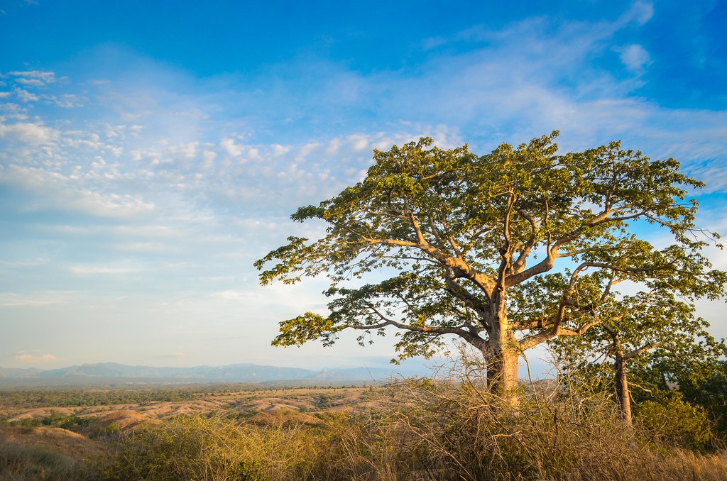
The huge baobabs standing under the blue sky make a perfect scenery. It could be anywhere in a National Park, there are so few humans. I didn’t see any but Denis said the hamlets are far from the main road. I hope I am still on the way to Mumbondo, I feel uncomfortable every time the GPS track is going a bit too north or a bit too south.
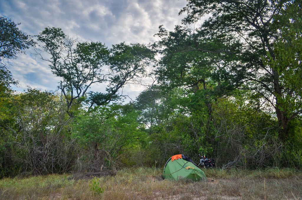
I can pitch my tent absolutely anywhere. I do it next to a small track, only to be surprised by a motorbiker passing at 8 pm at night. They are really people living here!
Maybe it was the same man that walks past my tent with a rifle at 6 am. It is confusing to meet no one for hours of cycling and suddenly be disturbed when I least expect it.

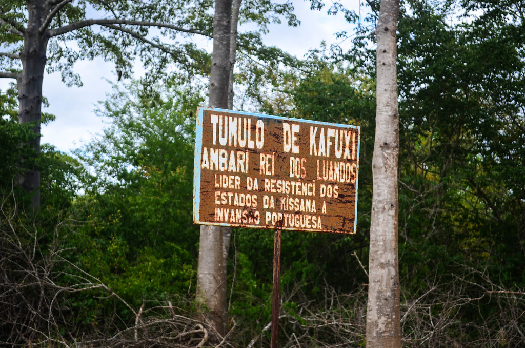
Hunting bush meat must be the main activity of the few people living hidden in there. The area is called the Luandos. There are two of three improbable signs by the road, that don’t let me know how far Mumbondo really is. I should reach this place called Boumbi, but when?
The only motorbiker I meet for the whole morning carries a large antelope behind him. He is going to sell it in Dondo, a two-hour drive for him. He confirms that Boumbi and Mumbondo are indeed ahead, but far …
I don’t know where to go when I face what looks like a crossroads: tracks going right and left. I try to analyze the marks in the sand to determine where did the morning motorbiker came from, but I can’t draw a clear conclusion. No one will come and help me, so I have to follow my intuition, supported by my GPS position and the landscape around. Looking at the hills, I have to imagine where the track heads to, where the river could flow. I really feel lost. Away from any civilization, like if I was dropped as a coke bottle in a scene of the Gods must be crazy movie.
It feels so lonely I hear sometimes the noise of an engine. I expect to meet a motorbiker, but it never happens. It was just the wind.


Thanks to the GPS, where maps don’t display roads but do it for rivers, I walk away from my path in hope for water. I carry way too less water and I am rationing it, but even though, I finished already all I had. My lips are dry and become sticky, I really need water now!
Luckily, after 1 km of walk, I reach a river! It’s a big one. The water is brown but I don’t care, I need to recover the liters I lost. This water tastes right now better than any expensive drink.
For the food, I still hope I will find something soon. There is nothing on the way, except for the baobas trees. They produce huge fruits that become edible once dry, known as “pain de singe” (monkey’s bread) in francophone Africa, “mucua” in Angola. It does not fill a stomach, as it’s very dry and just absorbs saliva.


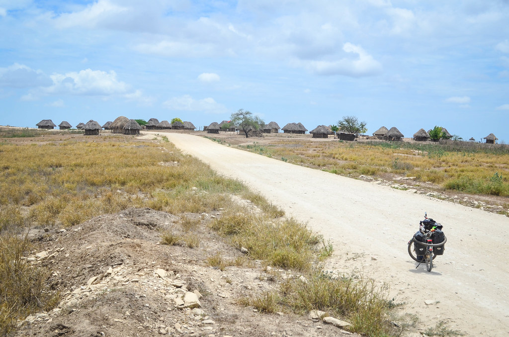
After 40 kilometers of intuition-cycling, I finally see the first settlement! There is music and people. It feels great, I am on the right way to Mumbondo. There are no shops here, but the chief feeds me and I eat a lot. I feel instantly much better. They say that there are more villages from now on.
A few kilometers further, I am finally relieved to reach Mumbondo. It is the comuna, where the school, health center and city hall are built for the whole area. Yet, it is not very populated. The only shop sells nothing more than drinks and bolachas, the dry cookies made in India or UAE. Now I am closed to a river, I don’t have the water problem anymore, and I decide to continue until sunset.

As I am asking for the way at the next village, called Maria Luiz, the soba (title for the chief of the village) intervenes to claim that the road is “closed. How come closed? “There are branches and thorns all over the path. No one can pass. Not even a motorbike“. That’s suspicious … a motorbike can always pass. The soba is not talking friendly, and the crowd of 30 persons that now surrounds me and talk without listening makes it difficult to get proper information and make the right decision. A motorbiker pops out from the path that is supposedly closed, making me feeling even more insecure about what the soba is saying.
The soba says that the only way to go further is to take a boat until Longa Nhia. Or Capolo. He is also the one operating them, so it’s maybe why he doesn’t want me to take the track?
Anyway, the villagers won’t let me try the track ahead of me, the “closed” track from where a motorbiker just came. It is late enough, and since the boats are not leaving before tomorrow, I return to Mumbondo to sleep at the school. The next morning, I will have time to talk with more people and figure out the best way to leave this strange place …
People of Mumbondo travel out of the Luandos uniquely via Muxima, a road along the Kissama national park, leading straight to Luanda. That is why I saw practically no one for 100 km coming there. Instead of falling asleep directly, a man from Mumbondo, who owns a generator and a TV, invites me to watch a movie. Alongside with all the kids, I watch Chuck Norris in Portuguese. It is definitely a strange place.
I get woken up at 5 am to wait for the boat at the “port” of Mumbondo. The boat engine is still broken, as it was yesterday, and I must wait for a while. Well, it’s normal. The boat would likely be a large barge like I have taken between Cabinda and Soyo.

The port is just a cleared up area next to the river, but there is still a 2-meter gap between the ground and the water surface. There are steps carved in the mud, but it looks nothing like a port. It is also where I bathed last night. It was tricky not to fall in the river or in the mud.
After waiting for a while, the two boys repairing and piloting the boat come to ask for advance money for the petrol. “It is 200 USD“. Eh? Now I’m sure it’s a trick. I was told yesterday the trip costs 1000 or 1500 kwanza (10 to 15 dollars). There is apparently a town called Longa Nhia, and another one called Capolo further down the river. Both would work as they are on the other side, but they are also far from Mumbondo. From Longa Nhia, the road goes on to Quilenda, while from Capolo, it continues to Porto Amboim. People I ask to insist in saying that there is no way to get there on wheels. Hmmm ….
Petrol is cheap in Angola and even if they do the trip for me, it cannot cost 200 USD of petrol (plus their fee). We go down to 45 USD for a trip until Longa Nhia, some 10 km away, but they finally disclose that there are running twice a week (Fridays and Sundays) for the villagers for 10/15 USD per person. The problem is that the next scheduled trip is in 2 days.
I am not keen to pay 45 USD to charter a boat and engine, and I don’t know either what I would do for 2 days in a place with no food, no cellphone coverage and no electricity. Hmmm … But I still need to get out of here.
I finally decide to stay. The wife of Daniel, the man screening Chuck Norris movies, said she can prepare food for me. A two-day rest in the middle of nowhere can be good for my mind and legs.
Back to Daniel’s house, waiting for him, I chat with the few old men sitting there. One of them wonders why I don’t cycle until Longa Nhia. Wait, is it actually possible? This old man is the soba of a village past Maria Luiz. He says the “closed road” is passable with a bike. Who is saying the truth? I wouldn’t be surprised if the soba of Maria Luiz lied to me so as to make money with the boat ride. Or maybe they all tell me to take the boat in order to “protect” me, to make me avoid hard times on poor tracks. But I’d rather do that than waiting for two days.
Another old man says he just returned from Longa Nhia with his motorbike. So there is definitely a way. I abandon the idea of taking the boat and will return to where the road is supposedly closed. The soba is going back to his village and offers to guide me. I pack the only food available in Mumbondo, the bolachas, two packets of tasteless crackers, and we move on.

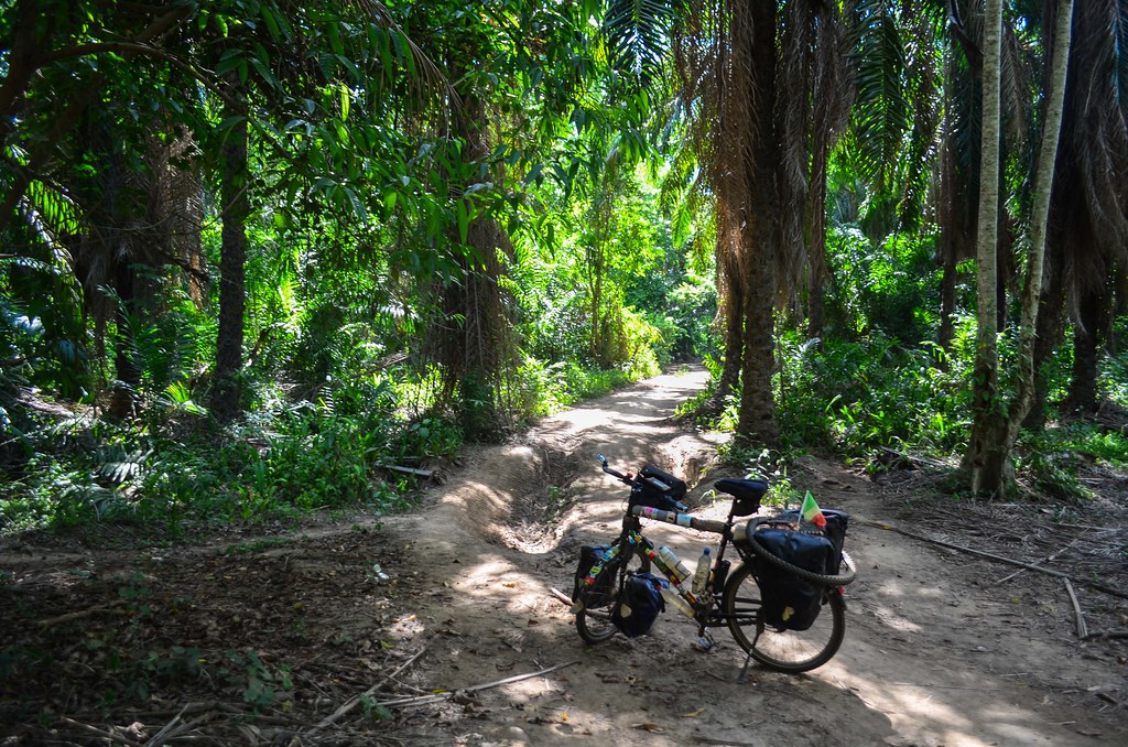
The soba is showing me the way, but behind me. The track is pretty straightforward so he is not really needed. We stop along to say hi to his family. But slowly, the track gets smaller. It first changes into a single lane.

Now it’s good to have the soba with me. There are some people living in huts along the “road”. But it is only accessible with a motorbike. Soon the vegetation takes over the narrow track and I can’t see the ground anymore. The soba goes ahead and I follow him, struggling to keep my balance. My front panniers are slapping the plants, I can’t be more “out of the beaten track”. Halfway through the nonsense, the soba stops and says we can’t go further.

So it was true! The track is indeed closed. The man who said he came from here this morning was probably making up the story. I am used to people lying for no reasons, but it is still annoying.
As we are along the Longa river, the soba asks young men on the other side to make us cross on a small canoe. We leave the bicycle and the motorbike on this side and reach the opposite village, called Camdombo.

Now it is real adventure. I have no clue what will happen. The soba is helpful so I am hopeful he has a solution. Anyway, I have no choice. We went 1 km deep into the herbs and I don’t see myself making a U-turn.
The village of Camdombo is, as expected, very quiet. It is nothing more than a hamlet of huts. There is no link from this place to the “outside world” that doesn’t need taking a canoe. We sit in the hut of the chief, waiting for a council to gather up. The soba is telling my story, but also chatting about everything, the family, etc. I wait for about an hour, I don’t know for what. They had already told me that the path from here to Longa Nhia doesn’t exist anymore. Then what?
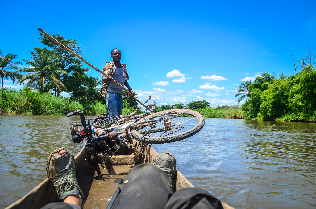
In a lost village only accessible by water, patience is a necessary asset. They finally say that one of them can take me downstream to Longa Nhia on a canoe. “- Is it big enough for the bicycle? – No problem“. Considering the trip takes one hour (as they say), I offer 1000 kwanza. They think it’s fair too, and one man goes and looks for the stick to drive the canoe. At this point, I have no choice paying someone to take me out of here. I’m glad that the meeting with the council went smoothly and that they didn’t ask me for a crazy amount of money.
The canoe is quite narrow and unstable, but I have no choice. We manage to “load” it without falling in the river, and here we go for eight kilometers of river.


The bicycle is laid in the middle of the dugout canoe. The pilot is skillfully standing at the back, handling the bamboo pole to make us flow downstream in the center of the river. I am sitting at the front, facing him. Initially stressed by a long journey on a canoe that needs little to capsize, I slowly relax. We waive at some people washing or doing laundry by the river, but that’s only in the beginning. The whole length of river we travel is uninhabited, so it is logical that the path cannot resist to the vegetation.
We see monkeys and so many birds. There is not a single noise made by humans. I am thinking some tourists would pay for such a cruise, but I am doing it only because I want to get out of this locked land as soon as possible.
After an hour on the water, we finally reach the “port” of Longa Nhia, another tricky and muddy slope to get on the land. There is a large track from there, making me feel better already. I see a couple of young men loading two motorbikes on a slightly larger canoe to cross the 20-meter wide river … they must know very well what they are doing …
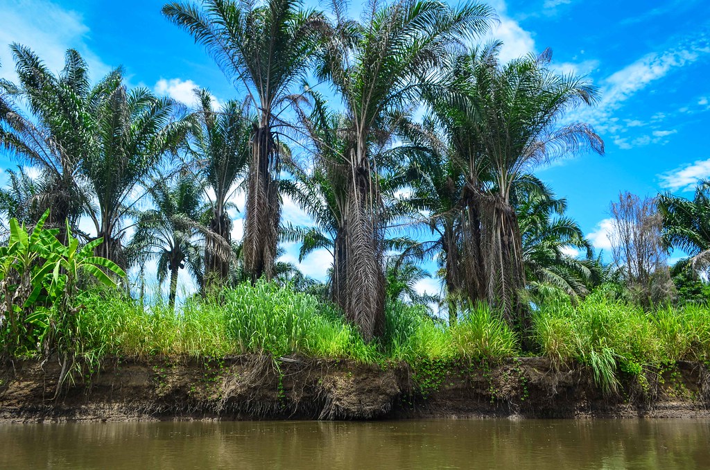
Longa Nhia is a small village taking its name from the two rivers meeting here: the Longa and the Nhia. The water flows then westwards until the Atlantic coast, north of Porto Amboim.
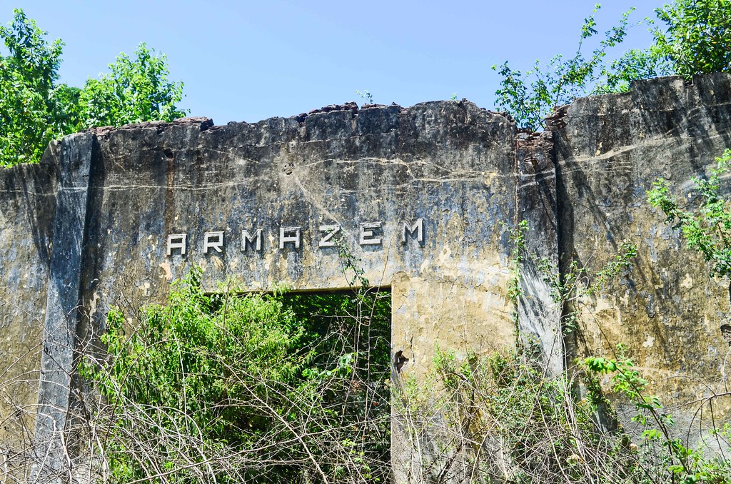
To my surprise, Longa Nhia has remains of an industrial colonial past. Today, it is a place in the middle of nowhere, but the Portuguese used to exploit palm oil in the area. The river allowed the producers to carry the palm seeds until the factory. There is even a short railway with a steel barge on it! The ruins are invaded by dense branches, a few men sitting around doing nothing contrast with my imagining a busy activity 50 years ago.


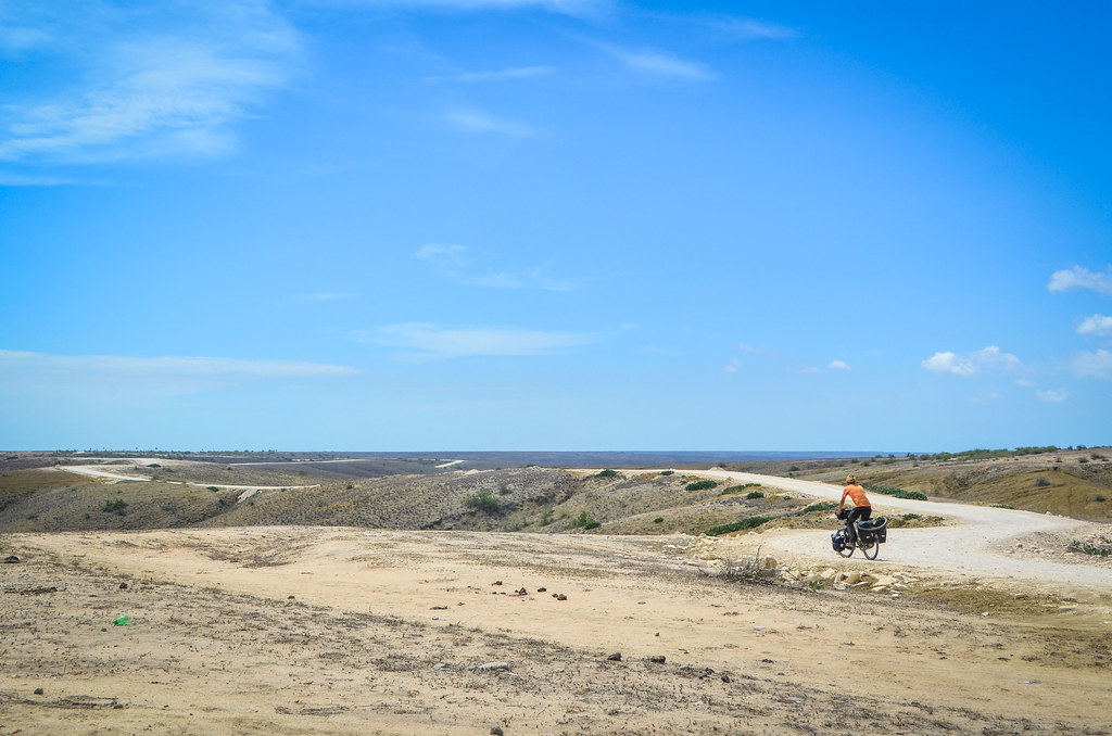
I am back on a normal dirt road, and can finally contemplate the idea of meeting an asphalt road soon. My original plan was to head straight south, until Quilenda, then the asphalt in Gabela. But that would make for me another 100 km of dirt roads unmapped. Plus, the locals keep repeating that the road is rocky and I would struggle a lot in the stones. I change my mind for the easiest road back to civilization, heading west for Capolo and Porto Amboim, on the coast. On the large-scale map, it seems close. Once again, what I believe to be a 50 km / 3-hour journey will last for two days …


I see no shop through the village, while I really need food now. At the exit of Longa Nhia, I spot an old colonial building, with an open door. It looks like it could be selling something. But as I get closer to the man standing there, I notice his blue cap … it’s a policeman’s cap … too late! “Please come in, we will record your details“. I am once again hit by the malediction of the police administration.
Fortunately, there is no signal and they can’t call the commandante. They just slowly copy my passport, incredulous at my coming until here with a bicycle. The good point is that I receive leftovers of funge and fish, much appreciated. Going into this part of Angola should be planned like a desert expedition, with sufficient food and water.
They say the road until Porto Amboim is straightforward. Yes! “Just go straight out of Longa Nhia, then take the first left, then the second on your right“. I didn’t ask too many questions as I was happy to finally be on the right way. I am now on the right side of the river and the landscape is drier, so it should become easier.
The problem is that there is no such a thing as roads on the left or on the right. There are many tracks, and I am unable to determine which ones are the right ones. I follow my intuition and head straight to the coast. I don’t have this road on my maps, but as long as I stay between the mountains on my left and the river on my right, I can’t really fail.

I followed the instructions of the policemen, but I am soon cycling into uncertainty again. There is no one on the road, and despite still being between obviously the mountains and the river, these are far away. I can easily take a dead-end road for 10 kilometers. Nothing is asphalted or looking like a main channel.

After many kilometers, I finally meet a motorbiker and stop him. “Is it the right way to Porto Amboim?“, I ask, expecting a yes/no answer, as Porto Amboim is the closest large town and the closest asphalt. People should know. The motorbiker replies: “I am not sure, but I think so. You have to take a canoe first“.
Well, that’s impossible, I am now on the good side of the river. I can say I am lost on a local scale, but I know my GPS position and there shouldn’t be a river barring my way. Especially not the Longa river I have just crossed.
I have nowhere else to go and continue straight. I see that the track is leading me right into the river. Bad luck, I won’t be out of this land tonight … I can make a U-turn for 10 kilometers or continue until the hamlet at the end of the track. At this point I wouldn’t mind if a helicopter came to throw me a rope.
I tell a man there that I want to reach Porto Amboim by land. “Where is the road?“. He replies that the road continues on the other side, and he can take me with his canoe.
I don’t want to go on the other side. There is surely a bridge on the paved coastal road from Sumbe to Luanda, but that would make a long detour. Three days ago, it took me a few seconds to decide to leave the paved road near Dondo. I have now been more or less lost for three days, progressing very slowly, and I don’t see the exit yet.
Sadly, I have no other option. My cellphone is useless, it has no maps and no signal. I reluctantly accept to cross the river again with the man and his narrow canoe. They all say Porto Amboim is this way, so should it make a detour, it’s better than being stuck. It is windy and the girls said it is better to wait an hour or two. Yet, we depart now. I have no clue where I am going, and the only way to feel good is to think that if I keep moving, I will eventually end up somewhere. Hopefully somewhere else.

On the canoe, the wind and waves don’t disturb me much. I am still wondering how and when will I get back on a “normal” road. I try to identify how the river is flowing, unsuccessfully. There isn’t really a current, and it looks more like a lake bordered by swamps.
As we cross, I observe the hills with a new angle. There is nothing where I expected the river to flow, just another hill. I realize that we will disembark on the same shore. So we are not crossing the river, but just a lagoon? It’s great! Logic and coherence are part of this world again. I don’t know why there isn’t a road going around, but well, why-questions can be endless and only call for funny answers.
Nelito tells me that the road is now straight to Porto Amboim. As usual, the directions are “Just follow the main road, don’t take turns“, but on a huge land without any sign and dozen of tracks, it’s easier said than done. He warns me about a steep hill just after disembarking.
I thank him and cycle on, only a kilometer until that steep slope. It’s sand and gravel. I can’t tell the percentage of it, but it is steep enough to make me unable to push: my feet are slipping backwards. I feel I have all the weight of the bike on my arms, and if I let it go, it will just slip downwards as well. Impossible to go up! Even just walking without the bike is hard. I’d have to go back a bit, unload the panniers, and carry items one by one.

Nelito was staying behind and is kindly coming to rescue me. For a hundred meters, cycling is becoming weight lifting. We barely manage to push the bike up without falling, and are completely drenched in sweat once on top. I wouldn’t have made it alone. I would call it a nightmare, but as I know I won’t suddenly wake up out of it, there is no point feeling low. Just keep moving forward.

“From now on, it’s easy, you can cycle until Porto Amboim“. I have heard this too many times to believe these words. The area is still quasi deserted and there is not a single sign to tell me what is where.


I cycle a few kilometers on the supposedly right track until it’s late enough to camp. There are no people. Not the slightest noise. At night, I see no light at all, I can only guess the soft light pollution of Longa Nhia. I “should” be back on the main tarred road tomorrow, and am really looking forward to it. What an adventurous day it was! Angola can be very easy to travel or very hard. Here I feel I could have been visiting the same place in 1650, being the first explorer, it would be no different. It is quite disruptive.

I finish my last drop of secret backup water with the morning spaghetti. I hope will soon find more.

But after three kilometers only, I have to face another junction with no signs.

I wait for about 15 minutes for someone to come, but that is hopeless. The area is barely populated. I follow my intuition and pick the right one. Later on I will meet a motorbiker confirming it’s the right way.


The GPS dot on my phone is getting close to the coast. Finally … finally I reach a large gravel road, that links Porto Amboim with a dam in Capolo. I’m back! Out of this lost experience!
The road is not paved as wrongly announced, but good enough for a 4×4 to drive it. And especially, it’s a straight line. It is marked on my maps so I just have to cycle the last 30+ km and I can fill up my belly with food and fresh cokes. I know now where I am going to end up.

Actually my first fresh coke is at a cantina of a hamlet of ten houses in ruins. Two policemen are stationed here, seemingly having the most boring life one can have. One is completely drunk, unable to articulate, and the other is telling me to stop listening to the first one.
The strong headwind is announcing the coast. I run again out of water during this last stretch: I refilled a bit at the cantina, but I refrained from taking too much: water is scarce and villagers have to send their kids on donkeys to fill tanks of water at a water hole far away.
I have met only few people these last days, but it has been long enough to say that I am seldom called “White man!” here. I hear sometimes “Mulatto!” and “Branco!“, but most of the times, I am called “Hey Amigo!“.
The annoying people talking rubbish about me, in front of me, are the same in the middle of nowhere. Without addressing to me, I heard too often that “he is cycling the world and he has everything in his panniers, water and food and satellite phone and gets paid by his government“. The weirdest moment happened when I was travelling with the soba. We stopped to greet his friends. They were standing right in front of me. Looking at me, one asks the other: “Do you think he is a tourist?“. And the other answers “Hmmm … I can’t tell now, maybe we should ask him more questions“. In Portuguese. Just in front of me. Perfect to make me feel like a zoo animal.
I finally reach the paved road and the traffic of Porto Amboim. I’m glad to be back to life: the interior was so desolated compared to the coast. I deserve a medal and a palace to recover from the adventure, but the reality says that I have to struggle to find a place to sleep in town now. I visit the guesthouses, where the cheapest option is at 30 USD for a small room with no more than a bed. 75 USD for the same small square of concrete with a TV and water.
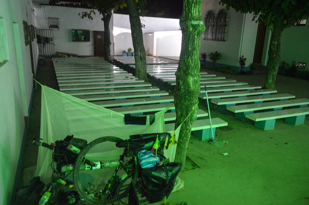
That pushes me to ask for the catholic mission, where I can maybe camp. The priests let me put my net inside, and the best thing is that electricity works throughout the night and I can use the much needed shower (cold, but who cares?), useful for a much needed laundry as well.
Priority is also on the food: I find the market and eat as much funge as I can. It’s not tasty but refills my stomach. A few pieces of meat served with cassava cost here the equivalent of 6 USD, six times more than what I have been used to.
Three Vietnamese are living at the chuch, three in a single room, doing the painting works. They have been here for two years in a row, without seeing their wife and children back home, to make better money. It is hard to converse as Portuguese is our sole common language, and their accent is so hard to pick. They are watching a Chinese movie dubbed in French bought in a local Angolan market … the joys of the globalization of crappy products.


Woof. A velo sous le soleil et sans eau… Ca fait peur.
J aurais pas tenu je pense. Content que tu ais survecu 😉
Ouais, j’étais pas en confiance tout le temps … mais de toute facons, de tenir ou pas, t’a pas le choix, t’es tout seul !
eh bé !,heureusement que ton GPS intuition est efficace, car au milieu de nulle part c’est bien utile .C’est vraiment l’Afrique très profonde que nous fait découvrir .merci
Many many :-* to you