Before starting cycling this very long road of 2000 kilometers between Guelmim, the gate of the Sahara in the north, and Nouakchott in Mauritania, I wanted to know if I could refill my water bottles between the main Saharan cities: Tan-Tan, Tarfaya, Laayoune, Boujdour, Dakhla, Nouadhibou. I didn’t find a detailed map to help me packing food and water, but it was actually much easier than expected. I never carried more than 5.5 liters on my bicycle and never drank more than 4 L before I could refill. And I always had someone to share dinner with (there’s much more people along the road than on postcard pictures of sand and camels). Here is a detailed map of the places where water and basic food are available.

In March 2016, Dorothee Fleck cycled the same road and sent me her comments, that I merged with my list below.
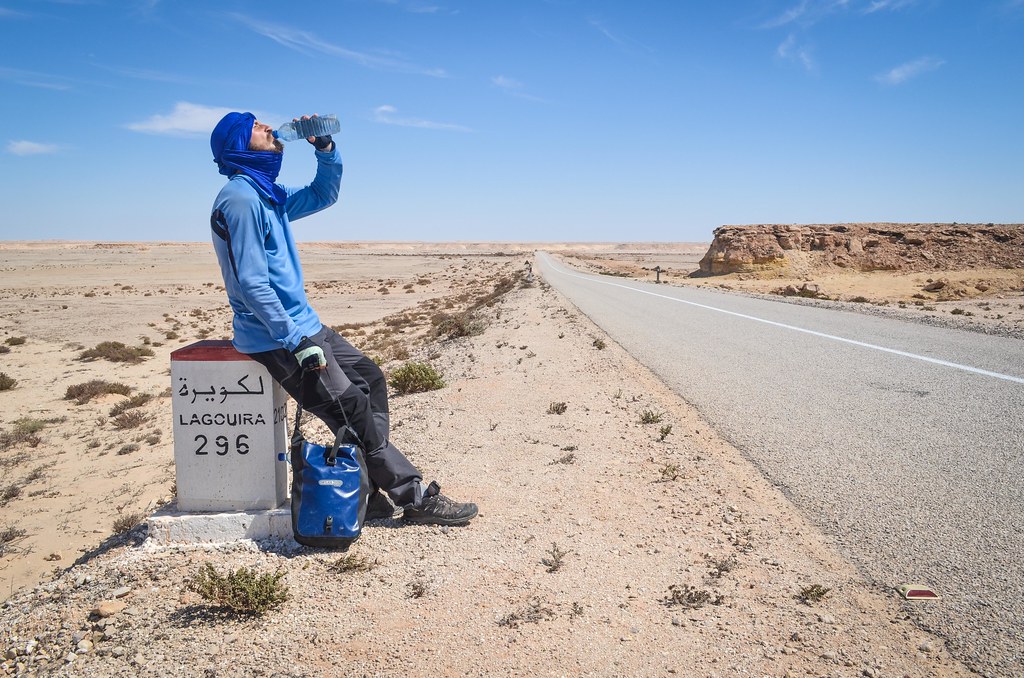
Guelmim, the gate of the Sahara: everything available.
From Guelmim
KM 025 : café and place to sleep
KM 050 : café with mattresses, speaks Spanish (abandoned petrol station) There is a new café (2016)
KM 080 : village Rass Oumlil : many restaurants and shops
KM 125 : Tan Tan : everthing (start of gendarmerie checkpoints and passport control)
KM 150 : El Ouatia / Tan-Tan plage : everything
From Tan-Tan plage
KM 030 : Chbika checkpoint : shop, café Only checkpoint (2016)
KM 070 : Oued El Waaer : petrol stations, shops
KM 090 : village Akhfenir : too many restaurants, fresh fish, shops and hotel
KM 110 : turn-off to Khenifiss National Park, basic camping 3km further (2016)
KM 200 : Tarfaya : everything
KM 300 : Laayoune / El Aaiún (N1) or Foum el oued (coastal road) : everything, camping
From Laayoune / El Aaiún
KM 030 : port El Marsa : everything
KM 100 : village Lamsid : petrol station, shop, big café
KM 150 : police checkpoint, “safe camping” (2016)
KM 200 : Boujdour : everything
From Boujdour
KM 090 : new café (2016)
KM 150 : shop
KM 155 : petrol station, café, restaurant
KM 185 : petrol station, café, restaurant (2016)
KM 220 : commune rurale Bir Anzarane : nothing but the only inhabitant Marfoud is hosting cyclists, and wonderful hot spring shower
KM 225 : petrol station, shop, restaurant
KM 280 : village Ntirift : shop
KM 300 : Point 40 : petrol station, shop, restaurant
KM 340 : Dakhla, everything (those 40 km to Dakhla are off the main road)
From Dakhla:
KM 040 : Point 40 : petrol station, shop, restaurant
KM 080 : military camp El Argoub : shops, restaurants
KM 100 : Tropic of Cancer : roadsign only
KM 125 : commune rurale Imlili : station-shop-restaurant
KM 200 : one of the new cafés (2016)
KM 295 : centre Bir Gandouz: petrol station, restaurant, shops, 2 hotels, haircut, Hotel Barbas (travellers meetup)
KM 380 : Guerguerate (border post) : petrol station, cafés, hotel, shop (expensive)
– – – No Man’s Land between Morocco and Mauritania – – –
KM 385 : Mauritanian border post: shop, cafés, currency exchange
KM 395 : crossroads Dakhla-Nouadhibou-Nouakchott : station + shop
KM 405 : auberge
KM 435 : Nouadhibou : everything (those 40 km to Nouadhibou are off the main road)
From Nouadhibou, the SNIM iron train is leaving to Choum every day in the afternoon around 3, 4 or 5 pm. From Choum it is possible to reach Atar, then cycle to Nouakchott. The train stops in Bou Lanouar on Thursdays only. It’s possible to hop for free in the ore wagons with a bicycle or anything else. SNIM phone number for information : 45741752.
Along the Nouakchott – Nouadhibou road, there are many houses, some are shops with very few items, sometimes open, sometimes closed, probably sometimes changing location. Prices can double outside of villages. The gendarmerie checkpoints can change location too.
From Nouadhibou (exit of town, KM matching with the milestones)
KM 030 : auberge
KM 040 : crossroads Dakhla-Nouadhibou-Nouakchott : petrol station, shop
KM 060 : gendarmerie checkpoint, shop
KM 080 : village Bou Lanouar : sand, auberges, restaurants, shops
KM 100 : gendarmerie checkpoint, shops Nothing (2016)
KM 150 : petrol station, restaurant marocain, shops
KM 175 : settlement : restaurants, shops, auberge, gendarmerie checkpoint
KM 200 : crossroads with the Tasiast mine : gendarmerie checkpoint, shops (2016) auberge, ask for VouLan
KM 220 : new town and petrol station under construction : nothing ready yet Military camp and town, probably at least water
KM 240 : midpoint station Gare du Nord: shop, restaurant, café, hotel, gendarmerie checkpoint
KM 280 : shop (2016)
KM 293 : shop, gendarmerie checkpoint
KM 367 : village of fishermen : shops of outdated products, and lots of dried fish, gendarmerie checkpoint
KM 380 : Tiwilit : petrol station, shops, gendarmerie checkpoint, small cases to rent for the night.
KM 430 : shop, few houses
KM 440 : customs checkpoint
KM 450 : settlement
KM 457 : turn-off to camping and restaurant (2 km off the road) (2016)
KM 470 : Nouakchott : everything
From Nouakchott, there are many villages, even more after Tiguent (KM 100) on the way to Rosso (KM 200). I took another road/piste, under construction no traffic, perfect surface to Keur Macene (2016), until the Diama border post which went very smoothly.
All the places above sell bottled water, and it’s possible to drink tap water until Dakhla, and further depending where it comes from. The longest distance without anything is 160 km. However, it’s possible to ask water from the gendarmerie checkpoints, the military houses by the Moroccan coast, guarded cell towers, and probably at fishermen’s huts and to truck drivers. Everyone in the region is very nice and I doubt a cyclist can be left stranded in the desert.
Among the officials, the gendarmes are the most educated and speak French and little English. They watch carefully after cyclists, in Morocco as well as in Mauritania. Their number is 177 in Morocco and 116 in Mauritania. The gendarmerie doesn’t like the idea of cyclists camping alone in the wild and most of the times I was asked to stay in or near people. As a result, it’s OK to ask to sleep in a roadside café, by a checkpoint of the army/gendarmerie, at guarded cell towers, etc.
Since logistically it was much easier than expected, I found the hardest in cycling the Sahara was mentally. It has very long stretches of road with nothing but sand and rocks, and it’s beautiful. But it’s a nightmare with a headwind. The wind is always strong, and fortunately it comes often from the north. The road is always flat and little slopes (for crossing a oued for example) are rare. In Mauritania, temperatures were much higher than in Western Sahara and I quickly had a dry throat. Something to cover the head, face and eyes is mandatory against the sun and when the sand is flying around.
Overall, it was a very good experience. My Log details my daily rides. Related blog posts: Entering the Sahara, Winds of change, Sahara: Swallowing kilometers, Until the south of the Western Sahara, From Morocco to Mauritania, Nouadhibou, Nouadhibou to Nouakchott, the Mauritanian desert.


Un gars a traversé le sahara sur cet axe en hiver 2017/1018 . Ses informations sur son blog ( en anglais ) sont précises:
Maroc/ Sahara Occidental:
https://www.manythingsontheearth.com/travels/cycling-western-sahara.html#more-9711
Mauritanie:
https://www.manythingsontheearth.com/travels/cycling-spain-west-africa-8-mauritania.html
How long did this take you?
Bonjour JB , je reviens à toi pour te dire merci encore pour ce partage, je tiens à notifier que c’étais une Bonne expérience de faire du vélo, avec la rencontre des genres sympathique et des moments de rigolarde. j’ai faire la traverser sans aucun problème, juste seulement les chiens qui me curèrent après. j’étais rester sur la cote jusque à tanger,
thanks very much for translation in french very usefull whith full of details i did it in2011 i would like to do it again in march
i apreciate a lot if you can go on translate
La version française est sur: http://freewheely.com/fr/2013/04/food-and-water-to-cycle-across-the-sahara-desert/
Chaque page est disponible en français en cliquant sur le drapeau dans le menu en haut de la page.
Merci à toi pour avoir partager ton expérience. Moi je me normes BOSSOUVI Carlos . Je vais faire la remontée d’ici quelques jours vers la France. Je bien content d´avoir tomber sur ton expérience avant de reprendre la route pour la traversée du Sahara
La remontée n’est pas facile, je te souhaite bon vent et bonne chance !
Merci beaucoup !