I am back at the feet of the mountains, the south side of the High Atlas, in Tinghir. A week ago, I was just on the other side. I contemplated the idea of crossing from Boumia to Tinghir or Dadès through Imilchil, at the heart of the Atlas. Imilchil, a Berber village of 2000 souls above 2000 meters, is known for collective weddings happening in late summer. But I was also just out of the Middle Atlas, having met some snow around 2000 m, bad mud, and a destroyed route as the paved road I was following, hence pessimistic about having the same experience again.
The road onto Imilchil and further would take me close to 3000 m, without asphalt. It was too risky without knowing the latest conditions: I didn’t want to go on for 2 or 3 days on bad tracks, and have to do a U-turn. Everyone I asked had their own opinions on the road and snow reports, but none reliable. That’s why I crossed the High Atlas a bit more to the East, through Rich and the Ziz Gorges, where the road is lower (below 2000 m) and asphalted. This also allowed me to pull my route further south to the sand dunes of Merzouga. However, there were two very scenic spots, the gorges of the Todra and of the Dadès, two rivers originating in the Atlas, at the end of the “high” route. So I decided to come back there and visit them on their own, going up as much as I could do. Actually, those two gorges connect together inside the mountains, with a piste between Tamtattouchte and Msemrir above 2800 m. I was convinced when a 4×4 driver told me it’s good. And if I am ever stopped, the U-turn will cost me only 1 day, and I’d still be on the right side (the south one) of the High Atlas. Plus, being always on the south face, I have less chances to face snow than if I had done the ascent from the north.
So, with the plan of leaving Tinghir northbound through the Todra gorge, crossing to the west with the 2800 m high piste, and exiting the mountains through the Dadès gorges, I am shopping in the morning in the market of Tinghir. This is the big town of the area and there is a too vast choice of food. As a result I am lost and and buy mostly fruits that I will rapidly eat.
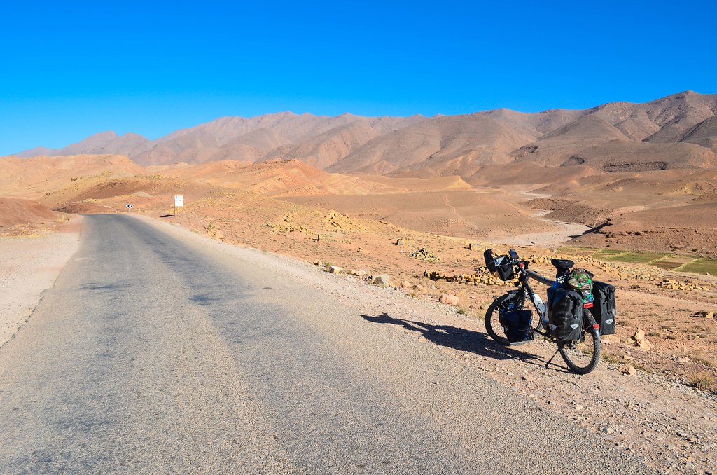
The first part of the route is the Todra gorge. It’s a very touristy area, supposedly very beautiful, and I can see it from all the signs for hotels, riads, kasbahs, guesthouses, etc.

Whenever there is water, there are palm trees and greenery. This contrasts sharply with the same area without water.


There is only one road going up the gorge, close to the river, and it seems bordered with hotels only.


I get excited at one shop as I find cookies, that will replace the other untasty cakes and pastries that I used to have. Those cookies will also create the biggest disappointment of the day. No wonder why I jump on non-local brand products when I see them. I sometimes dream of the Chips Ahoy “with mega big choco chunks” that fed me very well in Spain.

The gorges are populated with tourists in camper vans and locals selling the standard souvenirs by the road.
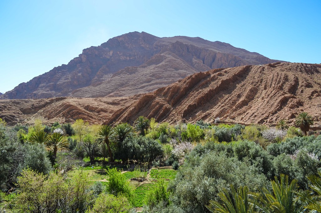

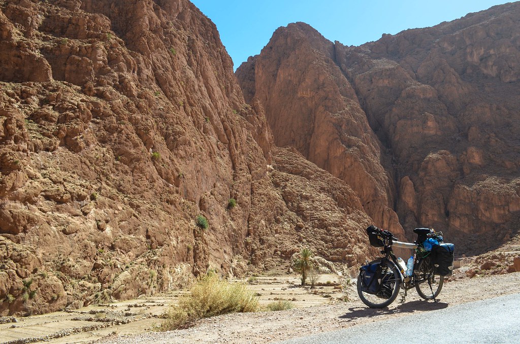
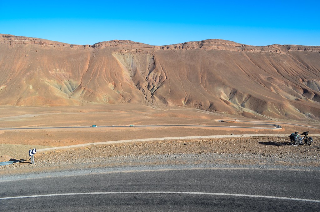
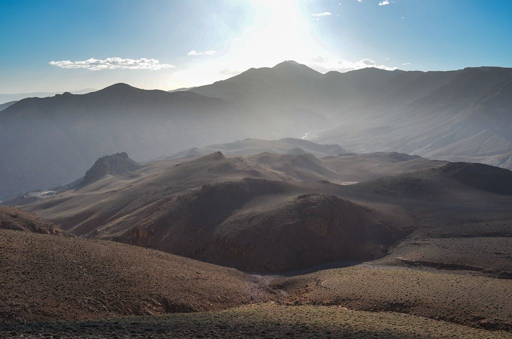
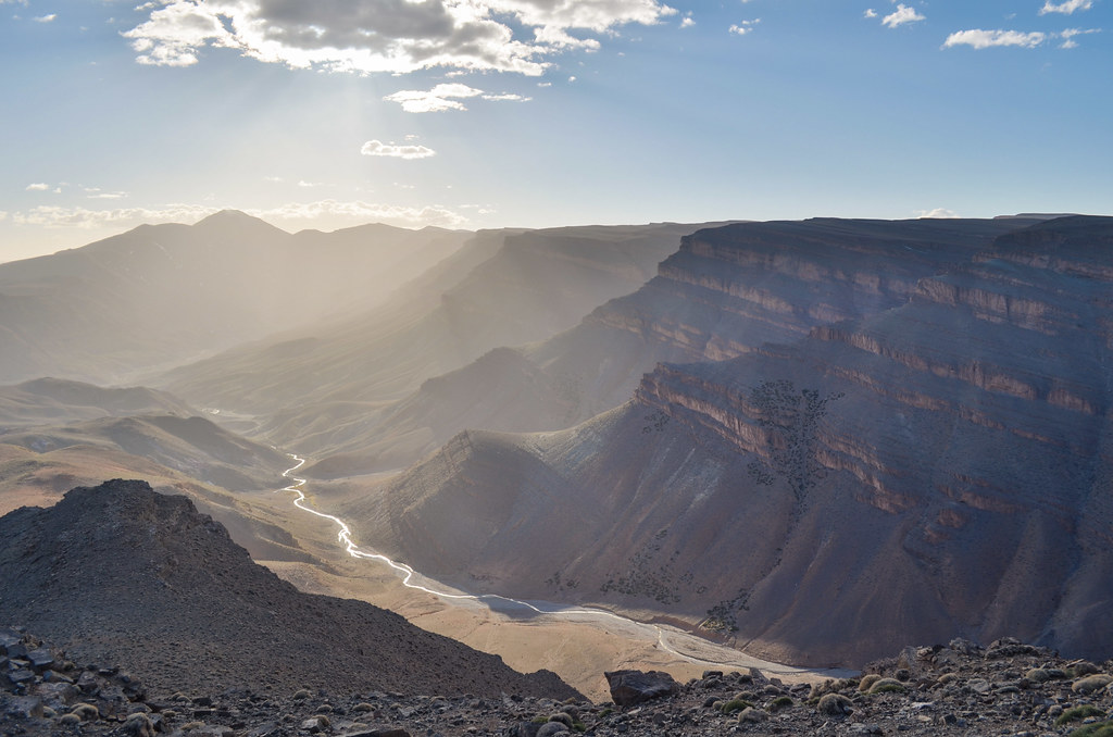
It’s very beautiful and impressive. The cliffs are said to be 200 or 300 meters high, and what is certain is that at the bottom, there’s just enough space for the road and the little flow river. The road continues beyond the cliffs, but strangely the traffic and activity stops here. There is no camper van and no souvenir shops beyond the highlight of the canyon. However, it’s still beautiful and impressive.
I see a few climbers though.

The road is still a narrow band of asphalt or concrete,and the echo in the silent canyon is powerful.
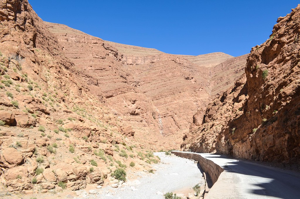
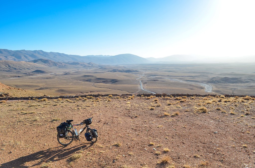
It lasts a few kilometers more before going out “in the open”. I am very alone, I can’t spot the usual herdsman with his goat or the guy with a donkey hardly discernible in the mountain. It’s rare to be in a place really empty. Especially a beautiful one like this one.

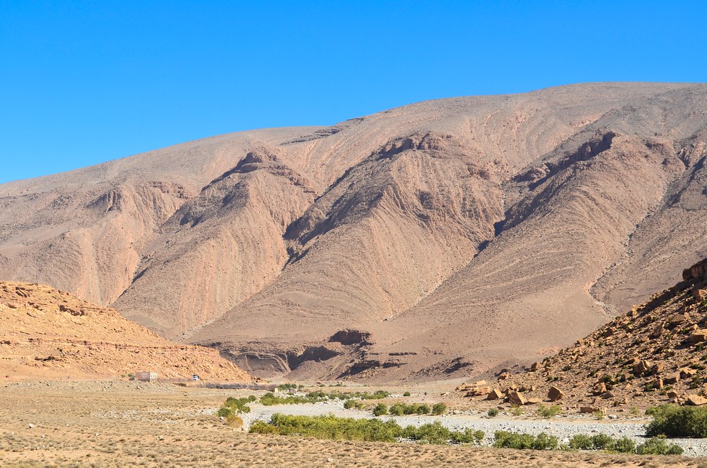
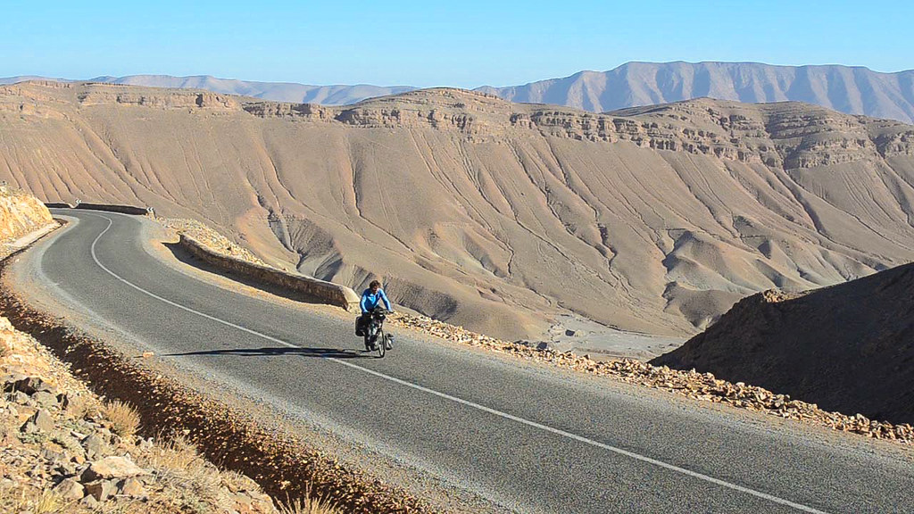
It feels like being on the Tattoine planet in the desert of the pod races. Yet I’m climbing and going higher and higher.

I arrive in Tamtattouchte where I have lunch and tea. I am now carrying my own leaves of chiba (absinth) as I noticed there’s less and less teas with mint or chiba, so I can just put them in the teapot anywhere. For 1 dh I got a big bunch that will last me a long time. A hotel man tells me the people “down the gorges” could be spreading the word that roads a bad further, so that they keep the tourists and money in their area. That would be very bad as I found the best part to be after the so famous gorge. He tells me also that the high piste joining Msemrir, on the other gorge, of Dadès, should be clear of snow as it has been a warm winter. It’s bad for the farmers but good for me, as the piste has 3 passes over 40 km and the winter is just over.
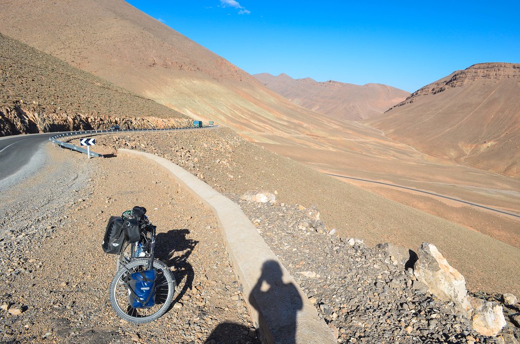
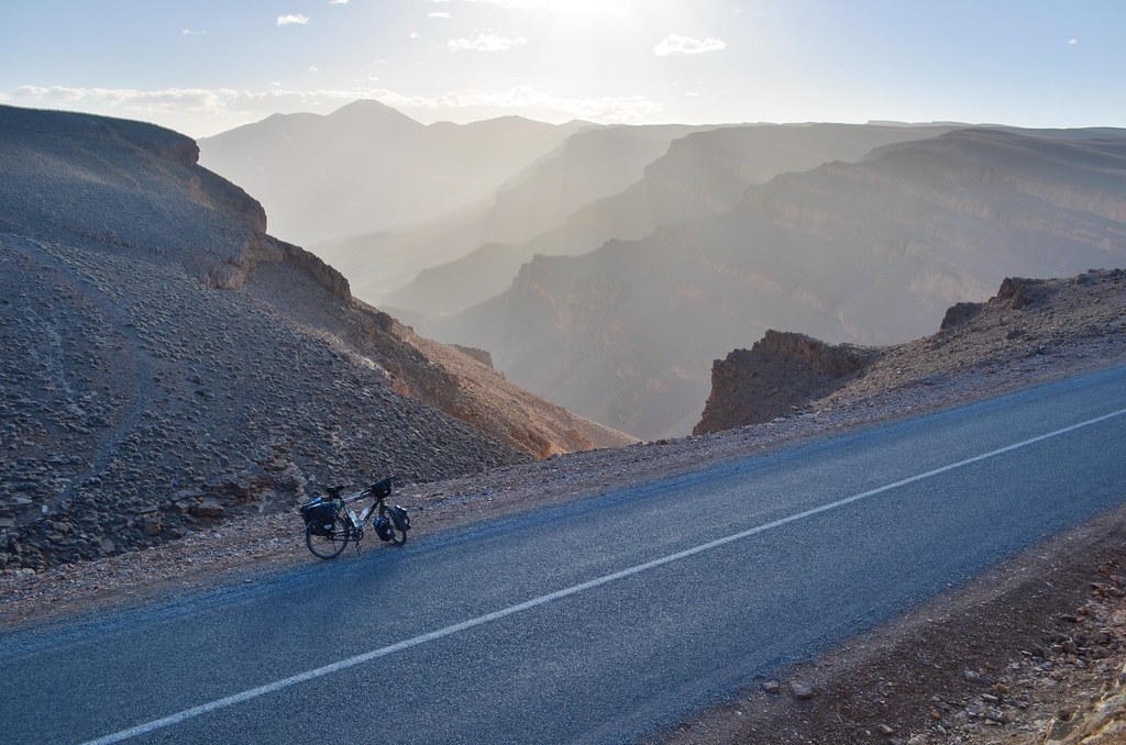
When I am at the crossing where the road forks, on the left towards Msemrir, and straight to Agoudal, deeper in the Atlas, I chat with a man on a bike. He is telling me good things about the “big loop”, i.e. continuing on the road until Agoudal, and turning back there. That makes a 200 km loop instead of the 100 km one I had planned, but considering the amazing landscapes up here, I am happy to extend the already short 2 days into a 3 day ride. So I change my mind. Plus, there are salt mines ahead. It’s not gold or diamonds but I still like mines. I am relieved also to notice that at 2000 m high, it is much drier than in the Middle Atlas for the same elevation. It was wet and green there, and for a mountain range just nearby, it is another world.


The road is going very well and the landscape stunning. I pass Ait Hani and will arrive for the night near Toumlilane, where the mines are located.


I continue beyond the houses to find a camp spot and enjoy the Tattoine landscape. I make my way on a piste of rocks when I am caught up in surprise by Youssef on his bike. He is the guard of the crusher area and saw me from his house. He offers me to stay at his family place in the village but I struggle to refuse to finally spend a night under the stars. He helps me putting up the tent and the perfect sky is indeed there. I am however too tired to enjoy it before I fall asleep above 2200 m.
Still tired in the morning, even if I felt asleep without eating dinner, I defeat my alarm clocks. At 9 am, the natural emergency wake-up call happens: the sun pops out from behind the mountain and quickly turns my 5°C tent into a sauna, especially since I am wearing a semi-survival outfit inside the sleeping bag. This same thing happened often in Iceland last summer, and was actually a quite good thing to stay in rhythm with the days, as the light all night long would not stop me from cycling.

From my isolated campspot, I witness a heavy silence while breakfasting. There is no wind, and apart from a bird or a car passing by every 10 minutes, being able to see kilometers away without hearing any sound is quite rare. I find ice cubes in my bottle that slept outside, and pack for visiting the salt mines.
I had passed them yesterday. My indications were “on the right where you see the traces of the donkeys, it’s just there”. And I left with these most useless words, thinking I would find the way easily in a place where traces of donkeys are everywhere. The path leading to the mines actually starts behind the village of Toumlilane, and without bumping into someone every 5 minutes I wouldn’t reach them. The auberge man tells me there are no jobs in the village for too many families with too many kids: only working in the fields, or the goats for the nomads, and the salt mine for the old people. The young have to work in the cities.

According to the man yesterday, the path should be a 3 km piste ridable on a bike, but it’s more a field of rock, in the dry river bed. I follow the water supply canal and finally see a man and a donkey coming down from a hill. It’s behind there. And indeed, I find along the path something like white moss and tasting like salt. Well, it’s salt, but it’s not the one the salt miners collect.


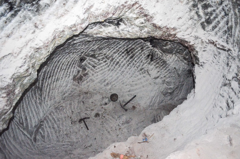
I finally make it to a hole in the mountain. There is a horse waiting for his master and load to come up.

There are 5 holes like this in the area. I am lucky to meet a miner finishing his job, carrying the 3rd of his 4 sacks of 50 kg of salt out of the mine. He has white lines on his face, the same ones a black tee-shirt would get after a good sweating session. He takes me inside for a tour, going down the gallery with an electric lamp. It feels more like unequipped speleology than visiting a mine. And that’s another satisfaction of always keeping my headlamp in my pockets alongside with my Swiss army knife (which has a little light too, but bright enough only for reading).


The salt miner shows me his basic tools, a gallery that collapsed, and another one that sunk into underground water. Almost all the walls are made of salt, and it’s quite hard. The mining is only done by hand and pickaxes, making lines on the walls. It’s fun to pick up salt on the walls but it shouldn’t be fun to work here every day.


Once the 4 sacks are loaded on the horse, who knows the path by heart and starts walking home immediately, I ask him how much would a 50 kg sack sell for. I understood ishrun dirhams (< 2 €), but then he started talking about rials (20 rials = 1 dirham), so I got lost. We walk back, I pick up my horse loaded with 4 panniers as well (but which doesn’t move by itself), and the miner invites me for a tea.
")

As we enter the village of Toumlilane, many ladies do the laundry along the water canal. Unlike the Berbers in the cities, they are all dressed colorfully and have the Berber tattoos, mostly a geometrical shape on the chin.
The tea is actually the family lunch, and I can’t eat much as I had a whole bread for late breakfast. Especially considering the way tagines are cooked and eaten: first is to be eaten the bread dipped in the soup, then the potatoes and vegetables, and at the end only the hidden meat appears from under the veggies. This time, he took the meat out, cut it and distributed 3 little pieces of it to each person.
They offer me to stay and leave for Agoudal tomorrow, but I’d rather leave now. In this area, if I accept all the invitations for tea, meal or overnight stay, I’ll hit the deadline of my permit to stay in Morocco before even leaving the Atlas. Hence, I start my cycling day at 15:00, with legs not in a good shape. And I spend 2 hours on my lowest gear to get to the pass at 2700 m, just above Toumlilane, in an amazing landscape.


Two herdsmen are here at 2700 m, preparing tea with the little roots available to make a fire. It’s getting cold and I start the descent towards Agoudal, still some 20 km away. A cold wind against me spoils the descent, during which I have to pedal and don’t even go fast. My fingers don’t like it either.
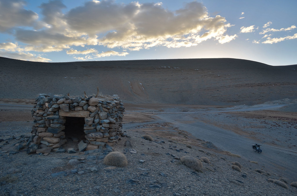
There are no villages until Agoudal, which I can’t reach before night. I see 2 men with metal detectors by the road, it reminded me that I was told fossils can be found just by the roads in this region of Imilchil. I see a shelter for goats a hundred meters from the road, and it happens to have a room seemingly more for humans than for goats, which will be perfect for the cold night.
The stars appear little by little, and I can cook my pasta with a small block of salt from the mine. I don’t carry salt with me since I picked up a good idea from Cyril, to use Maggi/Knorr cubes instead. On the top of giving a taste to the pasta, it makes a soup out of the water and kind of lubricates the pot, making it easier to clean. It’s another night in the deep silence of the Atlas.


Hey I was surffing on the net suddenly I found my village pictures. I really like your story.. so you are welcome to my village if you want to come back to Aithani I will host you in ly house. ok this is my email
aissaelyoussfi5@gmail.com