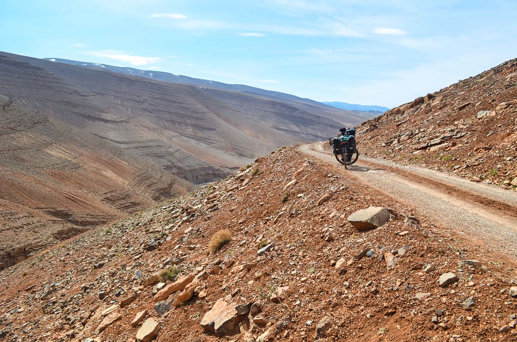
There are a few kilometers left until Agoudal. The road is still nicely paved. Apparently the surfacing was done very recently, but I doubt it will last for a long time. I could have cycled from Rich to Agoudal then Tinghir entirely on asphalt.


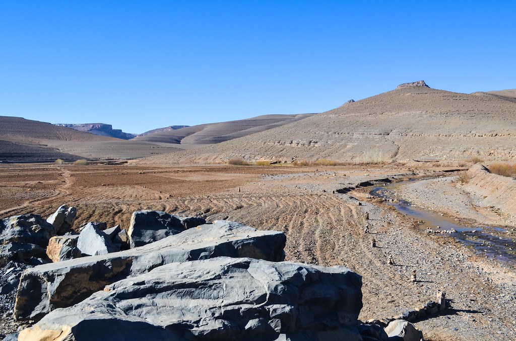
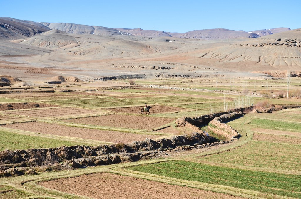
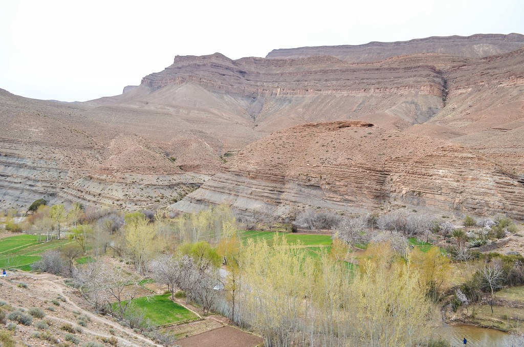
While the road from Toumlilane has been 25 km of strictly uninhabited and hostile land, I start to see exploited land around the almost dry river bed.

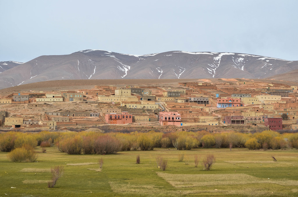
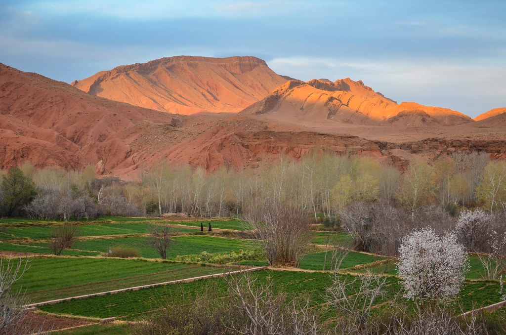
Right after a bend, I am facing the village of Agoudal, much bigger than I expected. And much sooner too. There is still no noise in the air and very little activity around, I could not have guessed there are so many people living up here. The elevation is around 2400 m.


Agoudal is the biggest village of this region of the High Atlas. I am lucky to meet, at the small shop of the entrance of the town, the owner of the guesthouse who sells me a bread (there are no bakery in the village) and gives me tips on the road. As I disclose my plans to return to the south through the Dadès gorge, he calls me crazy. Which I usually take as a little compliment, but for this time, it reminds me that I completely ignore the state of the road. I had inquired for a long time about the piste between Tamtattouchte and Msemrir, but since I changed my mind last minute and went for the bigger loop, I don’t know anymore. He tells me that the road is closed and no one has passed there this year yet. And that it must still be a bad piste, because of the snow and the red mud that attacks wheels and fenders. He says he rescued a French trying to pass there a month ago who had to abandon his motorbike.
That’s very bad news. I had forgotten about the snow, since I didn’t see any for a day above 2000 m. On the not so bad side, the critical point of this 120 km piste/road until Boumalne-Dadès is soon: the pass is 20 km from Agoudal. After it, this is downhill facing south, so there is no risk of snow. And among the 20 km to get to the pass, only the last 10 are bad.
It means I would know rather soon if I have to make a U-turn or not. It also mean that the bad section only lasts 10 km, which is reasonable to struggle for instead of making a U-turn. I have already crossed 2 closed passes, with struggle yes, but with success too. Let’s try another one …
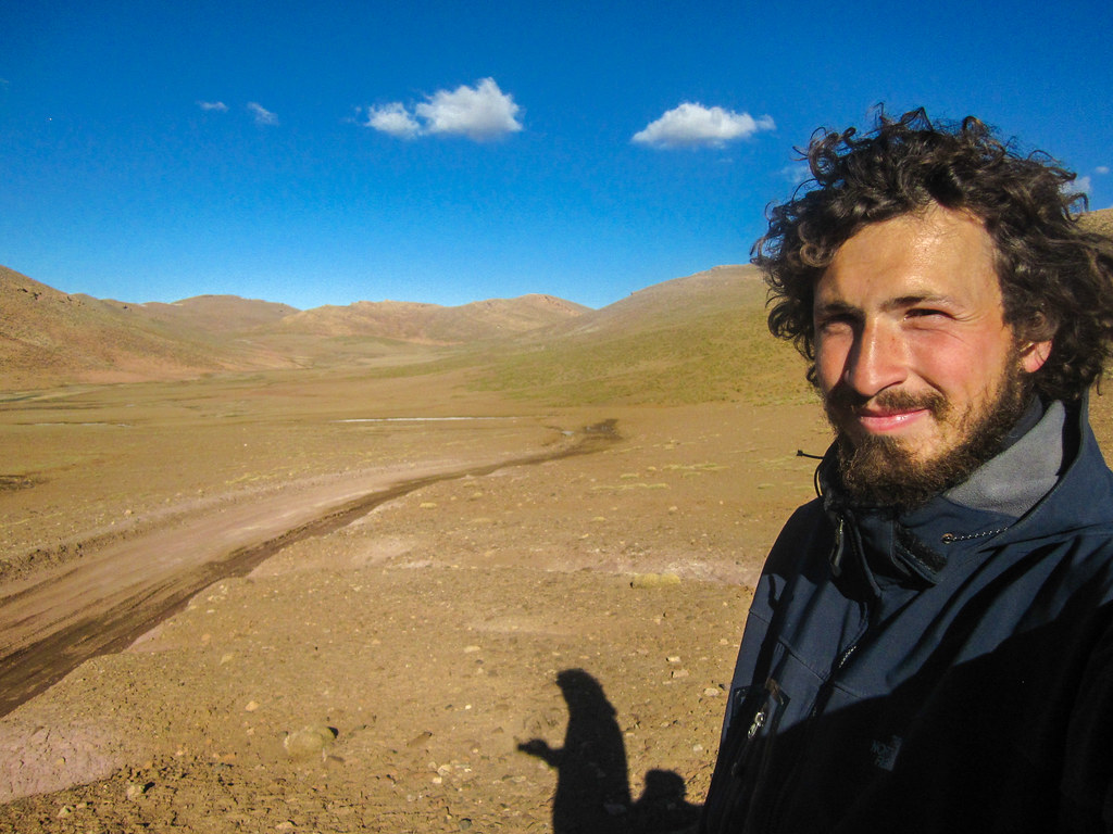
So I leave Agoudal for the unknown, with a bread, 4 oranges, and a dozen of very annoying kids running after me asking for sweets, pens, and just “something”.

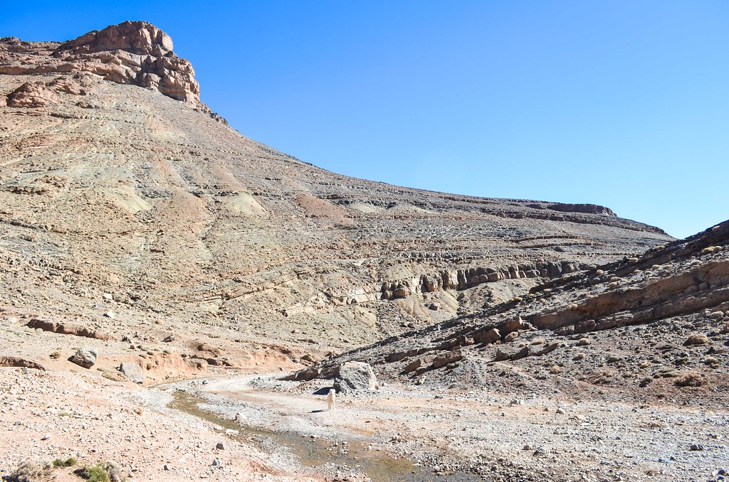

After 10 kilometers of a gentle piste, I reach a camping, a really lost camping. I noticed “camping” here sometimes means “parking for camper vans”, since there are so many of them. But it’s not the case for this Auberge-Camping-Restaurant, which has no activity during the dead season.
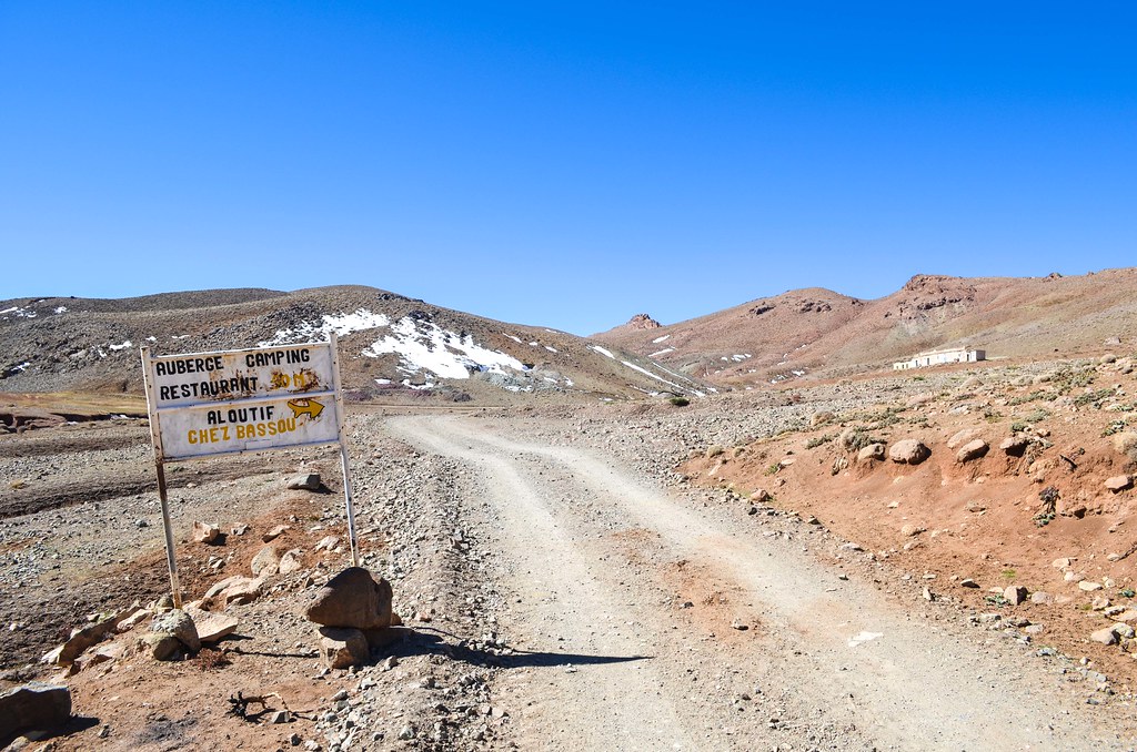
I wake up the two brothers “working” there around 12. We drink a tea and chat. There is no electricity but obviously they have watched Real – Manchester on TV with the solar panel. During a tea they tell me that 4×4 have actually passed this season, but only in the other direction, from Msemrir to Agoudal. There is still a bit of snow on the road and it’s impossible to cross the mountain pass in my direction. However with a bicycle it “should” be fine.
I leave for the tricky 10 km on this more positive note.

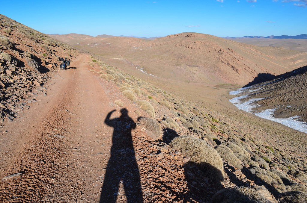
The red mud indeed appears soon. It’s sticky mud that once touched by the wheel, with only rotation, envelops completely my tire. Several rotations and the wheel is blocked inside the fenders and brakes. So I must avoid it absolutely. The road and roadside may look OK, but it is in fact not dry at all and very deceiving.

The best thing to do is to push the bike in the snow patches. It’s hard but at least leaves the bike in good condition. The ground is like a sponge, swallowing the melting water from the snow. I can’t go with the bike on it and must find the driest parts, that would allow me to push without getting stuck. It involves a lot of carrying over several meters.


The road is still covered in snow in the shades. That would be a no-go for cars but I can push my bicycle on the snow and ice.


Pushing and carrying for kilometers on this ground take ages. It seems it wants my shoulders to show in 1 day the same efforts that my legs produced in 1 month. I have no more energy in my upper body to push when I finally reach the pass: Tizi n’Ouano at 2700 m.

That is a semi-celebration, because the road doesn’t go downhill yet. It goes higher. While eating I watch passing the only vehicle of the day, a 4×4 with tourists but with a local driver. Apart from this one, this is a very secluded place. There is nothing here but mud and snow. No animals. Absolute calm.

The end of the afternoon is slightly easier. I still have to push and avoid the mud, hence making my own route, but it’s not as steep as in the beginning. I finally reach a drier piste for what should be the last ascent to the real pass.

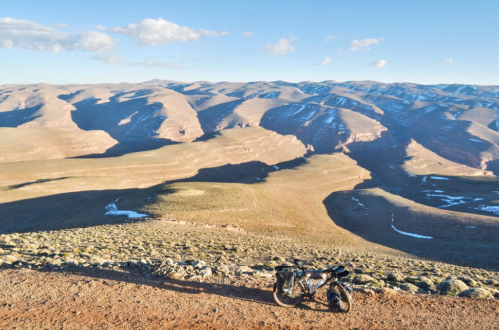
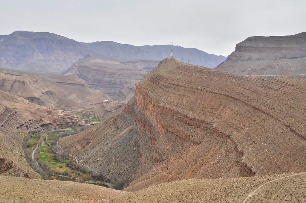
This pass has no name, no sign. Nothing to to say “This pass at 2920 m is open from April”. There is just an abandoned house. Still, that is a huge satisfaction to have crossed here: I don’t have to make a U-turn and I will go back to the main road through the scenic Dadès gorge.

At the moment I crossed and I could see the downhill road finally, my phone caught the network. Even Maroc Telecom’s network was out of range in this area. Now, 3G is received, so I guess I am soon back to civilization.
I can finally stop struggling and enjoy the views. It cannot be described. From almost 3000 m, I have a great range of mountains in front of me over which I can see very far. And there is no one to make the slightest sound around me.

If I were to believe the Agoudal auberge managers, I would say I have “opened” the pass this year in the direction Agoudal – Msemrir. Or that I am the first one of the year to pass here on a bicycle. But I noticed tracks of another bicycle. Not always logic, but avoiding the mud pools just like I did. Maybe a mountain biker.

I stop in the middle of the descent: I have noticed suspicious movements in the still environment. By the time I spot them, they are all staring at me. It is a far-west duel between the group of approx. 20 ibex and I.
When I start to pull out my camera, they start jumping and running away. Very fast.

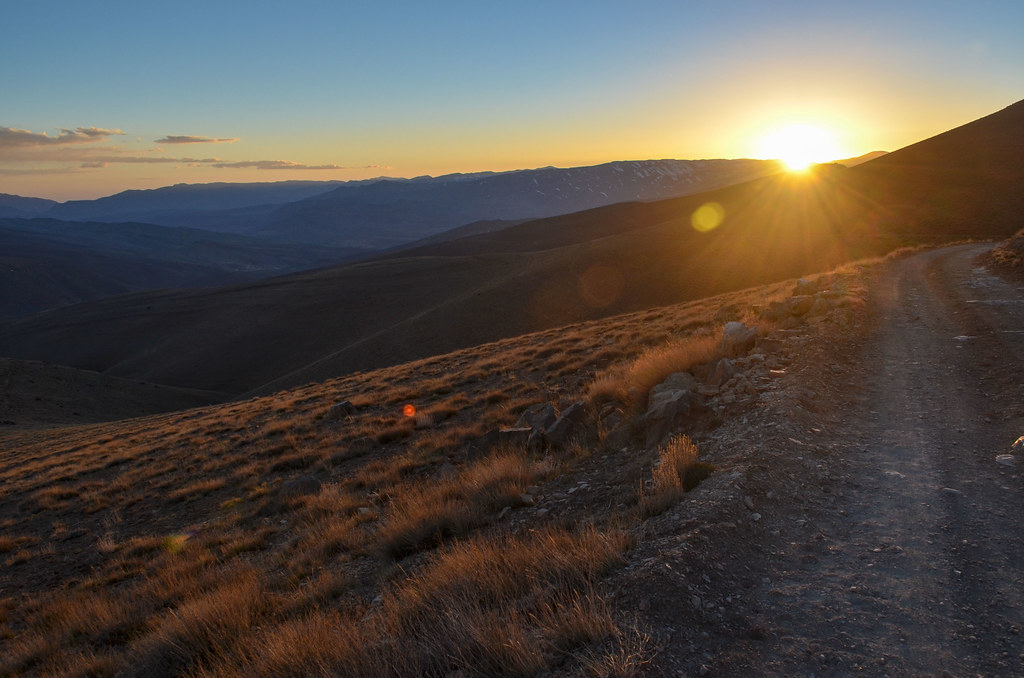
The sun is setting and I am still very high in the Atlas. I cycled from 10 am barely completed 30 km today.
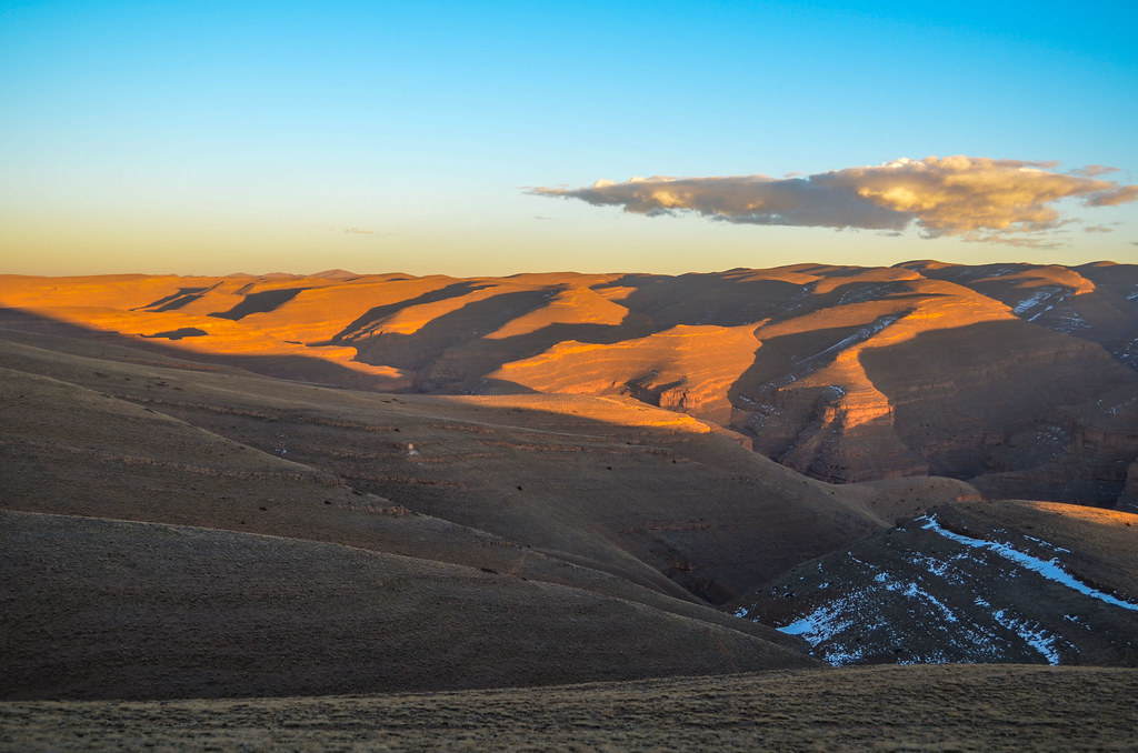
By 6 pm I am still above 2500 m. The sun disappears and the cold takes immediately the vacant space. I can see the first village down the winding road, but will not be able to reach it before darkness. I miss 30 minutes, probably the ones I spent drinking tea with the auberge brothers. And finally, this beautiful road is better to be taken in the morning under the sun rather than speeding in the darkness tonight. So I decide to camp here in the cold, on the top of the world.
The problem is that there is nowhere to shelter and the whole ground is made of stones. I choose a small area by the road and clean it for mounting the tent. At the same time, the wind picks up. And pretty strongly. For once Youtube being helpful, I remember a video about setting up this tent under very windy conditions.
But this doesn’t solve the problem: the wind is still very strong and my tent looks permanently distorted, to the point I am scared it would be torn down. From inside the tent, the flapping noise is unbearable, and under the panic I run outside to collect big stones and build a little wall against the wind. I don’t know how much it helps, but at least it keeps my busy until the winds calms down a bit. I can see all the lights of the villages in the Dadès canyon. It is very beautiful but too cold to stay outside.
Indeed, it shows 0°C inside the tent. I am curious to know how cold it is outside but not enough to open the zip. I wake up after a bad night, it is still cold but am relieved the tent is still above me in one piece.

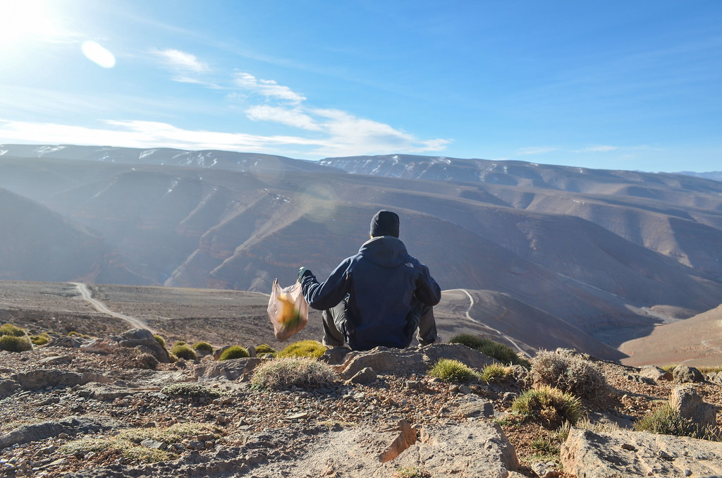
I have breakfast with Sergio the fake Nutella in front of the still splendid scenery.
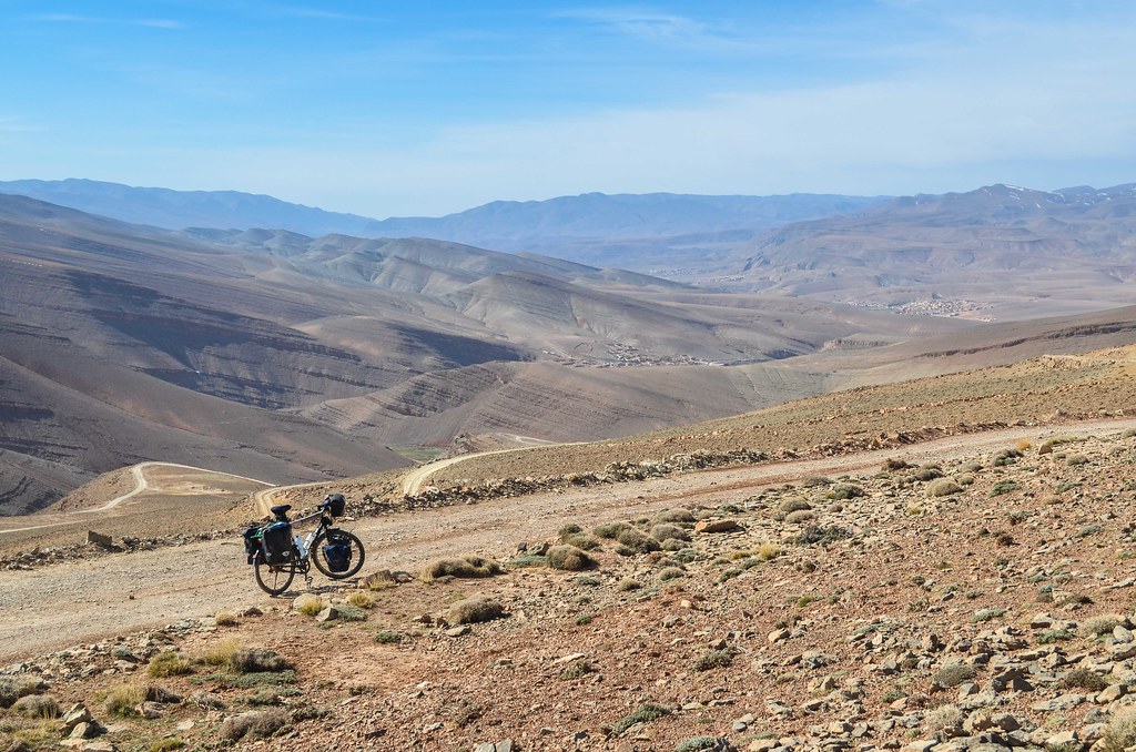
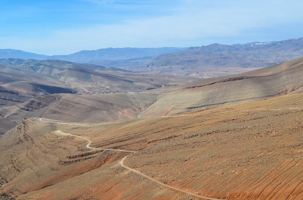
The plan of the day is to cycle downhill the kilometers of piste left until Msemrir, then the paved road until Boumalne-Dadès, on the main axis between the High Atlas and the Anti Atlas.

I am glad I didn’t cycle down yesterday evening, as the piste, limiting my speed, takes one hour to take me to the closest village. And there are some places where it’s better not to slip.


The sky is grey instead of the great blue I have been used to. The pictures won’t look as good, even though the feeling of riding in this immensity is absolutely special.

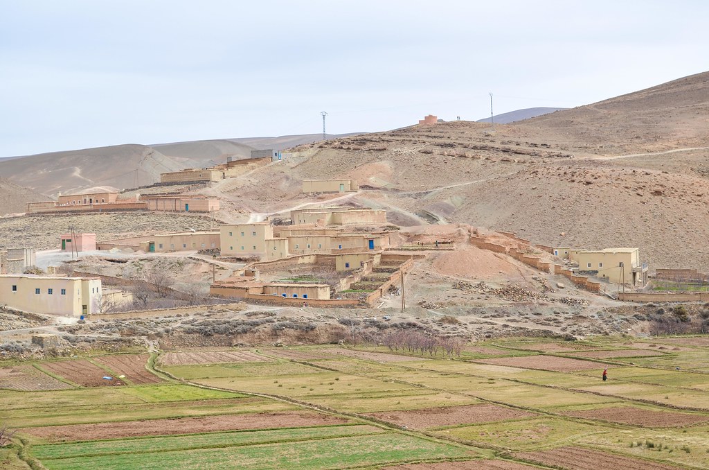
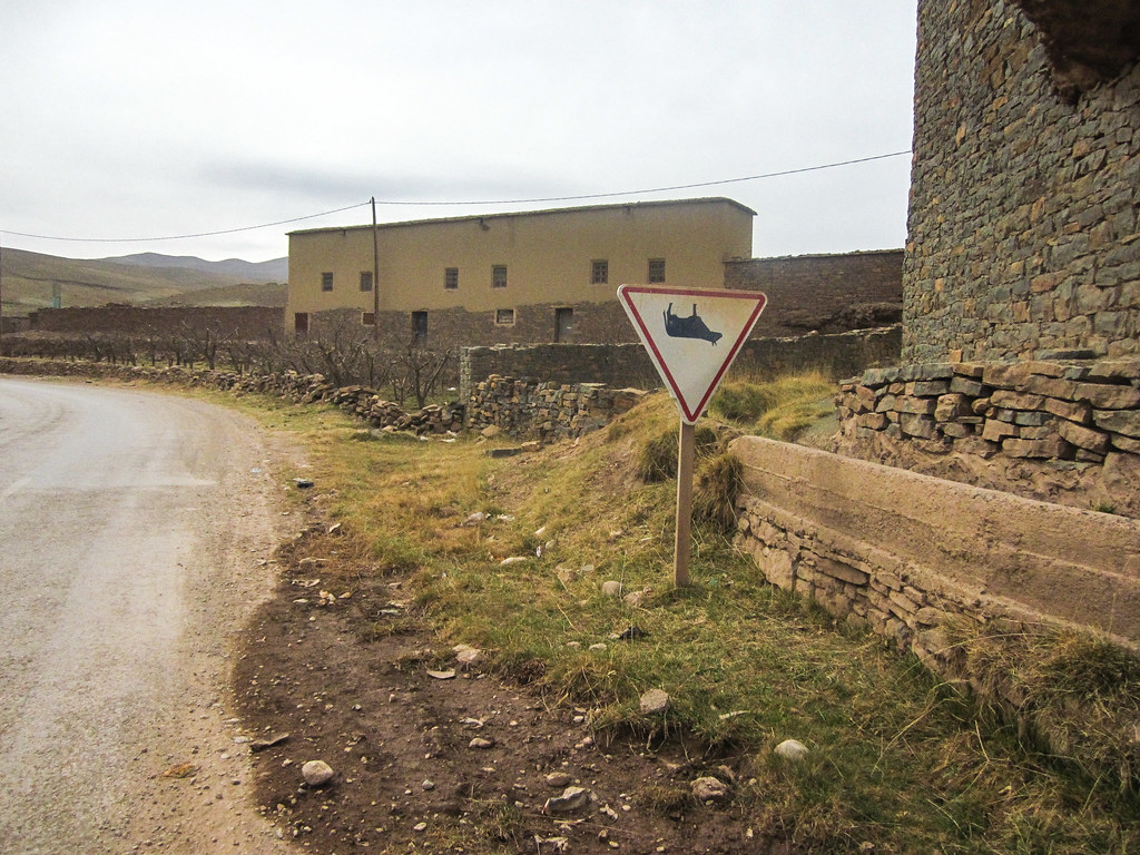
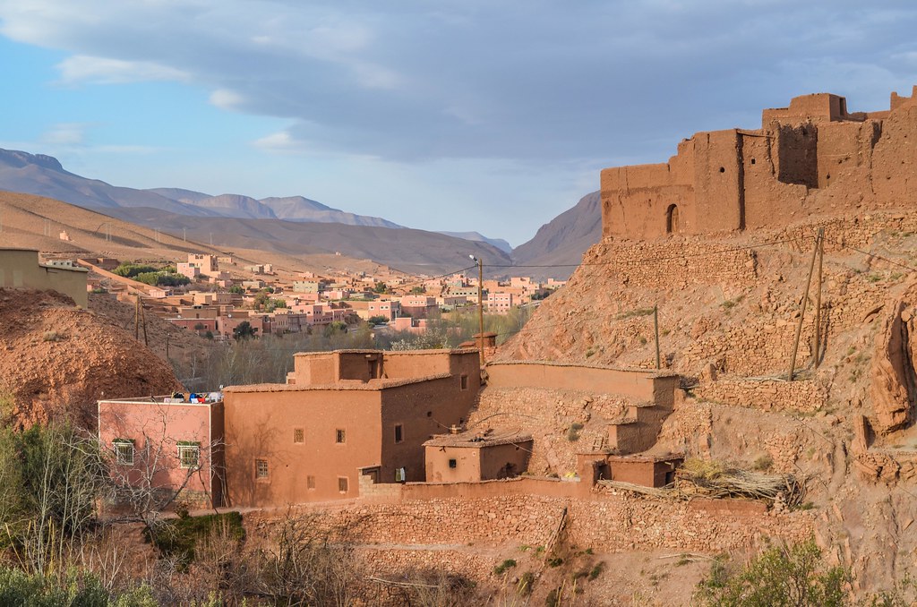
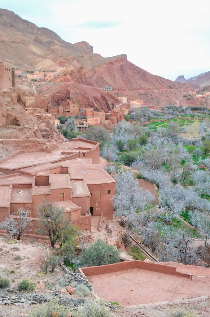
I cross many Berber villages as soon as I get down to 2000 m along the water stream. Apparently, there were many sources in the past, but the winters of the last years have been dry. Without snow in the mountains, there is no continuous water flow for the farmers. All the villages and cultivated plots are organized around the Dadès river. The villages are small enough to have no shops, but a huge load of annoying kids.
I didn’t face it until now, but the kids pressure is now unbearable and I do my best to be as fast and discreet as possible when going through inhabited areas. It’s difficult when even the cars and trucks are rare and when the single road, sometimes paved, sometimes not, is the center of the village as well as the kids’ playground.
Whenever a kid between walking age and teenage spots me, even from afar or during a game, he/she leaves everything and runs towards me shouting “bonbon” (sweet) or “donne moi un bonbon” (give me a sweet). If I talk with them, it always happens the same way: I don’t have sweets and I carry the minimum with me. For sure I am the tourist with the less thing to give away (and also much hungrier than them). Then they want a dirham. Then a stylo. Then just something. And I am stared at like if it’s abnormal not to give something to all the kids in all the villages.
Maybe the tourists in camper vans and 4×4 can carry presents and distribute to them, and when they are fed up they can close their window and drive away. I am the one to take all the negative side effects: some kids tried to grab me, to kick in the bike, to take what I have on my rear rack, to shoot a ball at me, etc. I had read about cyclists being thrown stones at when passing kids. It didn’t happen to me but since the whole area has stones, I’m not staying too long to test it.
It had started when the kids, until this mountain area usually happy to say “Bonjour”, showed their hands to do a high-five. But they actually wanted me to show my hand so they can use it as a punching ball for fun. The only amusing reaction I got was with a kid too young to be mean. He was like others asking sweets or money. I argued that I am the one cycling up the gorge and I need energy like sweets much more than him, who was just playing by the road and receiving things from the tourists. He seemed to agree but said he didn’t have sweets with him. And was about to give me his collected 1 dirham coin so that I can buy a sweet for myself.
The worse is when women are in the game too. They ask for the same but more insistently. The women in business are very rare, as almost everything is run by men, but the most shameless asking prices (tea, shop item) I heard were from them. Once, in a reply to “Give me something”, I answered “Look at my bike, I only carry the minimum”. She continued: “OK, Give me minlimon”. Except for a school teacher I met, that is the level of conversation I can have with rural women.
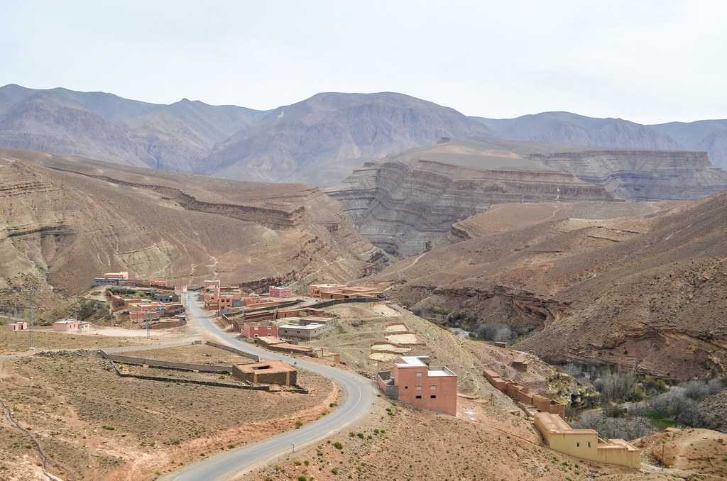
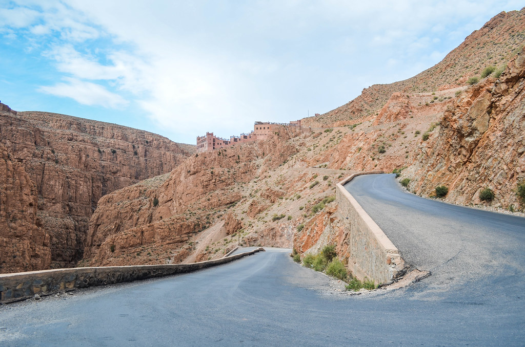
After those hostile villages, I finally reach the permanent asphalt in Msemrir. It is the last town that tourists usually visit while driving up the gorge before going back. Arriving here means that I am done with the remote inland country. Indeed, I start to see shops, restaurants and guesthouses, even though they are mostly closed. And the kids behave like kids again.

The narrow part of the road, stuck in the canyon formed by the Dadès, starts also here.


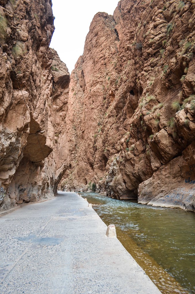
I stop at the restaurant above the famous postcard picture of the défilé d’Imdiazen.

The end of the gorge is called the vallée des roses. The road is no more squeezed inside light ocher stone walls, but meanders over red hills and strange rock formations.

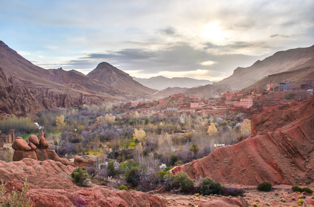
The gorge meets with the main road in Boumalne-Dadès, the small big town of the area. No one would want to stay in this dull town when the gorge is a few kilometers away with splendid sights, but I need the 3G network that doesn’t go through along most of the road. The 120 km from Agoudal to Boumalne-Dadès were the highest concentration of stunning views. It had been overall, since Tinghir, four excellent days in the wild, and I am glad I made the extra effort to get the reward.


Hallo, pls what part of year it was, which month? i would like to drive this way in the end of march… Thanks for answer
Hi Jb,
Amazing photos, thanks for sharing your experience with us, good luck, good care et bon courage!!!
Marwan
Thanks!
I am so thrilled to read your diary and see the photos! Gambatte ne.
Gambatteruyo!
Wow – super belles photos! Ca a pas l’air mais tu avances vite quand meme.
Merci de nous faire partager ton periple! et bon courage pour la suite 🙂
Merci, Les 1500 km / mois en moyenne tiennent bon. Ca suffit pour changer souvent de décor.
Yes, les gorges de Dadès, la vallée des roses, les doigts de singes…tous ces paysages magnifiques me reviennent en mémoire en admirant tes photos (superbes, comme d’hab’). Pris le temps de faire un trek dans l’atlas de plusieurs jours en partant de la vallée des roses…et là aussi, dans les villages traversés à pied, loin de toute piste, les enfants étaient hypercollants et réclamaient tout ce qu’ils pouvaient…mais n’ont jamais rien reçu de mon groupe d’amis. Tu n’es pas le seul à donner ni bonbons, ni stylos, ni dirham, ni même le minlimon…
Il semble que tu prends goût à franchir des cols fermés, dans la neige et la boue. Un peu maso, non ? Mais c’est clair que le paysage qui t’attendait en vallait la chandelle !!!
Le plus pratique pour avoir les cols ouverts ET le sahara froid c’est de partir d’Europe en début d’automne. Je l’ai loupé de peu mais c’est toujours passé limite 🙂 Et ca a payé a chaque fois.
Les seuls trucs que j’ai acheté pour donner sont des cigarettes. C’est pas bien, mais plusieurs fois j’ai rencontré des hommes ou des nomades sur la route/piste seuls, a plusieurs heures de marche ou d’âne du point de vente de tabac, et qui ne voulaient rien qu’une cigarette au cas ou.
Belles couleurs mais on sait pas trop si c’est la balance des blancs qui nous joue des tours! Faudrait aller voir sur place pour comparer… Je passe le bonjour à minlimom-san de ta part 😉
Le ciel était nuageux et tout le paysage de roches rouges ou oranges, donc oui la seule solution est d’aller sur place!