The heavy rain has passed while at home in Pontarlier and I’ve sorted out what I needed to. I just postponed one activity, the compilation of a video of yoyo-cycling in the Swiss mountains.
I could also do some repackaging. I dropped my divebook and some documents from the panniers. They got replaced by water purifying products, a cap and a cream for dry skin. Also got downgraded my jacket and a pair of socks, with the assumption that Switzerland would be the coldest of the trip (I hope the Pyrénées will abide by this assumption).
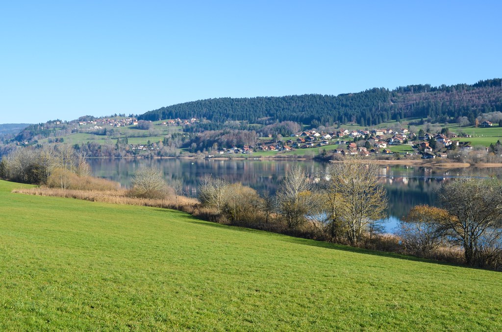
I am leaving to go South for real now. I leave Pontarlier (quite late in the day) by the Lake Saint-Point, which I used to cycle around during high school weekends or holidays. Despite 4 days of rest, my butt muscles let me know immediately that they didn’t forget what they had to do the previous week.

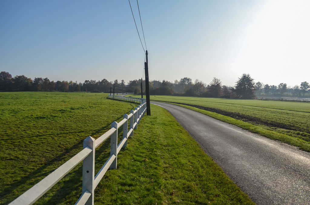
I continue further south, through very quiet villages. I barely meet cars on the road, and the villages seem deserted. I don’t have the luxury of dedicated scenic road paths like in Switzerland, but cycling in the back country in France is just the same. And it goes faster.
For the first time since my departure I feel like cruising at a decent speed. This is confirmed happily when I am detected by the speed indicator panel at the entrance of a village: 30 km/h. Those devices seldom work with a bicycle. And 30 km/h is quite good, as on average on a flat road, I would rather do 20 km/h with my fully loaded truck and 2” tires. The elevation of the road oscillate between 800m and 1000m, but without steep climbs. It is a pleasant ride, everything around me is green. Despite being at the end of the day already, my objective is to get out of the woods, and camp somewhere lower and warmer. It is still quite cold.
I am now no more in the Doubs but the Jura. Not to be mistaken with the Swiss Jura, much higher in latitude. The French Jura is at the level of Nyon and almost Geneva. Well, all in all, it’s the same hills, trees and valleys.
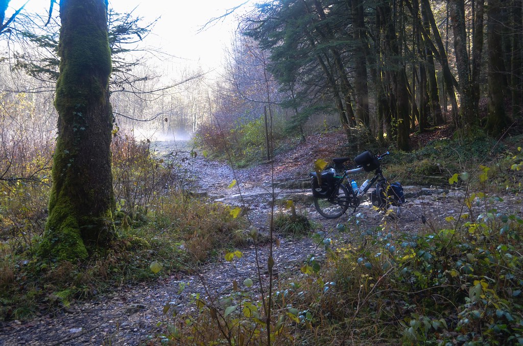
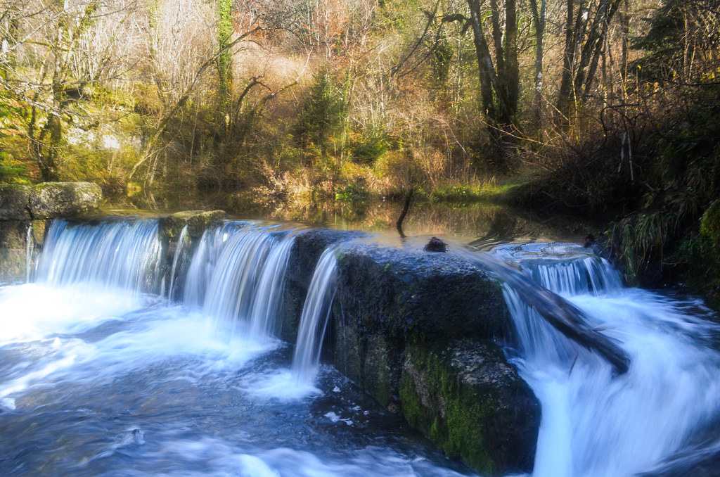
My objective is not actually reached since I sleep at 735m, with a temperature of 5°C during sunset. But it is compensated by the location, the sun setting right at the time I reach the Cascades du Hérisson, a serie of waterfalls along the Hérisson river. I always enjoy camping by a waterfall, it makes water for cooking and bathing, a background noise, and a dynamic landscape to rest in.
Getting up by the waterfall, I need to go jogging along the Cascades du Hérisson to wake up and warm up. Industrial activity (iron works) took place here from 7 centuries ago until the early 19s.
I follow then the “Route des Lacs”. This part of the Jura seems entirely shaped by water: canyons, valleys, roads following water streams, … it’s cold but all beautiful.


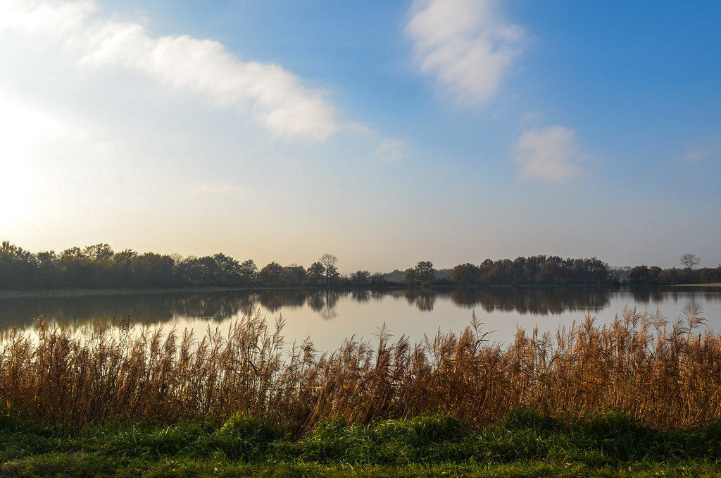
Then appear what I had spotted on the map and looked funny: the Lake of Vouglans. It was born in 1969 when the Vouglans dam was built. The water filled up the tortuous valley on 35 km. It looks like a snake on the map, and in the reality too. From now on my road is not straightforward as I wanted to cross the lake in 2 parts, on the Pyle bridge and at the end on the dam itself.


The lake is said to be the training place for the French rowing team. It’s quiet and somehow protected from the wind. From the roads also, as none is following the contour of the lake. This makes me do ups and downs if I want to find point of views. I get close to Moirans-en-Montagne and don’t follow until Oyonnax but turn right towards the dam. Unfortunately I can’t cycle over it, but at least get a viewpoint over this piece of 545 000 m3 of concrete (half of the volume of the Empire State building).


By the end of the day, I reach Thoirette, which is the southernmost town before getting in the next department. I have no network since a dozen of kilometers and my phone is roaming with a local SIM card.
I get up early to be sure to make it to Lyon by the evening, before sunset. Entering a big city is always annoying, and the night make things worse.
I keep cycling down the Ain river and the beautiful canyons. But today, the day is slower to wake up than me.

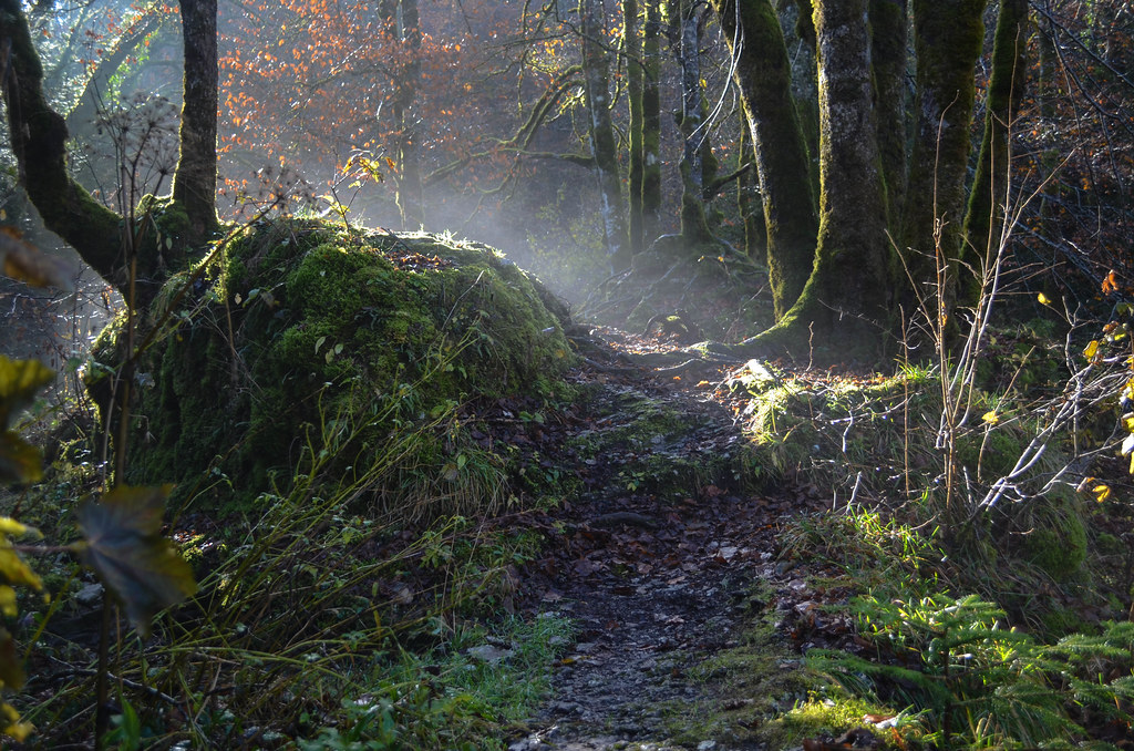
The fog is thick and the visibility between 20 and 50 meters. I can read on the signs how nice it is to be here, just not this morning.
As I don’t see anything I get off my bike to visit a cave, the Grotte de Corveissiat. I’m no longer in Switzerland, and noticed already in the past days that the signs are not sufficient by themselves to find a location easily and require further guessing. Yesterday I missed a site of dinosaur footprints “along the road between Coisia and Thoirette”, which I took. And managed to miss it on a bike. That must be a training or a re-conditioning in preparation for the next countries …


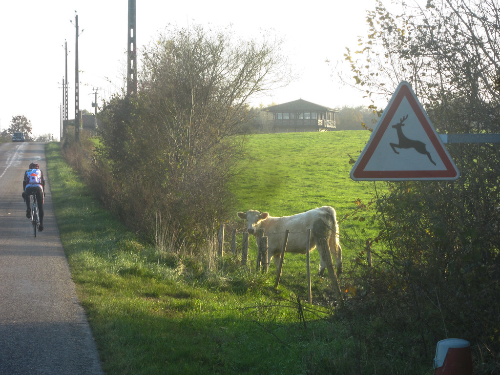
Still, around noon, the fog is still all around me and won’t let me enjoy the scenery. The visibility is similar to the one of a good dive, but the animal spotting slightly less interesting. A horse here, a cow there. A squirrel comes to see me on the road. I see one piece of blue sky for a minute, on the top of a hill, but no more. I decide then to leave the “beautiful” Ain valley for a more western part, in la Dombes.
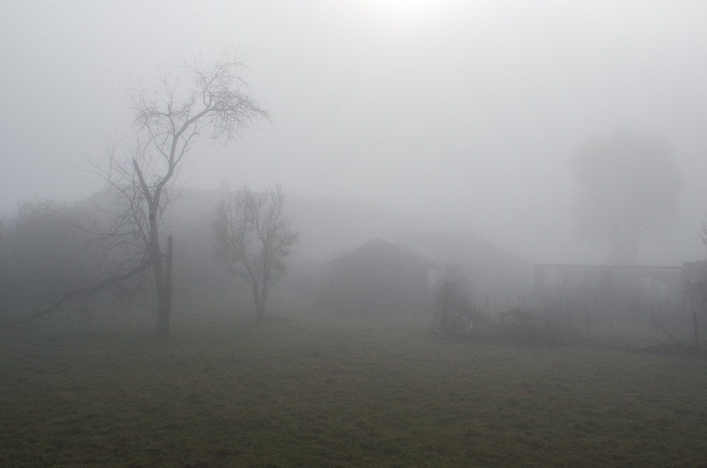
I notice at some point that my hair is wet. Without rain or intense sweating. My clothes are also covered in little crystals. Riding through this fog for more than the whole morning feels like being in a cold hammam with “cold steam”. My tent was also very wet this morning, without any rainfall.
Once on the other side of the highway and railway, this is the domain of la Dombes. It is a flat region full of ponds. The sky finally turns blue and reminds me how nice it is to have the sun warming my back. The last dozen of kilometers towards Lyon are pleasant through the “Route des étangs”: straight roads, ponds and animals.


Luckily to get into Lyon, I can follow the Rhone river on the south bank. There is a walk/bike path taking me straight into the city, avoiding most of the traffic that I had to cope with in the suburban towns already. And that I don’t like at all.

I find Aurelien and Diane quickly and get dry, warm, clean and satiated. That was a nice ride through greenery, small villages and lots of water.


I’m such a nerd, I’m thoroughly enjoying all the engineer-ish stuff about airfields, concrete volume etc. Courage, JB, courage!
Amazing! Thanks for the report! Its like almost be there as well… 🙂