69 Rhône, 42 Loire, 63 Puy-De-Dôme, 43 Haute-Loire, until the border with 15 Cantal. And crossing some of France’s longest rivers, Rhône (812 km), Loire(1012km), Allier (420 km).
I restart from Lyon after 2 good days with Aurélien and Diane. I also find to replace my tripod Takeshi by ShinTakeshi, and a new SIM card to replace the one from Orange, who still invent new ways to scam customers by creating useless technical terms just to bill more a posteriori.
We find a way to get out of Lyon easily, as I don’t like to have to deal with cars, and motorbikes and pedestrians hidden between cars. It’s dangerous and not compatible with touring, i.e. somehow enjoying looking up, left, right. The cycling path along the Rhône is perfect and beautiful, and leaves me in the south of the city, almost already in the quiet western suburbs. It’s warm and for the first time in France I’m riding without my jacket, and only 1 layer of clothes.


I make a brief stop in Chaponost, to see the roman aqueduct well conserved. It was built in the 1st century, and even had siphons to cross valleys with minimal pressure loss.

The inconvenient of planning a route with Google Maps instead of a good paper map that has town names AND elevation levels, is that I can’t tell if I’m gonna have hard time or not. Well, I could foresee it with the little hairpin bends of the road … and after all the most challenging brings also the most beautiful. So I engage on the road to Yzerdon. It appears to climb for 10 kilometers. It goes fine as my legs are in good shape, and takes me from 200ish meters to 777 meters high. And here I am again in a chilled climate …

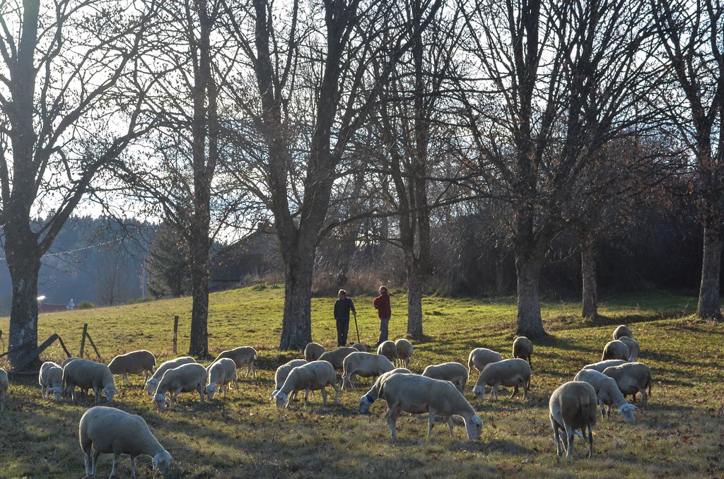
But the views are nice and I decide, since I’m “up”, to stay there, and continue to Saint-Martin-en-Haut, and other villages up on hills. I complete my collection of towns-that-like-to-add-many-words-in-their-names with Saint-Symphorien-sur-Coise and then down on Saint-Galmier. It is the hometown of the Badoit water. I meet Laurent on his bike who explains me the best road choices for my next days, and by that time the fog rises and invades the valley. It’s not raining, it’s not a bad weather, but by riding 200 meters, one can gather enough of the water particles to get the jacket and hair wet. It’s an incredible humidity level. I’m camping but am sure to find my tent wet in the morning as if it rained. At least the temperatures are warmer. It’s 10°C in my tent when it was 5°C at the same time of the evening 4 days ago. That’s better to avoid having toes and finger frozen (frozen finger are not compatible with unclipping the tent clips on the poles, just like texting without gloves under the snow).
After a delayed waking-up process, not really wanting to leave my warm and dry cocoon for the cold and wet outdoors, I’m finally dressed up and on the road. My tent’s outer layer is soaked from the mist and humidity. I still can’t see much through this fog, and like the cars, I am cycling with my lights on. I need to readjust my clothing after 2 minutes, my fingertips being already frozen. Still in Saint-Galmier, I go and visit the Badoit factory, just to see if I can get some water from the spring. And it is possible, there is a spring “chalet” with locals refilling their hundreds of plastic bottles with free Badoit. I do the same with my 2 bottles. It is less sparkling than Badoit, but does taste like Badoit.


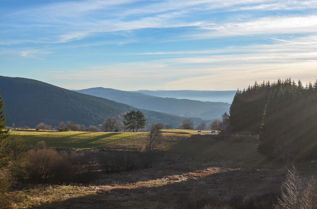
For the whole morning, the visibility is only up to 100 m, until I reach an altitude of 600 m around noon. Then I can see how green and nice the villages are around me. I make a stop in Gumières at the restaurant to refill my stomach and especially put my tent outside in the sun to dry.

There is no phone network in the surroundings, the lunch is big and my tent completely dried. With these good news I continue the climb quickly enough and reach the Col des Limites at 1157 m, the border between 2 departments, the Loire and the Puy de Dôme. This is only to lead me down to Saint-Anthème, and up again to 1196 m at the Col des Pradeaux. All this uphill roads for a final 10 km descent to Ambert where I find to sleep in the closed campground.


I sleep well and warm, that’s why I am surprised to find bits of ice on and in my tent. Departing quickly, I have no time to feel the cold because I am already on the road of a pass. I finish en route the rests of my bits of food collected until now, bananas, ham and morbier cheese. I am not taking the easiest road, definitely not, but surely one of the quietest. I can cycle 10 km in the middle of the road without being disturbed by a car. The villages are also deserted … November is the very low season, after summer but before winter. Most businesses are closed, and the ones “open” have funny opening hours.


After the first pass at 1085 m, the road doesn’t leave me time to rest, as the second pass of the day is already coming: the Suc des Trots at 1115 m (well, it doesn’t come by itself, and replaces the illusion of a great descent). I receive droplets of water but keep going. A short stop in Saint-Germain-l’Herm at the tourism info lets me know that the rain will stop in the evening. So I resume and will have my deserved great descent under the rain. I have the choice of the cap and the sunglasses to avoid getting rain in my eyes, and having already 2 things over my head (it’s cold), I opt for the 2nd solution. My lenses being orange, it turns the blue tones of the rainy landscape into warmer ones, and almost makes me forget about the rain.


I arrive in Brioude, cross the Allier river, and the rain stops. I am quite wet. Doing a few steps “on the ground” removes the heavy weight I had in my toes, a similar feeling to the one in the jaws after a visit to the dentist. I have 1-2 hours of daylight available, some more kilometers to go and must find a place to stay indoors for the night, as my tent, jacket, and shoes are wet.

The road to Massiac leads me under the viaduct of Montgon, 567 meters long for 40’000 tons of concrete and 2000 tons of steel, until Grenier-Montgon where I find signs of a gîte (B&B). Happy to go there, beyond the train tracks, I actually find no one. It’s closed. The farmer exploiting the neighboring field let me stay in the barn, with water and electricity.


I don’t know if my stuff will dry, but for the moment I have warm food, music, and internet …


Leave a Reply