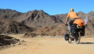
My cycling-brandy-braai partners stick to the main road, the N7 until Nuwerus. But after a great day around Leliefontein yesterday, I can’t help leaving Garies for the dirt again. Via Lutzville, I should be able to reach the coast within two days.

Farms look much less fancy than in Namibia. They are also closer to the gravel road. They seem more numerous, so maybe each farm has a smaller land than in Namibia? It would make sense, since the rainfall, even if ridiculous compared to the east of the country, is still much better than around the Namib.
What I was told earlier about dirt roads seems to be verifying: Namibia has very few tar roads, but the vast network of gravel road is almost always in excellent condition. On the other hand, South Africa has lots of high quality tar roads, but their gravel roads don’t look as maintained as in Namibia.


The road is not so interesting, and there’s nothing really pretty. My several maps indicate various roads, and there are even more dirt roads and tracks out there, it’s a bit confusing.
In addition, rain is starting, it’s cold and wet, and doesn’t feel like a day for being outside.

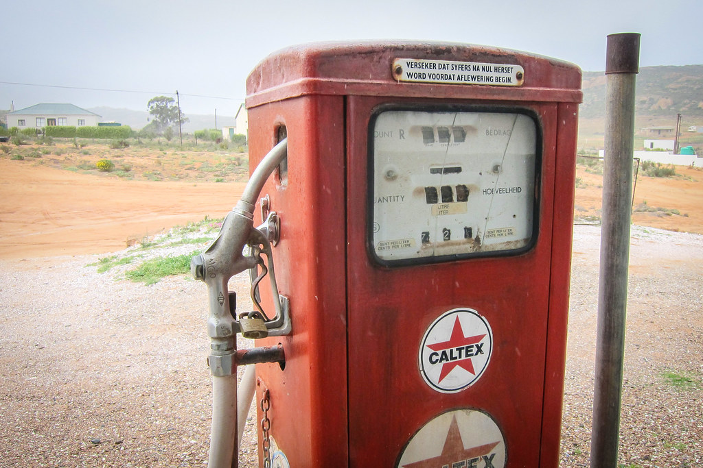
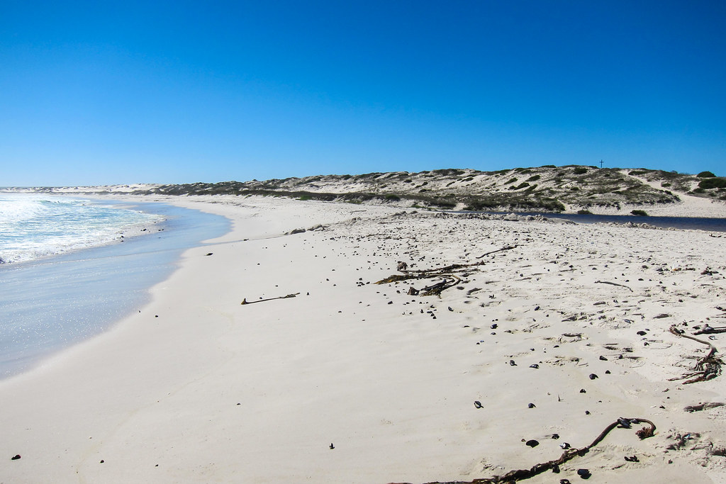
Kotzesrus is a small hamlet of people living from agricultural activities. I shelter under a roof of what seems the community central point, with a shop (closed), an old gas pump, and announcements on an environmental study concerning new mining projects in the area. I ask about the roads to a man passing by, and he tells me the sea is just 15 km away. What about all these roads in front of me and on my maps? Ah, they are the same, but one is going via where the Black people live. It’s then similar to my encounter with the huge population of Aussenkehr that was barely mapped, or to that location behind a hill in Twyfelfontein, the only place to buy spaghetti within 50 or 70 km, but very well hidden. There is definitely a problem with the mapping of some areas, which seem deliberately left out of the traveler’s knowledge zone. It’s maybe the smallest of the problems of people living in townships and informal settlements, but since every road and every potential shop and water point is important to me, it impacts me a lot.
Since the rain is not stopping, I accept Etienne’s invitation for a tea in the guesthouse he is setting up. Before that, the lady running that small community shop arrives, and not only can I buy a cold Coke, I can also luckily take some of the droëwors freshly made from game meat her husband went hunting in Namibia. It’s 100 rands for 1 kg, and it’s always useful!
The rain stops and I don’t really feel like staying here longer, but I’d rather use the little time left of daylight to cycle further. Etienne calls a friend of his who owns a self-catering house 16 km away, in my direction, and on which land I could set up my tent. That’s a good idea, since it’s not that easy to “sleep anywhere” where every bit of land belongs to a farm.

I know I compare Namibia and South Africa a lot, a bit like I compared West African countries together. Namibia and West South Africa are close enough in terms of climate and population density; Namibia was administered by apartheid’s South Africa until 1990; the social organization, the economy (diamonds, minerals and delicious meat), the people (Khoisan and European) have actually a lot in common, on a land that spans over a distance as big as Bordeaux-Budapest, Barcelona-Copenhagen, or Monrovia-Lagos.
I get to see the sun again when it sets, and it’s so much nicer than a grey and flat land. But it’s almost night, and the rain has made the sand/gravel road sticky.


It’s finally night time and I’m still on the road. I told myself I should never end up cycling alone at night in South Africa, but here I am. That house mustn’t be really far … there is a last great downhill, during which I see many lights far, far away. Maybe a town for tomorrow. Helped with my bike lamp and headlamp, I finally get to that gate, and can start inspecting the buildings. The self-catering house is locked, the barn is entirely packed with hay, but I find a bit further a shed half in ruins … perfect!

Perfect … or almost perfect, since a bird sneaked its way in and I can’t get it out. Considering the many bird poos on the floor, I’d rather build my tent so as to avoid waking up with a bad surprise in my hair.
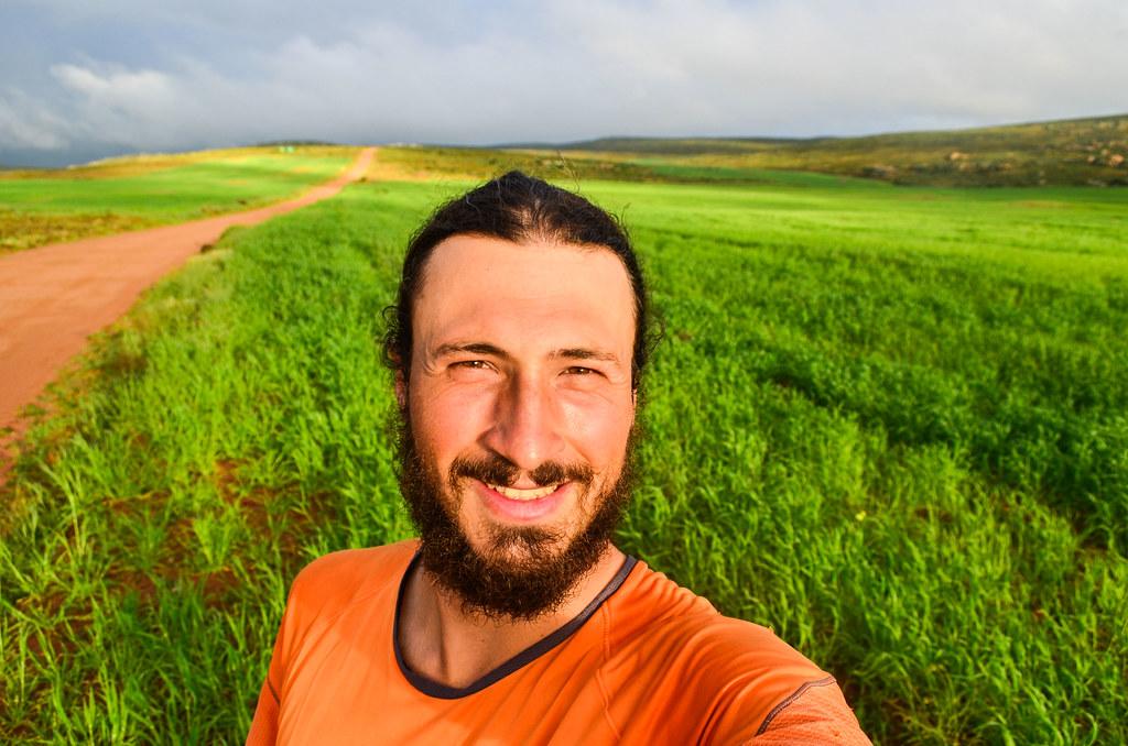
And I sleep 12 hours in a row! I really needed a long night like this one after cycling with others. It’s simply not sustainable to cycle everyday and party or chat in the evenings.
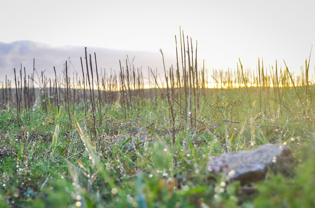
I continue on my road of rural Western Cape. I’m approaching Cape Town (my destination is only 5 days away), but it still looks like Namibia: relatively good gravel, no cars at all, and a few farms and windmills. Except it’s green and massively cloudy. The clouds only change the whole experience, I have been treated with so much blue sky for so long in Namibia that I forgot there could be days when my camera sensor is unhappy.


This railway is the Cape Town – Bitterfontein railway, used to carry ore from the Okiep copper mines, near Springbok. It didn’t look like a lot of activity is happening, but the railway has “fresh” tracks. I wonder what kind of trains run here and how often.
I am waiting to meet with the Sishen-Saldanha railway, which is very exciting (for me), as the train running there is one of the longest in the world. It’s an iron ore train, just like the Mauritanian SNIM train carrying iron ore from the Zouerat/Fdérik mine, that I spotted near the port of Nouadhibou. The Sishen-Saldanha railway must be close by.


And suddenly, the tar reappears at a T-junction, with the Landplass station. A brand new tar road, still in the middle of nowhere. Trucks are coming from the east, on the coast, where a sign calls that place “Brand se Baai”, but I have nothing on my maps. It’s another “road paradox”, at the other end of the spectrum, balancing with the paradox of dirt roads leading to townships with a significant population. From my cycling experience, a nice tar road leading to nowhere, when there’s not so many tar roads around, is often linked to a mine.
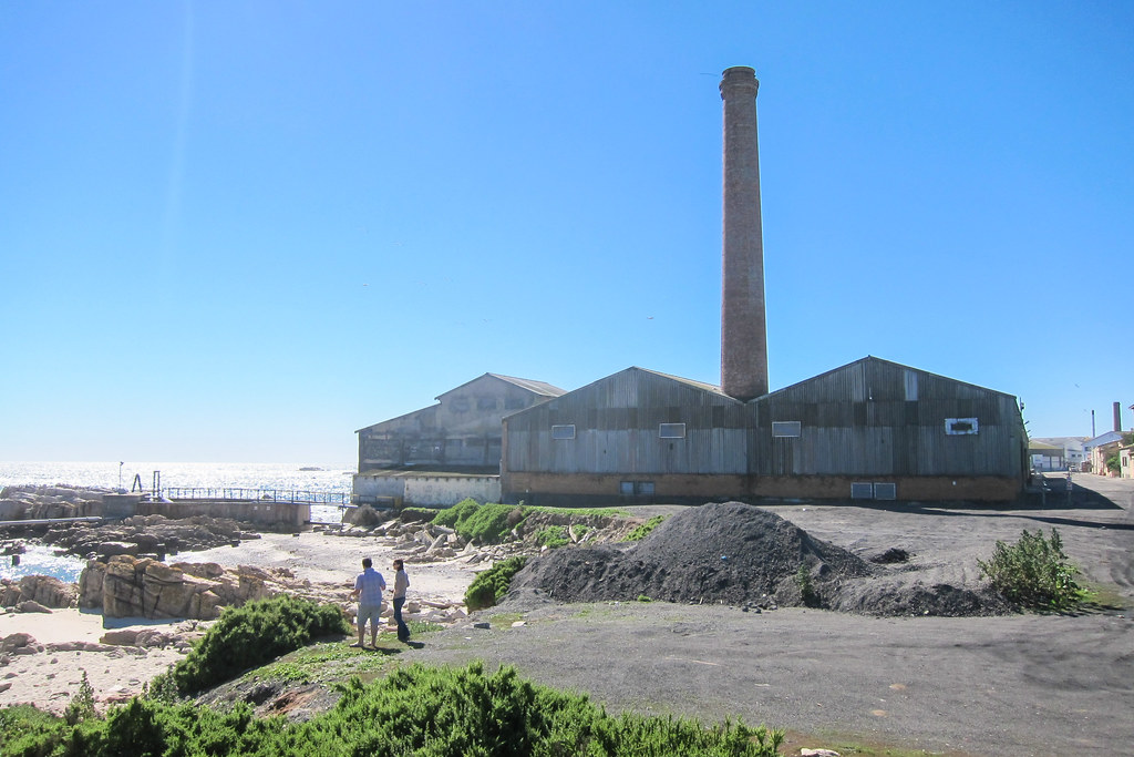
, mineral separation plant")
And a few kilometers further … Jackpot! A separation plant for the Exxaro-owned Namakwa Sands mine of Brand-se-baai, at the end of that tar road, which actually looks like this.
The brand new tar means that my last 30 km to Lutzville will be fast. Lutzville is known for its vineyards. The town is located on the Olifants river, and from the satellite view, it seems the whole river is being used for agriculture.
Five kilometers before town, Amanda calls me. She is the cyclist Etienne told me about yesterday, and we had exchanged phone numbers. She says she’s staying on a farm near Lutzville, and I should make it there. I am already in the vineyards, but I’d need some time to complete the 10 remaining kilometers.
Yet, while passing the tomato factory, a pick-up stops on the other side of the road, and I am told to climb up. What? Loading my bicycle and driving? No way, that’s cheating, and I’m determined to cycle every bit. It’s strange, actually, the more I progress on my journey, and the more I’m radicalizing towards doing everything on my own. I’ve had to cheat four times so far, always against my own will, but I surely cycled a few thousands extra kilometers to make up for the few dozens my bike couldn’t do. Amanda calls again, more or less asking me not to be that stupid when she sent Jasper just for me, and that makes my 5th and last time cheating for the whole journey.
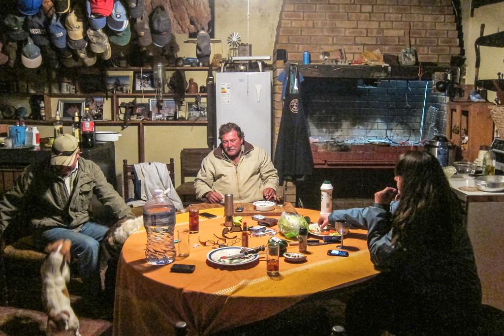
I’m a bit annoyed about it, until we reach Jasper’s farm. It’s not really fancy, there’s no running water until some point when it flows yellow, but better than water, there is brandy and meat! “These are the best lamb chops you can taste in South Africa“, he said, and it quickly proves true. Well, when treated with a braai after a day on the road, I think I tend to be agreeing rather easily. Amanda is more or less living on her bicycle, so it’s also very easy to connect.
The Afrikaner hospitality I have been receiving so far in South Africa is a bit incredible, as a result I haven’t really slept outside. And it always comes with a braai and meat until getting full, which is basically what I have been dreaming of for the past year. Something surprising is that I have always been welcomed by White people. Where are the Blacks? In fact, Black (as in Bantu) people have never lived in the dry western half of South Africa. It was home to the Khoisan until Europeans settled in Cape Town, and progressively took over the land. Today, the dominant population map of South Africa still shows clearly the division, and that’s why I don’t see as many Black people as one could expect for Sub-Saharan Africa. The map defines the dominant population of the Northern Cape and the Western Cape as “Coloured”, as were called, during the apartheid, people not white enough, and not black enough (and also, not Indian)(so it leaves the Khoisan themselves, and the people resulting from natural mixing and re-mixing between the Khoikhoi, the Europeans, and the imported slaves)(if it doesn’t make sense, it’s normal).
By the way, anywhere in rural areas between Senegal and Angola, I would be called “White White White!” up to a hundred times a day, and possibly asked for a present, but after explaining that I am not a journalist and am just looking for food and water, it’s often that I ended up sharing a meal and offered a place to stay. In rural South Africa, nobody is calling me White or trying to get my attention, I guess because my whiteness is no more special, and possibly because whiteness is more associated with apartheid than with tourism or with Santa Claus. The only ones hosting me are the ones whiter than me. Amanda says that I’d have to cycle the Eastern Cape, to find a positive experience similar to the ones I had elsewhere in Africa.

If I understood well, Jasper is the country’s biggest sweet potato producer. The farming area is no bigger than the average farm in Namibia, but it’s probably easier to work and it seems to produce much more. The problem is that he cannot make long term plans, as sooner or later his land will be seized and redistributed. Indeed, South Africa and inequality are almost synonyms.
My previous country, Namibia, is the country where the ratio of the average income of the richest 10% to the poorest 10% is the highest in the world. South Africa is almost topping world’s list of countries ranked by Gini index, which is a proposed measure of inequality of income or wealth. The mathematical function behind the Gini index is far too simple to account for the history, population diversity and growth of the countries studied, but it works rather well for one wondering “where is the cheapest place to hire my neighbor as my domestic worker“.
These two, plus Angola, Zambia and Botswana, are in the world’s top 10 worst Gini’s (Zimbabwe’s case can’t fit in the formula), while the Scandinavians are, as usual, at the other end of the spectrum. So it seems Southern Africans have a problem with sharing. It is to be noted, also, that independence in Southern Africa was obtained slightly later than the rest of the continent.
Back to farming now. Land ownership is one of the most obvious representation of inequality in South Africa, and a legacy of apartheid. Still today, White South Africans, representing 9% of the population, own much more than 9% of the land. It’s actually hard to get the real numbers, as hard as it is to find scientific honesty when it comes to political matters. The government is currently taking the land from White farmers against a compensation, and giving it to black-run communities. It seems nice compared to what Zimbabwe did, but naturally it doesn’t make the White farmers happy. Among the nicest things that I could hear about Black South Africans, are “when they receive a farm for free, they would buy themselves a nice car instead of investing in tools and making plans, and eventually ruin it“, or “they use welfare to live for free off the few taxpayers“. Fact-checked, it’s true that only 6% of the South African population pay taxes (compared to 51% in the USA or 46% in the UK). It’s also hard to pay taxes when you simply have no money.
It seems everything is, and has to be, about race. In more lighthearted comments, “the real rednecks are the British; an Afrikaner doesn’t sunburn, he knows how to deal with Africa“, or “when it’s too cold in the Free State, the Afrikaner puts on two pairs of shorts“. The South African Whites can be “divided” into two sub-groups, the Afrikaners (like Charlize Theron), mostly of Dutch origin, with a few French Huguenots also on the boats, who first settled in 1652, and the British (like the Princess of Monaco), in their colonial expansion, who joined the invasion some 150 years later. Of course they managed to fight against each other, even that far in the south.
I also hear a lot about how lazy South Africans are, and how Zimbabweans are much more hard-working. On the other hand, these same Zimbabweans are the first ones accused when a crime is reported. It reminds me that I’d have to cycle there, apparently in Botswana for the wildlife and the cheapest meat, and in Zimbabwe for its welcoming people. I could have forked east from Namibia, but I already wanted to finish and went straight south.
Despite the apparent technological predisposition of South Africa (the first human control of fire, the first heart transplantation, Ubuntu-Linux, plans for the future SKA radio telescope, and Elon Musk were made there), the richest men of the country are mostly into mining, and the top politicians are super rich and super corrupt. My takeaway is that, even if it’s hard to define South Africa as a first world or a third world country (it’s nowhere near as undeveloped as what I have seen further to the north), it has for sure both first world problems and third world problems. Besides that, the landscape is beautiful.
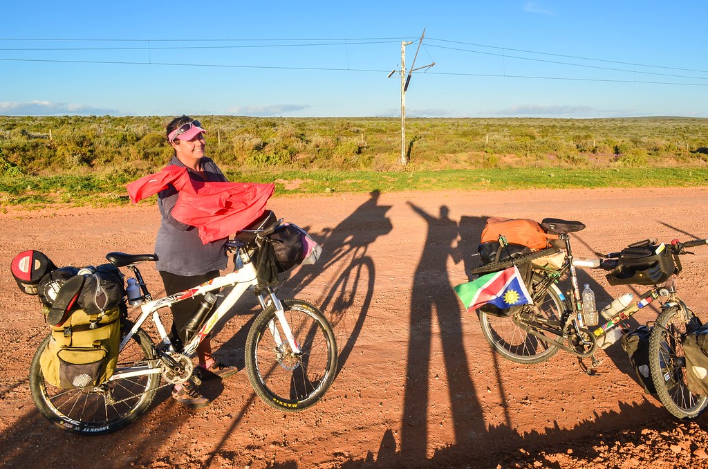
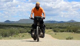
We leave the next day with Amanda, heading to the coast in the direction of Cape Town. She has cycled the area many times, so she knows a lot about the things to see.

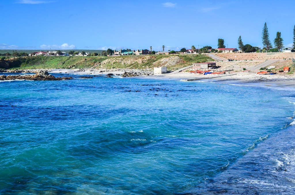
Tadam, the sea! I did well at avoiding it during the whole trip. Now we’re together until the end. The mouth of the Olifants river is just there, with a windmill farm in the background. It’s called Papendorp. Maybe I will see more of the Cape flowers from now on?
")
Amanda suggest we could enter the first coastal village of our road, Strandfontein. It looks like fancy holiday homes by the Atlantic Ocean. However, we’d have to go downhill and cycle up again … I was ready for that until she said one of the next villages has seafood and a wine estate. It’s not meat, but it still suits me.


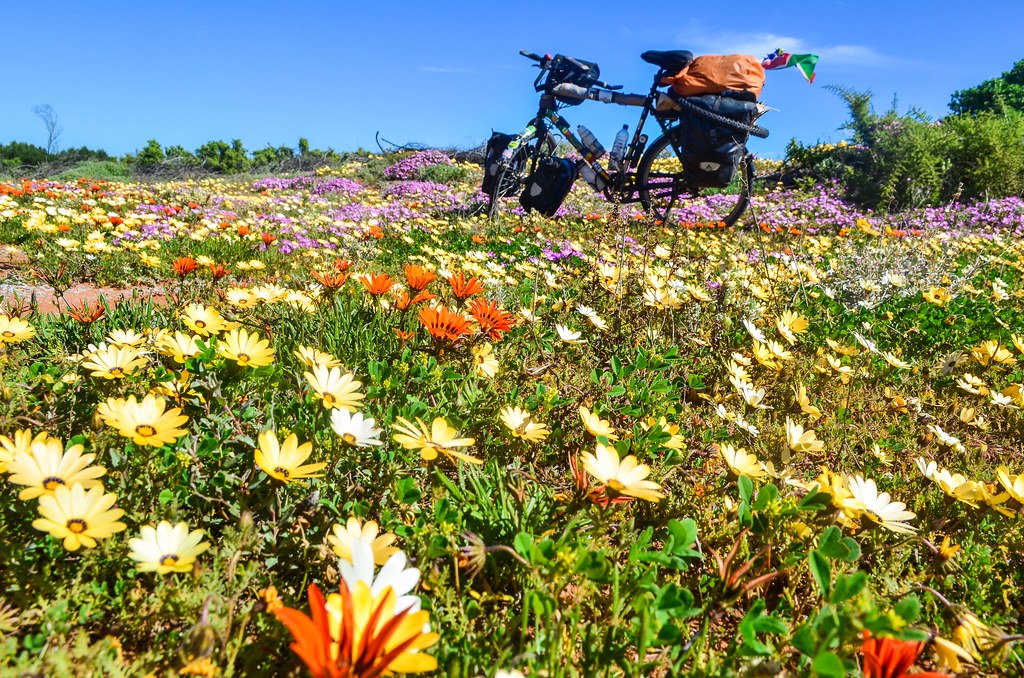

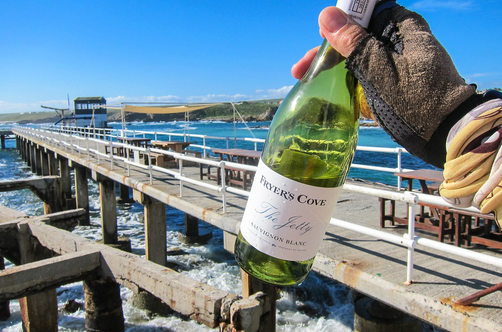
While posing in the flowers, I spot a whale! Just there! It’s being a very good day, and the best is still coming up. We reach Doringbaai, another coastal village, just after passing a vineyard on our left. It’s a tiny estate, and they don’t sell their wine in many places, but it’s possible to taste it at the restaurant on the pier, near the old crayfish factory. And we end up buying a bottle with our seafood.

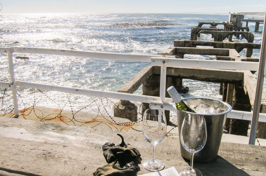
It feels strange, since my fanciest lunches on the road have been a plate of rice or some cassava-based meal. And today, we just need to stop with the same bike, same dirty gloves, and we can have real good food in a superb setting? Then why have I been touring Africa? Why did I do that to myself? That’s my initial reaction … but I know well that comfort quickly gets boring, and adventure is not found at the bottom of a wine bottle.
Our target for the day was Lambert’s Bay, the largest town on the coast, where Amanda has friends. But it’s 16:30, and we only cycled half the distance from Lutzville. Hmmm … not really smart, but not guilty either, since the stop in Doringbaai was worth it. Despite a bottle of wine in the legs, we decide to stick to the plan and see if we can reach Lambert’s Bay before night.
")
The 34 kilometers between Doringbaai and Lambert’s Bay are easily feasible, even if the map show the road R362 cut between the two places. The tar road is indeed stopping, but we can easily continue with the Transnet private road. It’s a dirt road always sticking close to the iron ore railway line, originally a service road, but now open to anyone. It allows to cut through nature reserves.
")
")
And finally, at the end of the day, the giant caterpillar shows up on the railway. The Sishen-Saldanha train once held the record of the longest train in the world, with 16 locomotives, 660 wagons and 7.3 km in length. It’s like if one train has wagons continuously filling up the rail track between Zürich HB and Schlieren. The only way to see it entirely is to go up in the sky. It runs 861 km from the Sishen/Kathu iron ore mine in the center of the country, to the port of Saldanha.


This train, that I catch on its way back from Saldanha, is a regular one: only 8 locomotives, 342 wagons, for a length of 3,780 meters. That’s long enough to try all the possible settings on the dSLR. I will be passing by Saldanha later to check it at the terminal.
Now, there is still 15 km to cycle at night. Fortunately, the service road is very quiet, and we have two powerful bike lamps. I still decide to wear my reflective jacket before entering Lambert’s Bay. It’s Friday night and the town is the largest coastal town of the area, with a whooping 6000 people.


That Transnet service road has gates from time to time. Despite being open and free, it’s still a private road and cars are being checked. But it’s really the best way to cycle north or south in Western Cape.
With little visibility, we finally reach the town where Karen and Marais, Amanda’s friends, welcome us, directly at the bar. Straight from night to light, and from peddling to drinking. We’re not dirty enough to need a a shower right away. Some of the music playing sounds like something I know … It’s old Afrikaans songs, but … do I really know it? It sounds exactly like Apres-Ski music! I was already finding Afrikaans and Swiss-German quite similar in how unsexy it can sound, and now I can’t help thinking about this.

Marais is here a first name. As a last name, Wikipedia lists more Marais in South Africa than in France. Without forgetting all the wrong things that White settlers have done to the people here, I find it interesting to notice some European heritage at the bottom of the world. Amanda will stay longer in Lambert’s Bay to delay her arrival in Cape Town where she doesn’t have a house yet, but I will get on the saddle tomorrow. I’m only 3 days away from my destination!


Leave a Reply