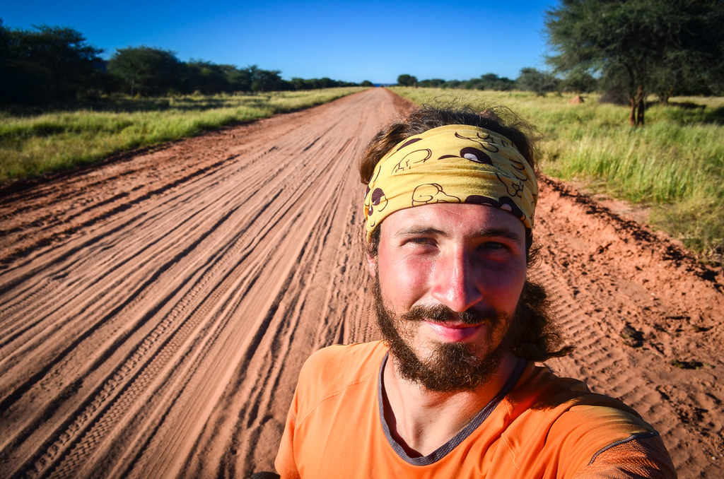
I have lost maybe seven or eight kilos since the last time I weighed myself, which I think is as far back as Monrovia. I was surprised when I played with the scale in the Shoprite supermarket of Tsumeb. But since I arrived there, I may have gained them back with a month of good eating at the Etosha Café. Dayne has spoilt my “plan” to ride until Cape Town powered by local food, pulled by the idea of feasting on good meat once there. But Namibia is like South Africa: it has already plenty of good meat, and it’s apparently cheaper here.
It’s time for a new departure now. I noticed that whenever I take a break, it takes more and more efforts for me to recover the cycling mood. My legs are inexplicably weak and my motivation low. It’s night at 5 pm now, when it was at 7 pm when I entered the country. Winter is coming, alongside with the daylight saving time change. Temperatures are significantly lower as well, a jacket is needed in the evening and wearing flip-flops is hardly possible after sunset.

I had time to define my itinerary for Namibia. Since I’m already close to the east, I will cycle close to the Kalahari and visit the Waterberg plateau, before heading to the Atlantic coast via remote scenic roads.
I have on my bike two new Schwalbe tires (my third pair) and a new chain from Taiwan (my fourth). These are probably the last changes before I reach Cape Town. My previous Schwalbe Marathon Mondial tires were pushed to 13’000 KM until the sidewall of the rear one cut open. The chain, after a fair 6000 KM, was becoming noisy, and since I had a Cymot shop nearby, I thought I could replace it as well. I’m no more in these countries where the only spare parts are the cheapest and most unreliable Chinese things!


Despite winter coming, it’s very hot outside during the day. The first 40 km go well on the not-so-interesting tar road to Grootfontein, but I already have sore legs for the next 20. I didn’t do any exercise for a month and maybe my legs thought the adventure was over?

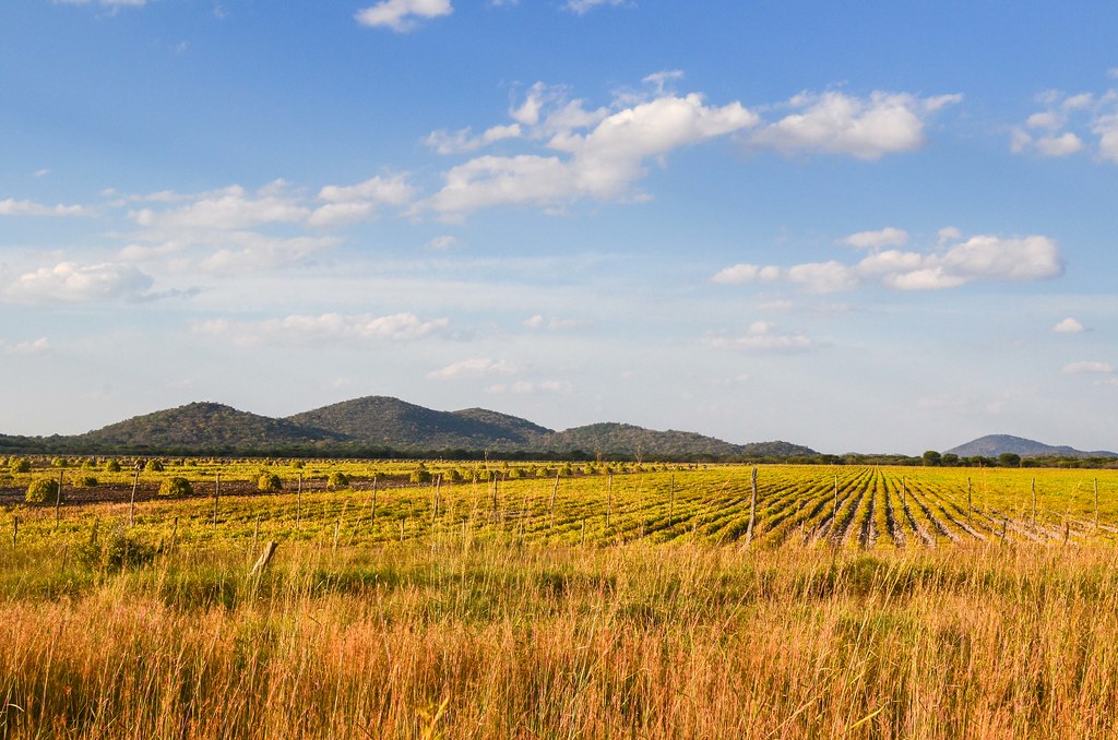
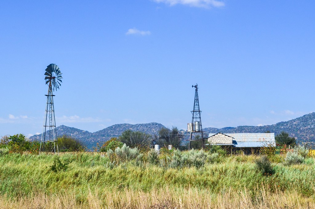
There is not a single house by the road for 60 kilometers. Only fields and farms tuck away for privacy. The air starts to turn cold from 4 pm and the sunset is there at 5 pm. I’m just in time to reach the house of Hannelie’s mother, a few kilometers before Grootfontein.
Instead of continuing past Grootfontein until Otjiuuo, and get a glimpse of the Kalahari plains of The Gods Must Be Crazy, I turn back earlier to pass by the Hoba meteorite. You can’t really miss it.

The Hoba meteorite is the largest in the world ever found as a single piece.
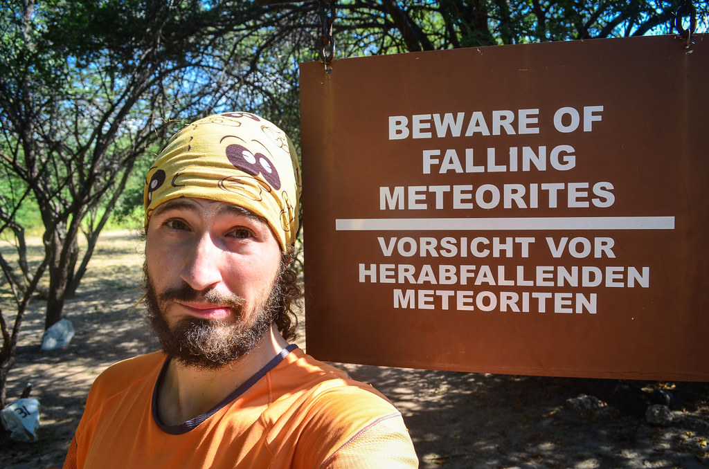
Discovered in 1920, it looks like a flat stone weighing approximately 50 tons for dimensions of roughly 3m x 3m x 1m. It is said to have struck the Earth 80000 years ago and is composed of 82% iron, 16% nickel, 1% cobalt, with traces of chromium, copper, zinc, etc (called ataxite). That’s enough to make plenty of steel alloy bike frames!


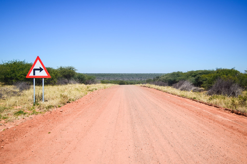
I can continue from there until the Waterberg plateau through dirt roads. Among the very little traffic, a minivan stops by me. The passenger is a cyclist on a rest day: he says he is riding from Nairobi to Cape Town, with road tires, thus he is limited to tar roads. Cycling Africa on tar roads, I fail to see the point; I think tar roads are by far the greatest danger of cycling in Africa, as most drivers have no consideration for cyclists. Plus, tar roads are busy, boring, always leading to uninteresting large cities, while the best of the adventure and encounters are made on dirt roads. Especially in Namibia, the country has so much to see, but it’s always at the end of gravel roads.
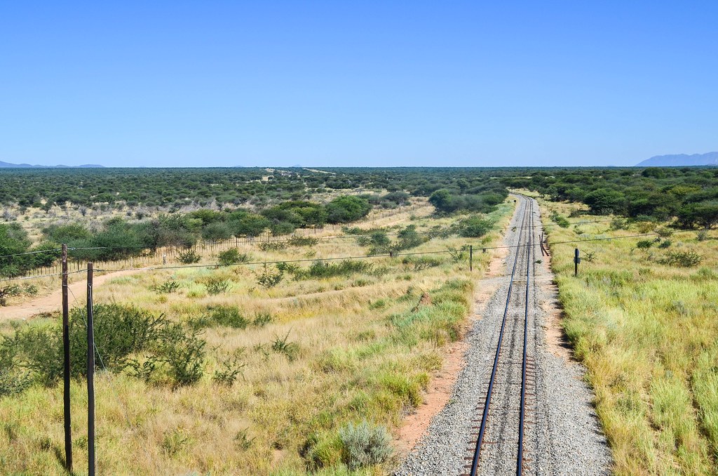
As I was saying about Tsumeb, the region is rich in underground resources. The area between Tsumeb, Otavi and Grootfontein, is called the Golden Triangle, referring to maize production. I probably have a selective perception, as I see more mining activity than maize. My gravel road goes alongside a railway, which connects the Kombat mine to the rest of the network, although I don’t know if it is still in use.

This branch is part of the Otavi Mining and Railway Company (OMEG) which links the region’s mines (iron, copper) to the port of Swakopmund. All built by the Germans in the early 1900s. I find rail transport in Namibia quite impressive for such an underpopulated country, even if everyone travels by car or 4×4. But mining and railways are always good friends.

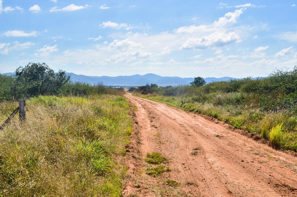


From the Otavi-Grootfontein crossroads, I continue straight onto the D2512 gravel road to the Waterberg plateau. It’s very hot and as usual with very little traffic. But the good gravel roads allow me to make 114 km in a day off the tar.
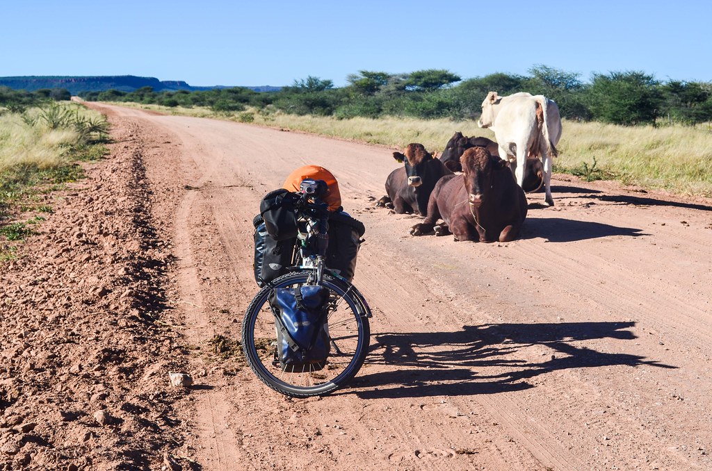
I see my first “wildlife”, i.e. big animals outside of a national park. Ostriches (although they seem to be in a farm) and kudus, recognizable by the white stripes on their grey bodies, making huge jumps over the cattle fences. They’d both made great steaks if they were not this shy …
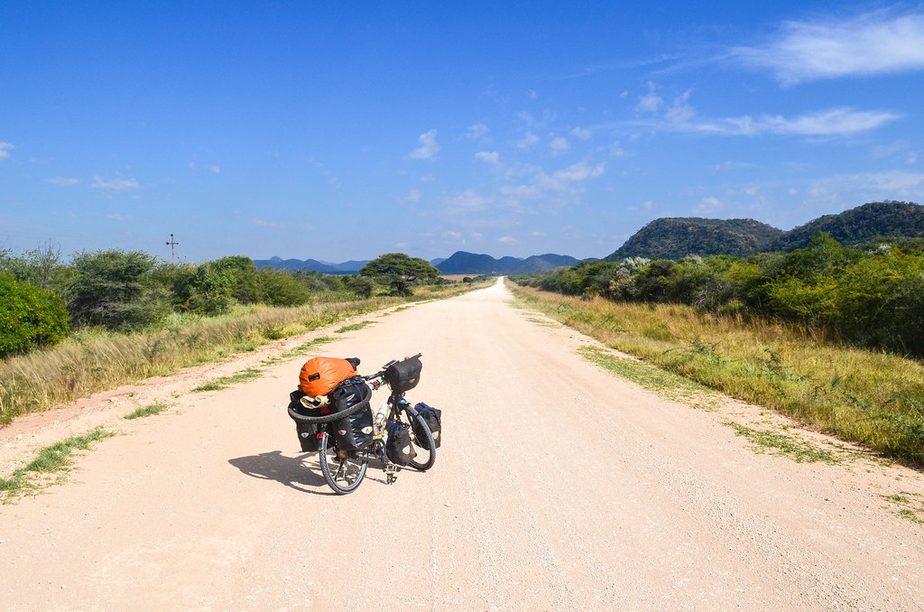
D2512 is a minor road, but still the main one to link Grootfontein to the Waterberg plateau. Yet, I have to open and close the gates every time I change farm, more or less every 10 kilometers.


The road itself offers little to see when it just crosses farm after farm. Slowly, the gravel is taken over by loose sand and it makes my time harder. From 3 pm, many small flies, sticking around my head, bother me. I have to find a place to put up my tent, hardly possible since the farm fences are very close to the road. There is no free space.
Farm houses do exist, but far away inside their land, and the few roads that seem to be leading to the houses are locked with gates. I can’t even go to someone and ask a permission to camp. I finally find a spot better than others, five meters from the road, along a fence. I just hope I don’t step on a snake, as I already saw two dead on the road today.
For my first night out in a month, I really feel the cold: jacket, winter hat and gloves! But at least my legs are back and the sky is full of stars.

It gets really cold at night, the temperature drops to 12°C inside the tent. It’s still much warmer than my first nights in the European winter, so I probably have to get used to tolerate the cold again. The sun is out at 6 am but I don’t leave my warm sleeping bag until 8.
As I walk out, I surprise a dik-dik, and am surprised in turn by a mysterious disappearance: my yesterday’s poop is gone from the road. A few meters further, a maxi-version of dung beetles are fighting together to appropriate my droppings.
This road has now lots of sand! It will be much more difficult than yesterday. Plus, my rear tire is deflated, with no apparent puncture. I hope the slime will work. Unless the slime tube itself is so bad it can’t keep the air inside.

The ugly crickets are here too. I find the armored crickets disgusting since almost every time I see one, he is eating another one. They are beautiful pieces of military engineering, with a hard spiky shell and long legs providing great mobility, but they also don’t hesitate to feast on brothers of the same specie, even if they prey is still alive. Beuark.


The southern side of the Waterberg plateau is beautiful, but the D2512 is a tough road. No traffic and no houses. Just farm land and cows. And too much sand. And another kudu.

I don’t climb on top of the Waterberg plateau, a national park which must have many animals, but only cycle on the road that borders it. The NWR (managers of Namibian national parks) asks for 80 N$ only to have a look at the German cemetery and 210 N$ (20 USD) just for a camping spot!


There is a German cemetery at the foot of the plateau because of the battle of the Waterberg against the Herero, which took place in 1904. The Germans were present for only 30 years in what was called at that time South-West Africa, but they had time to put in practice their extermination skills and concentration camps with the Herero genocide, the Herero being one of the ethnic groups present in this region rich in iron and copper deposits.


At the end of the day arrives Dayne in his yellow bakkie. We had planned to meet here to spend the evening, but he has to work tomorrow in Otjiwarongo. Heading there for the night, I end up cheating for 100 km, by loading the bicycle in the pickup truck.
During my whole journey, I’ve never voluntarily cheated, except for three times when I was forced to: 50 km of suburban train to enter Barcelona because I was stuck in a valley with a highway only, 10 km in the Moroccan Atlas when a local picked me up on the dirt road until his house, and 100 km of boat between Cabinda and Soyo to go around DR Congo into which I was not allowed.
I don’t like the idea of cheating; I want to do everything with my own legs. This time, I can make myself feel better by thinking it’s not really cheating: Tsumeb-Otjiwarongo is 180 km with the direct road, and I did 240 km to the Waterberg plateau, where Dayne took me 100 km back north, so I can continue south again on other roads. It is like the 100 km boat trip from Calabar (Nigeria) to Sumbe (Cameroon), compensated with 1000 extra kilometers backwards in the Bamenda region of Cameroon.
And after all, the Africa-West-Coast route (Zürich-Dakhla-Monrovia-Cape Town) is 16’000 km long according to Google Maps. My trip will be around 25’000 km, I am not taking shortcuts at all, on the contrary.
And now that we are in Otjiwarongo, a city of 70’000 but as dead as a village of 1000 (there are only 2 bars open)(2 bars for the white town center, but probably a hundred shebeens in the black township), at the image of Namibia, we can have a good dinner and sleep not in the cold.

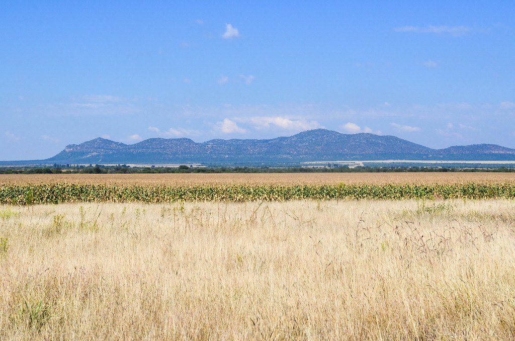
To get to the scenic roads of Damaraland in the west, I must first cross the central part of the county, as boring as it was in Ovamboland, but this time on the southern side of the Etosha National Park. It is paved all the way to Outjo, and I have little to talk about.

With this road, I am actually back to the Kunene region, the one of the Himbas. I have practically circled around the very large land of Etosha.

I had packed food and petrol for my stove this morning, but Outjo supermarket offers another chance to pack more food. I continue 10 km outside Outjo to the west, where everything is fenced again. But I had planned it this time: there is a farm with a lodge and a campsite. The Sophienhof lodge has leopards and game in a fantastic landscape.

The domain of the farm extends on 8000 hectares … it is 80 km2, or 11’000 football fields, for a single owner! By the way, the owner, very kind to offer dinner and breakfast, says other farms can be as large as 20000 hectares. That’s why it is very annoying for a cyclist looking for a camping spot: imagine a road fenced on all sides, with a farm house every 10 km only. It’s not easy for water either.
And what if I jump behind a fence and end up on a cheetah farm?
Later on, at another campsite, I saw a very special map. A map of Namibia with a name for each farm owner. Can you imagine a country map where every land owner is mentioned? It’s actually only the farm owners, in the “white only” areas of Namibian apartheid. The “empty” areas are either national parks, or, especially in the north, bantustans (black homelands).

On the high-resolution versions (5 MB, 17 MB), one can clearly identify Sophienhof a few kilometers west of Outjo. Because most farms have a sign on the road, I also recognize on this map all the names of the farms I have cycled through. Namibia is big (more than twice bigger than Germany), and its population is tiny (2.1 million). The population was only 700’000 in 1966, when the map was drawn. Since 1966, and 25 years after independence (1990), these German and Afrikaans names laid on most of the land are almost the same. Isn’t it crazy?
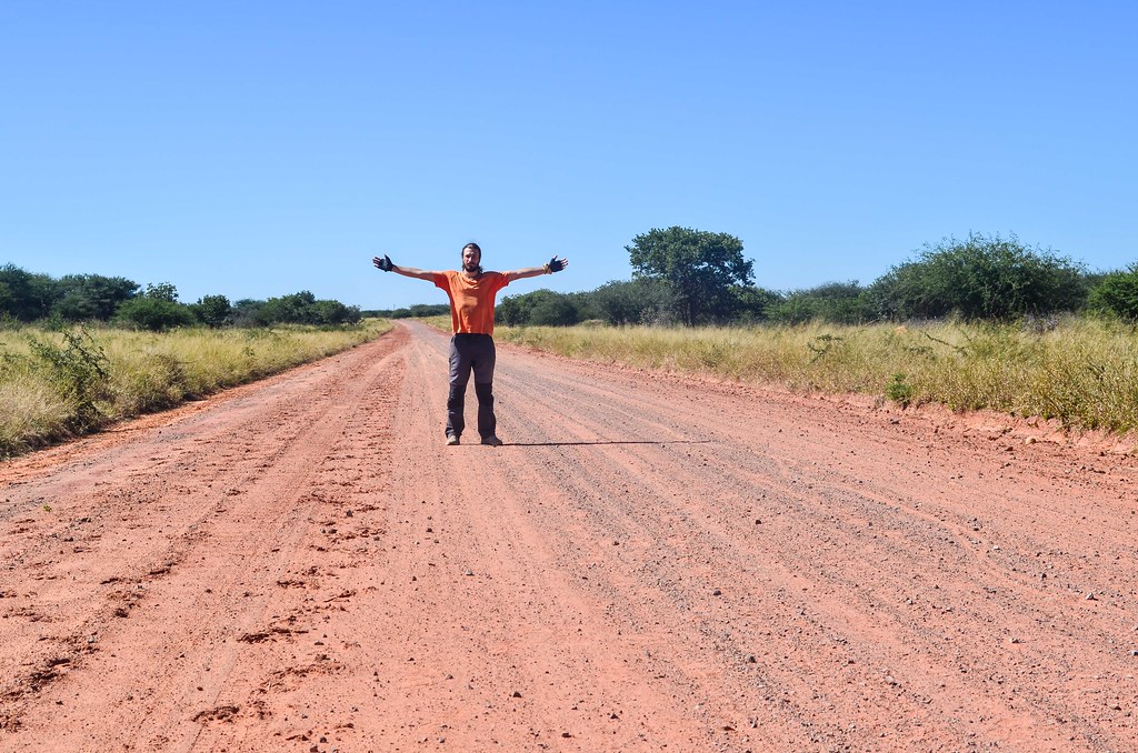
And to end on a more positive note, here is my chameleon skin, always adapting to weather conditions:


Leave a Reply